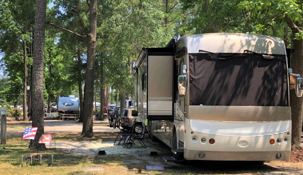
On Friday May 21, we left Yemassee, SC at 8:20 am with Acey’s mileage at 72,789.1 and Thor has 84,787. We stopped in Florence, SC for fuel and at a rest area to have lunch, and arrived at the Encore Twin Lakes RV Resort in Chocowinity, NC at 3:30. We got all set up; a nice spot with some shade and full hook ups for our 6 day stay.
During our last stop, in Yemassee, we were on the run quite a bit, with 2 visits to Charleston, a day in Savannah, several bike rides and tracking down Forrest Gump filming sites… it took Linda quite some time to sort thru the photos and get the blog done, and she posted it on Sunday afternoon.
Sunday morning we Zoomed with our Sunday School Class and worshipped virtually with Stephens Valley Church in Nashville via You Tube. (You can see the service here and the bulletin) Later, we Zoomed with the family. One of the benefits of the pandemic has been the fact that we can keep up with our home church and our family while we are on the road!
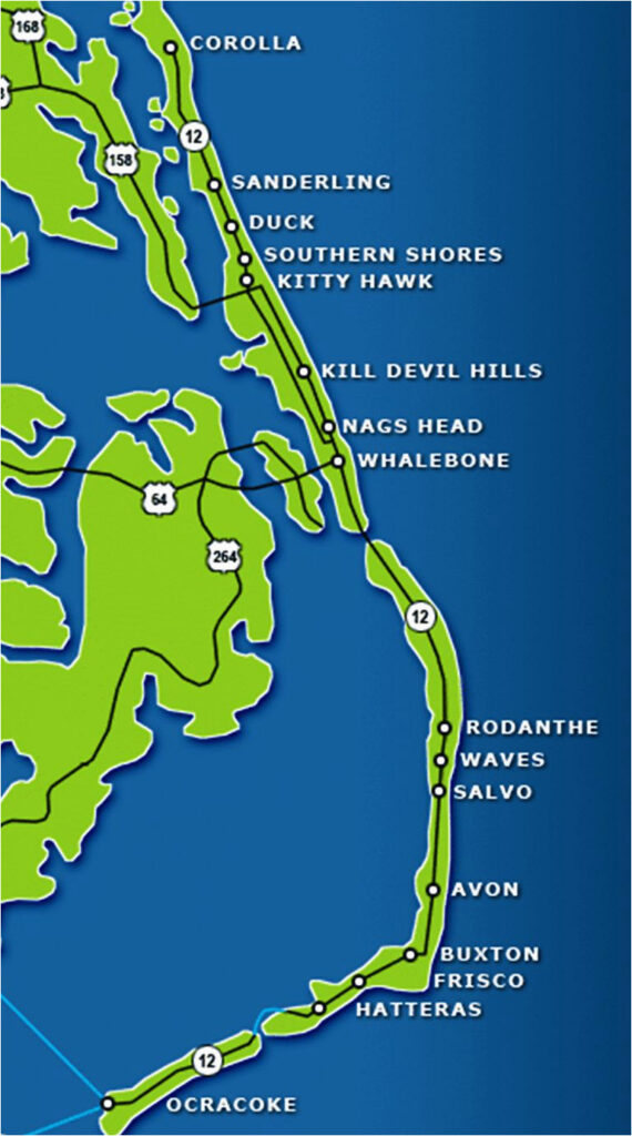
Monday we took a long drive out to the Outer Banks. We headed East on US 64, crossed over 2 long bridges as we hopped over Roanoke Island and out to the long strip of islands known as the Outer Banks of North Carolina (OBX)
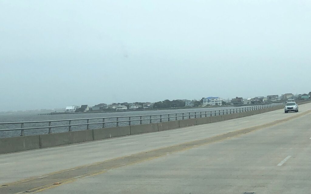
It would take several days, maybe even weeks, to see the 200 mile string making up the OBX, but we mostly drove on Bodie Island all the way to Corolla, crossed over the Oregon Inlet (past Whalebone) and back West on 64.
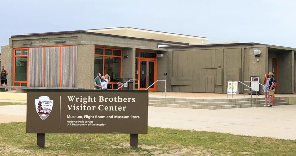
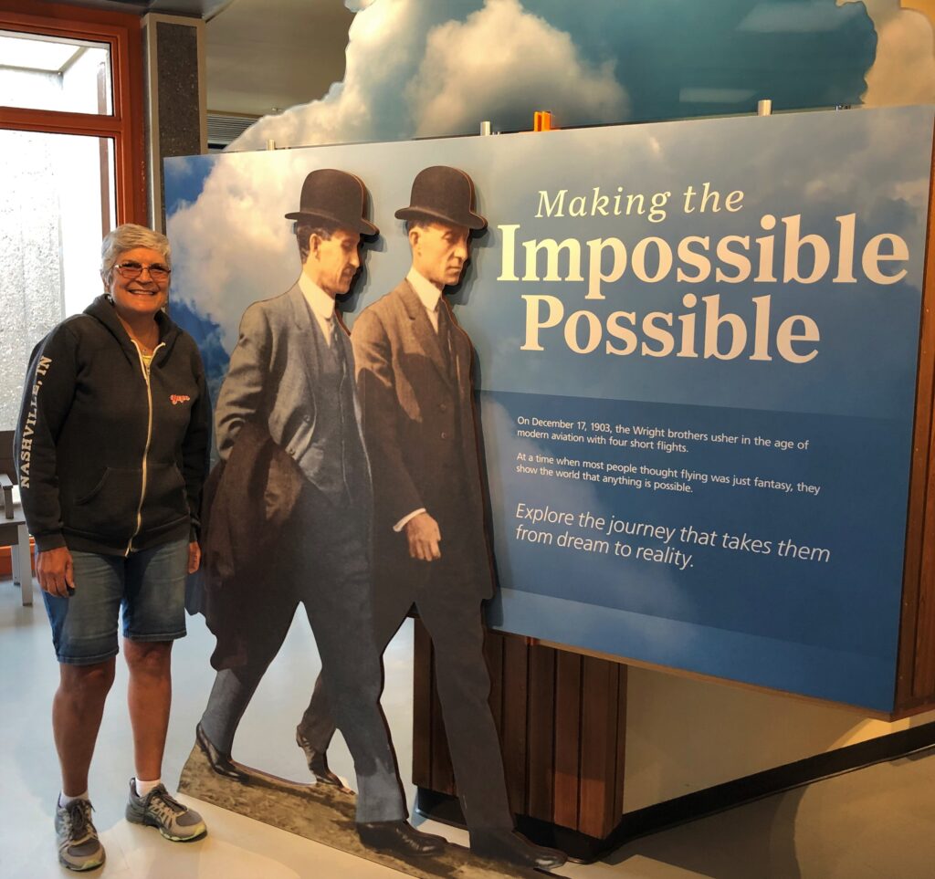
Our first stop was the Wright Brothers Visitor Center near Kitty Hawk. Jim had never been to there, and Linda had not been since 1969; she was there at the visitor Center with her family and watched on TV the first men, Neil Armstrong and Buzz Aldrin, set foot on the moon on July 20, 1969! (Apollo 11)
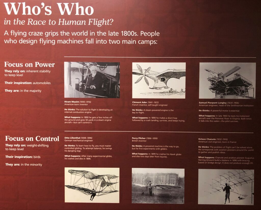
The museum had some great information about the Wright family
Susan and Milton Wright, the parents, were a driving force in encouraging their children’s curiosity about how things work. They have a close family relationship.

Many folks in the late 1800’s were trying to figure out how to make a flying machine. Most focus on power, others focus on control.
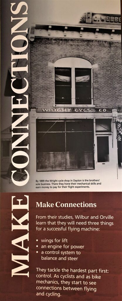
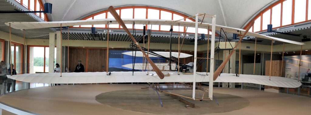
Wilbur and Orville built many gliders before they built the powered flyer and had their first successful flights on December 17, 1903.
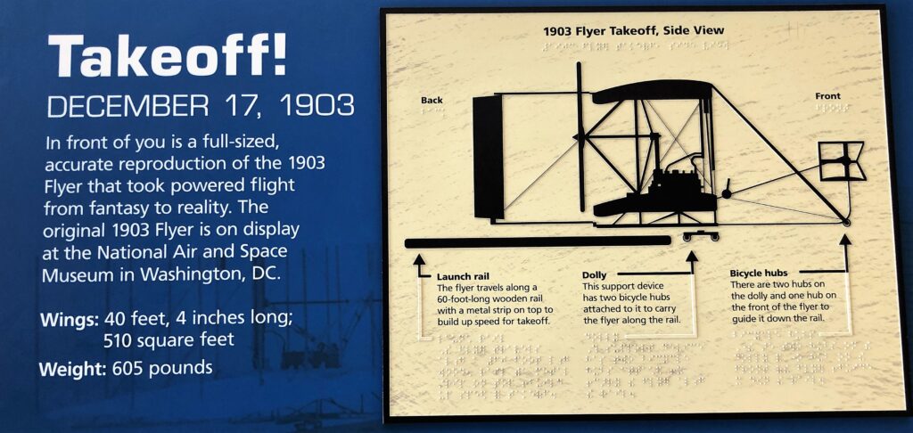
There was a replica model of the plane that the Brothers flew at the museum. The propellers were at the back, the pilot laid down and with his hips in a cradle to control the pitch of the wings and his arms could work the levers to control the front rudder. A small piece of the original flyer went to the moon with Apollo 11 and another small piece went to Mars; if the Wright Brothers only knew what they started!
We went outside and saw Kill Devil Hill. At the time when Wilbur and Orville were doing their experiments with gliders, this whole area was sand, and this big hill was a massive sand dune – and a great place to launch the glider from when the wind exceeded 16 mph.
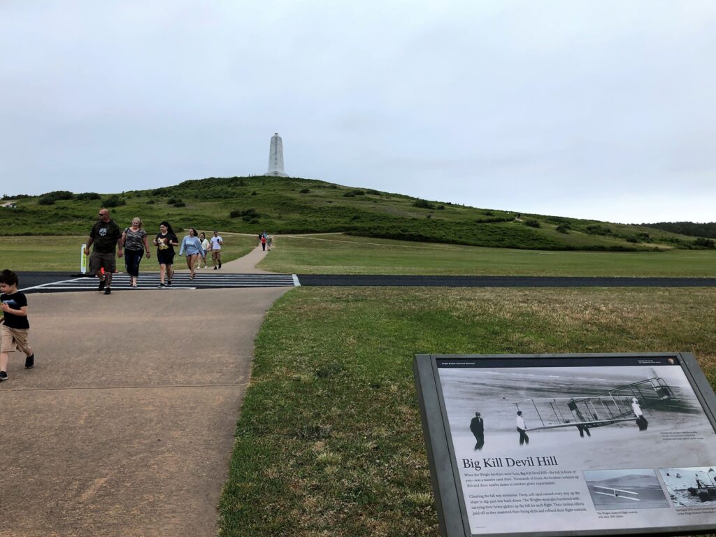
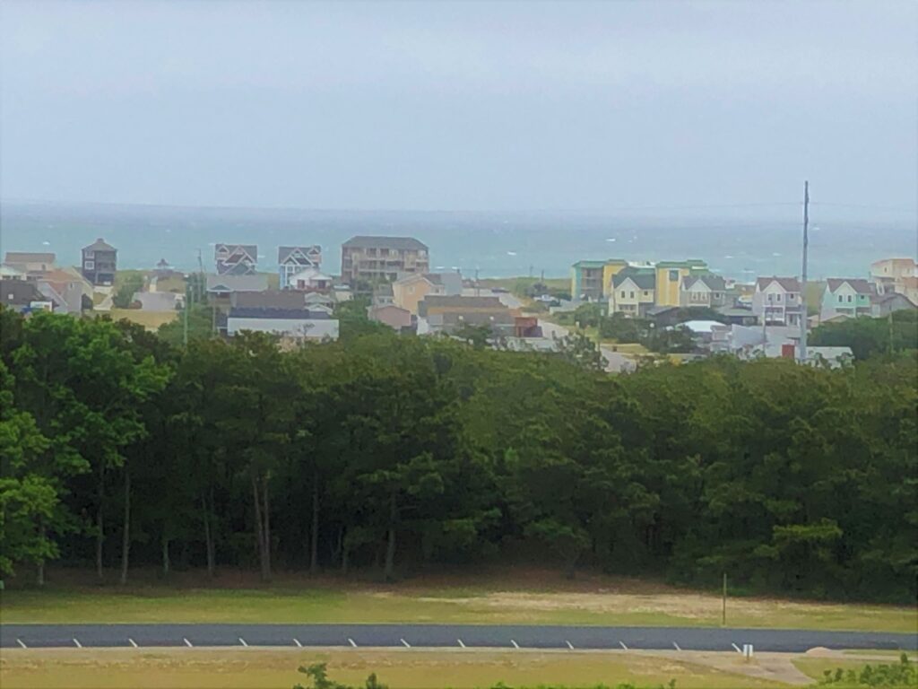
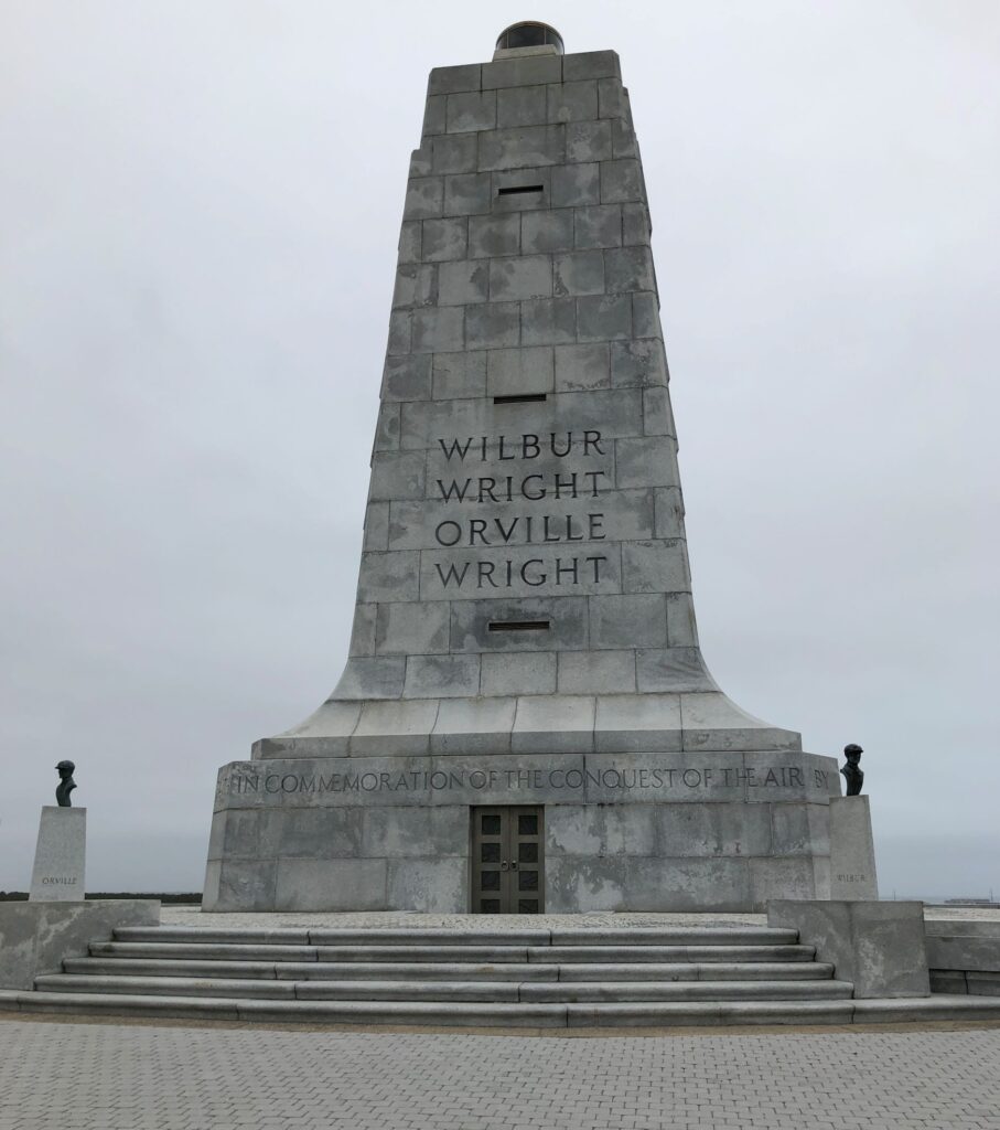
We climbed the hill, made much easier with a concrete sidewalk, and checked out the monument at the top. The view from the top was spectacular – we could see the ocean!
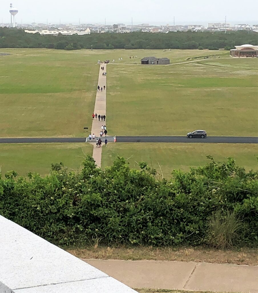
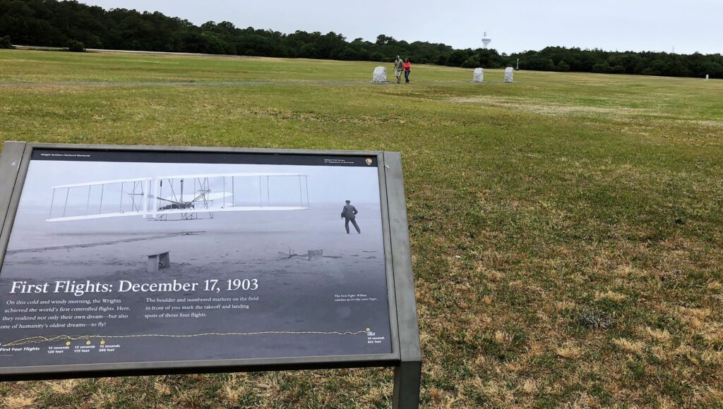
Looking down from the top of the hill, you can see where the powered flights took off and landed – the boulders at the far end of the sidewalk indicate where the first 4 flights landed. The trees were not there in 1907.
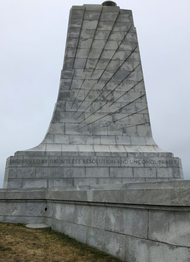
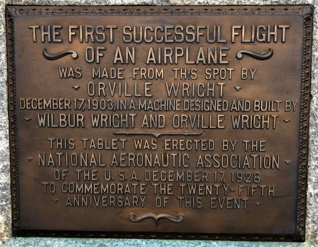
The monument on top of the hill was impressive! The message that went all around the monument read “IN COMMEMORATION OF THE CONQUEST OF THE AIR BY…
…THE BROTHERS WILBUR AND ORVILLE WRIGHT CONCEIVED BY…
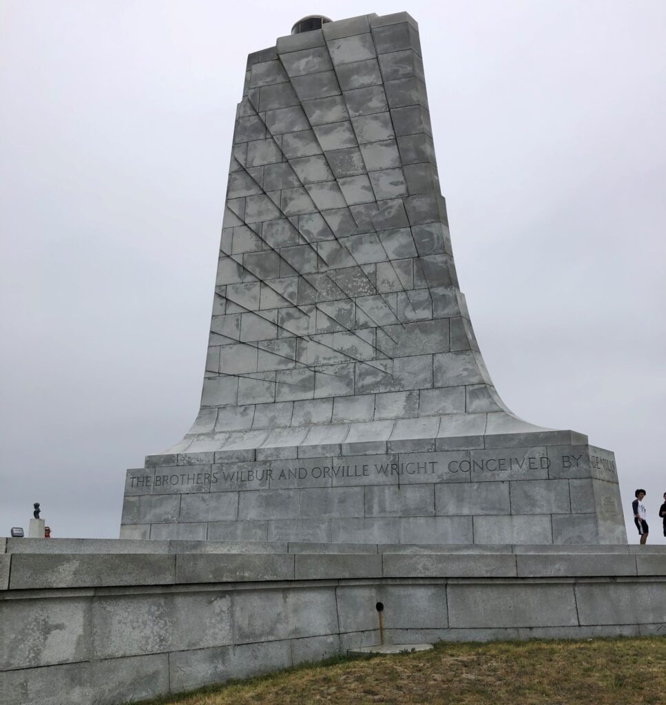
..GENIUS…
..ACHEIVED BY DAUNTLESS RESOLUTION AND UNCONQUERABLE FAITH
We came down the hill, to the very place that the first powered flights took place!
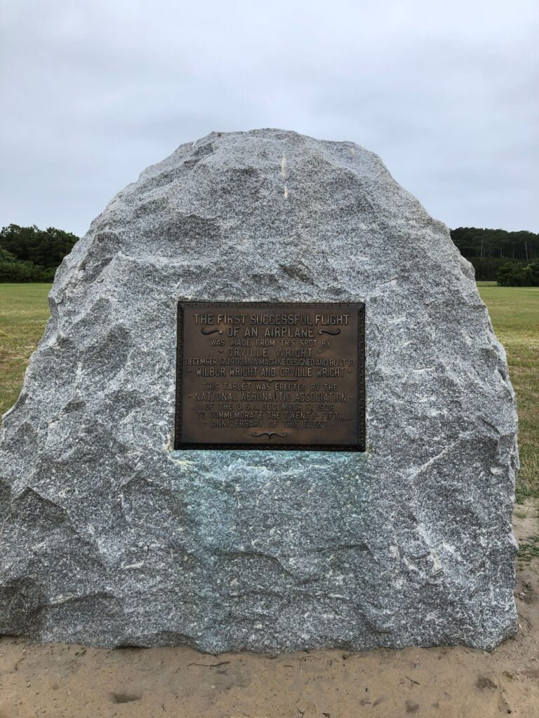
This flat area was where the Wrights set up a monorail for the plane to run along as it gained speed.
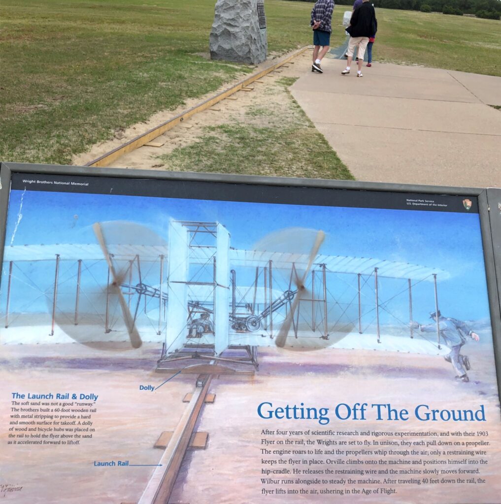
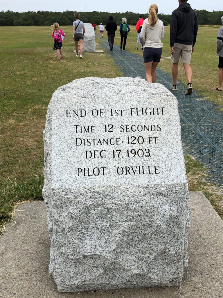
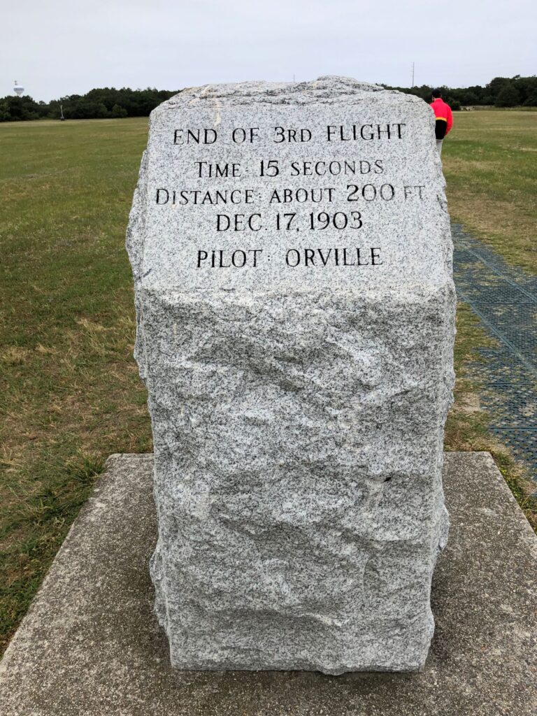
The white boulders mark the distance of the flights; The first one went 120 feet in 12 seconds; the second went 175 feet in 12 seconds; the third went 200 feet in 15 seconds; the fourth went 852 feet in 59 seconds! Orville went first, then Wilbur, taking turns. The sign below is a copy of an actual photo taken of the first flight.
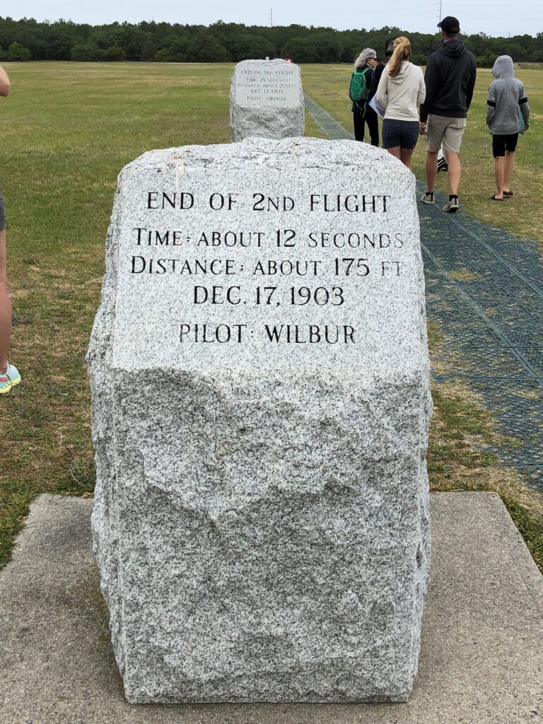
3rd flight marker right behind this one
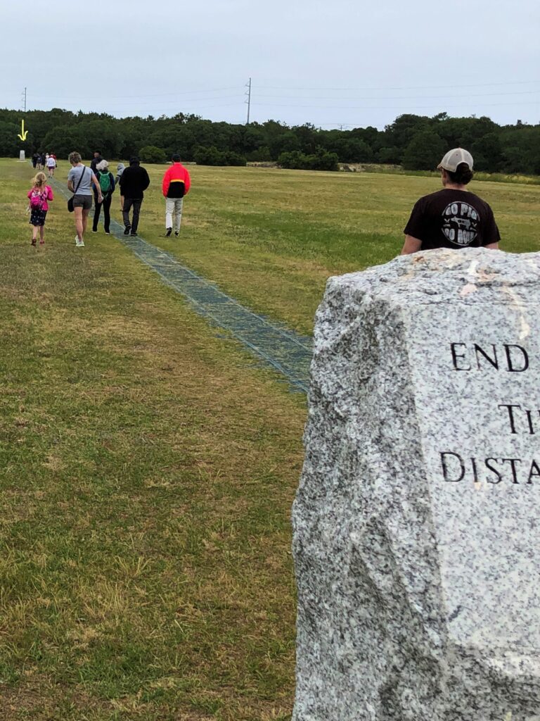
We didn’t walk out to the 4th flight marker, indicated by arrow at treeline
An amazing place where the Wright Brothers proved that man can indeed fly!
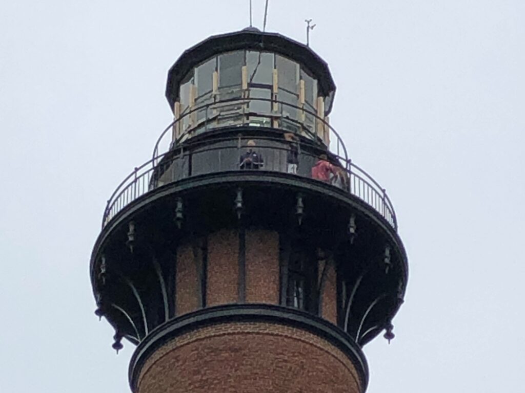
There are 6 lighthouses on the OBX, and we drove to north to see the Currituck Beach Lighthouse. Standing 162 feet tall, it was built from the same plans as the Bodie Island Lighthouse that we will see later.
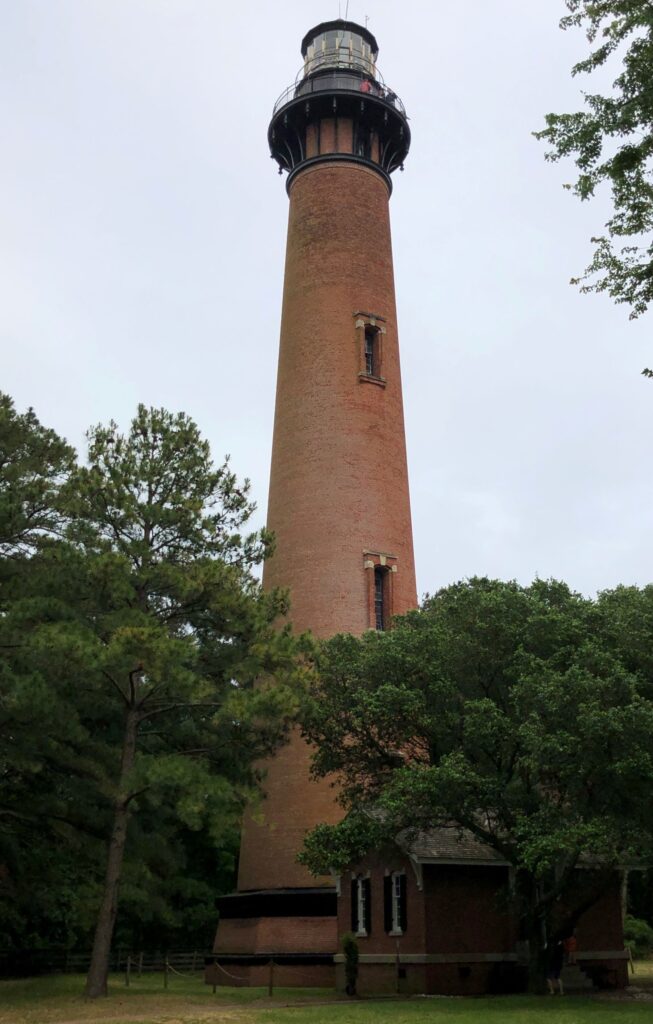
Wikipedia says it was “the last major brick lighthouse built on the Outer Banks. To distinguish it from other regional lighthouses, its exterior was left unpainted and gives today’s visitor a sense of the multitude of bricks used to form the structure. The lighthouse is known as a first order lighthouse, which means it has the largest of seven Fresnel lens sizes.” its light can be seen from 18 nautical miles. We did not have time – or a reservation – to climb the 214 steps to the top.
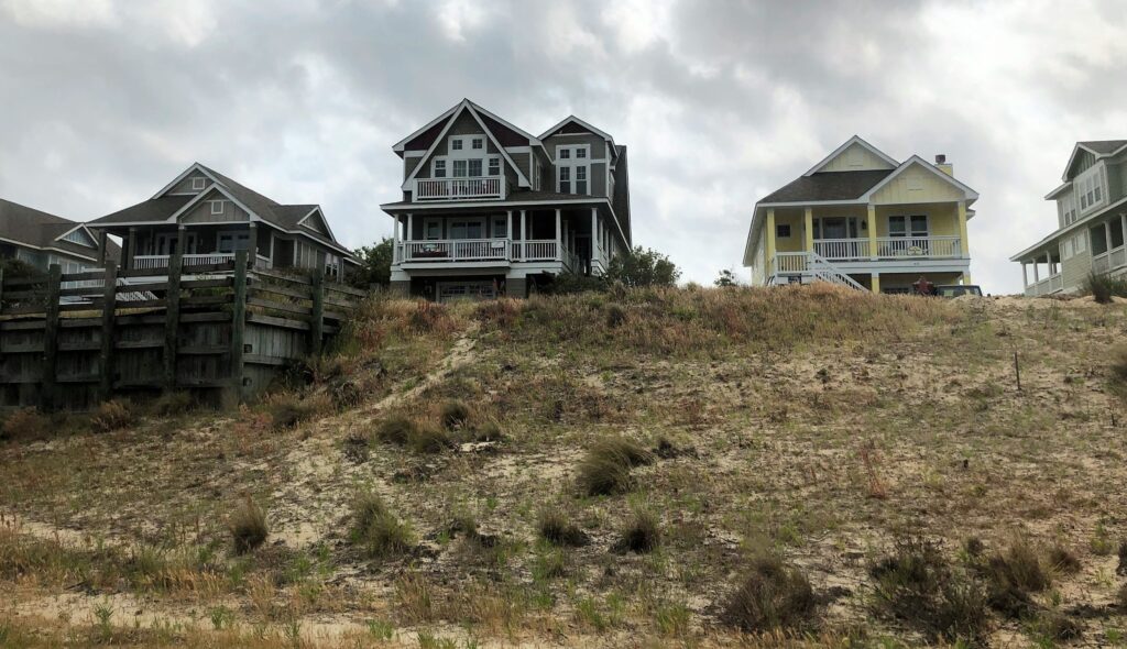
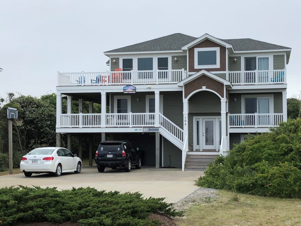
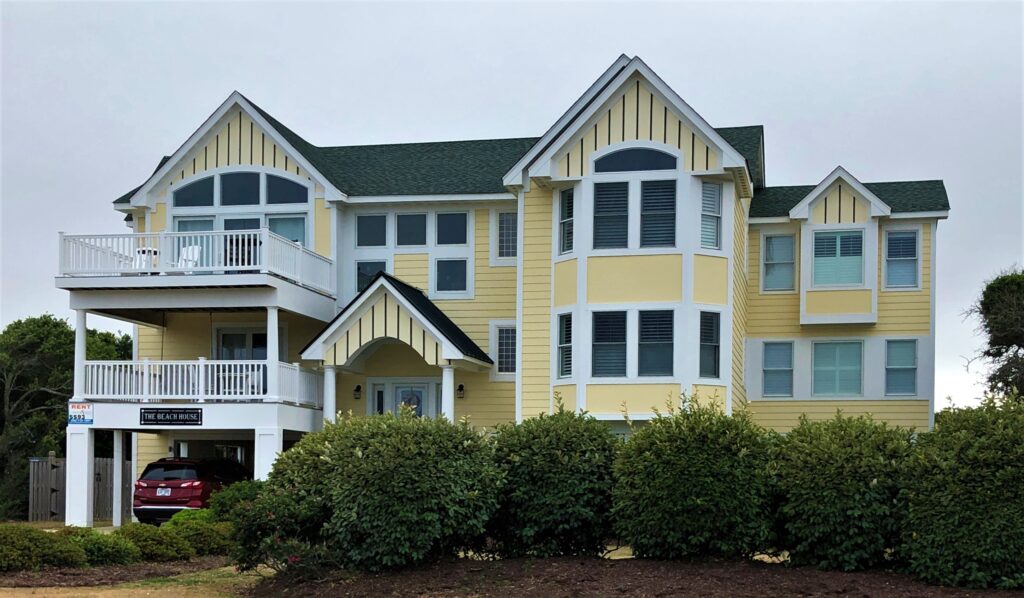
We drove south and loved looking at the homes along the way.
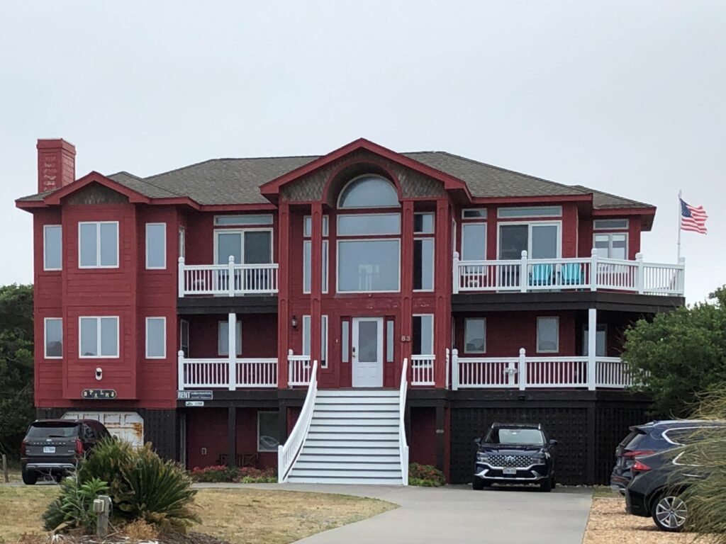
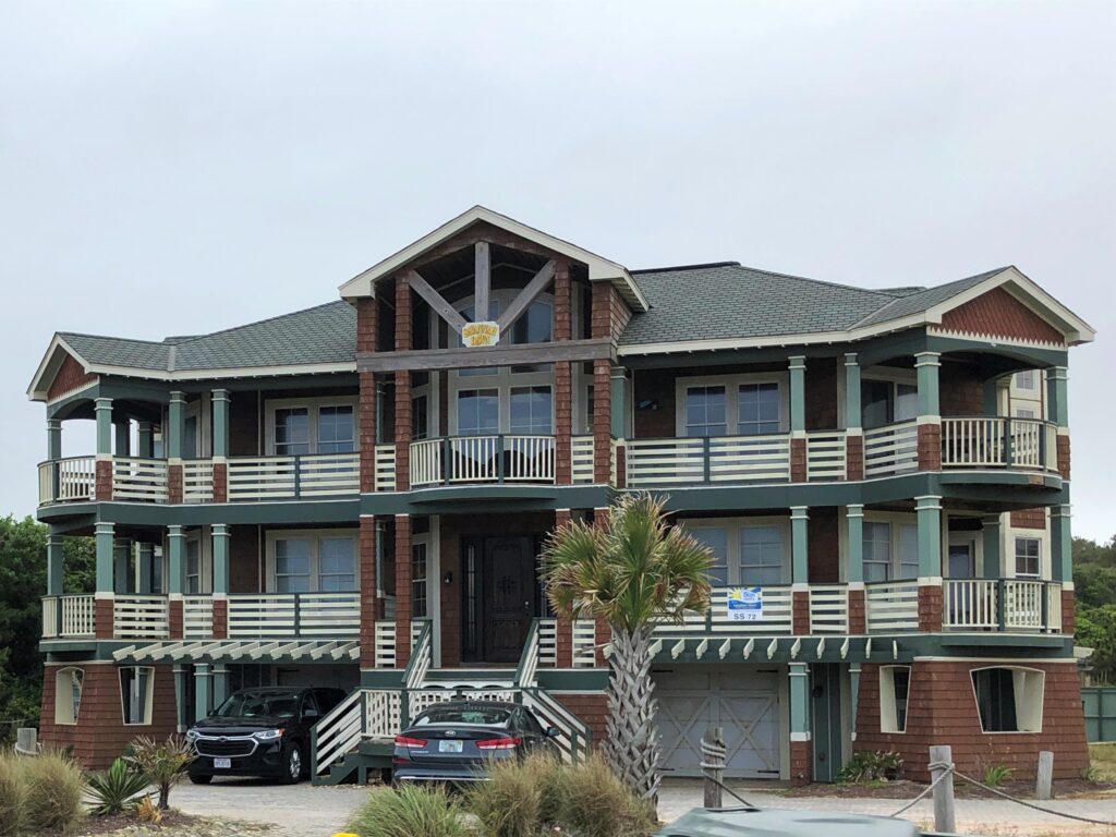
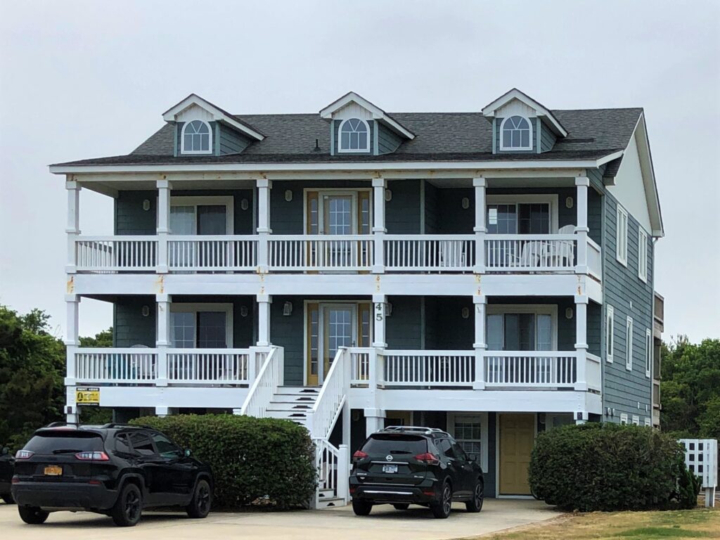
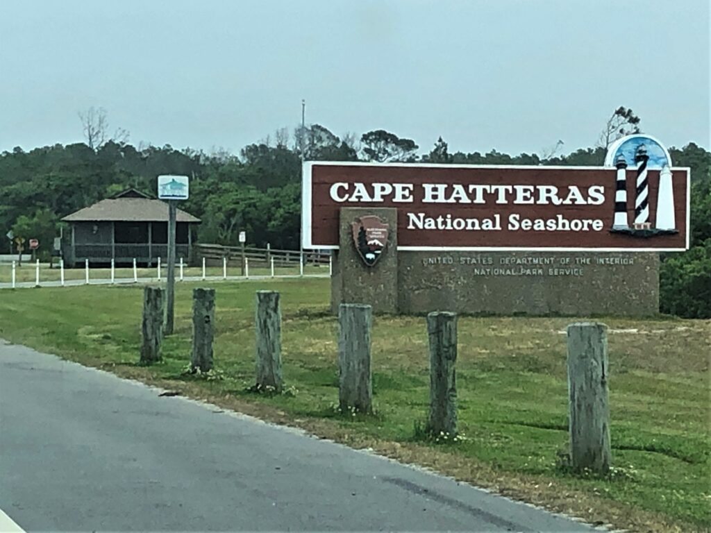
As we got to the south end of Bodie Island, we entered the Cape Hatteras National Seashore.
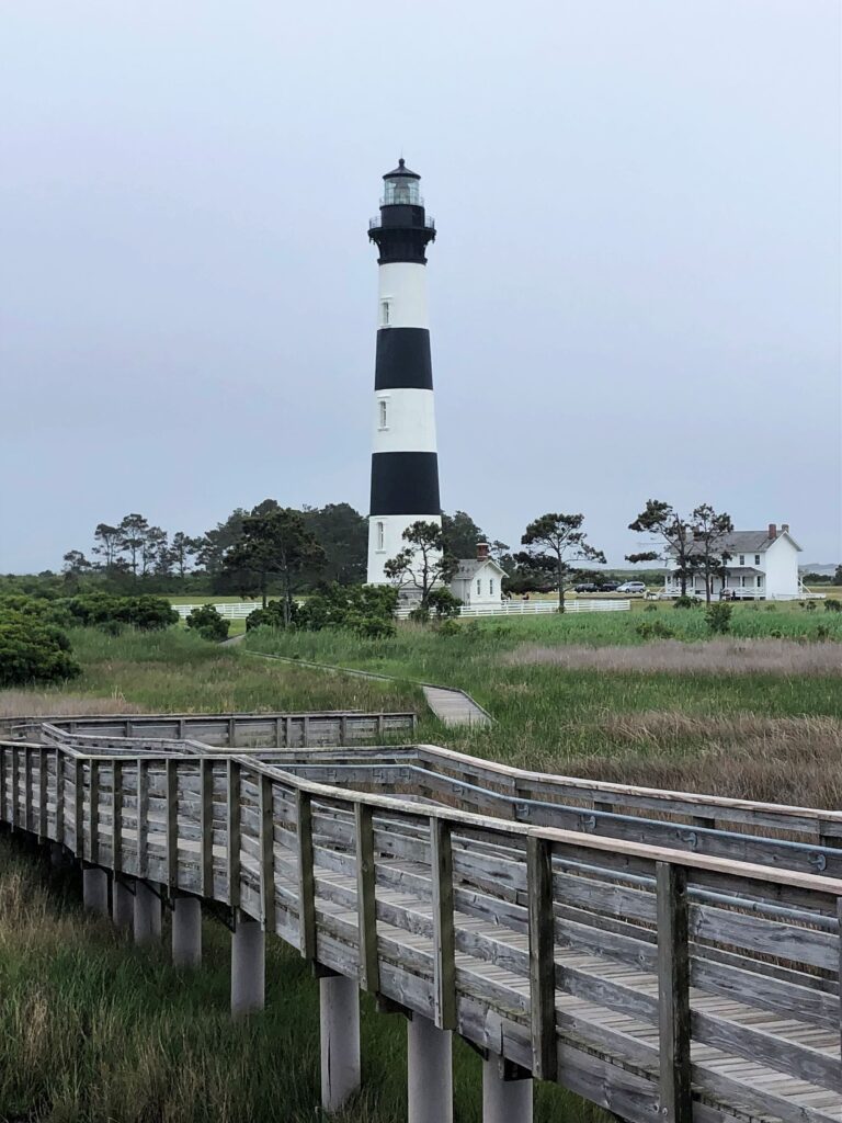
The Bodie Island Lighthouse built in 1872, and standing 156 feet tall is actually the third lighthouse built near the Oregon Inlet, but the first one to be built to the inlet’s north side.
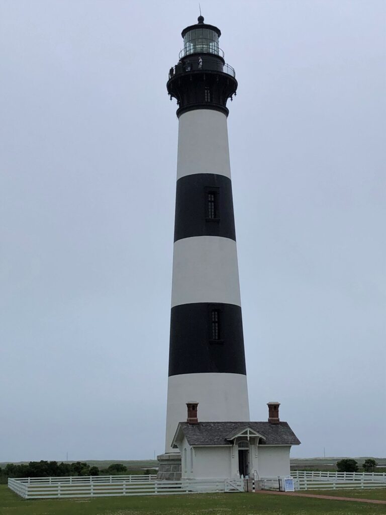
We did not make reservations ahead of time, so we were not able to climb the 214 stops to the top. There was a wooden walkway behind the lighthouse that the ranger recommended we check out.
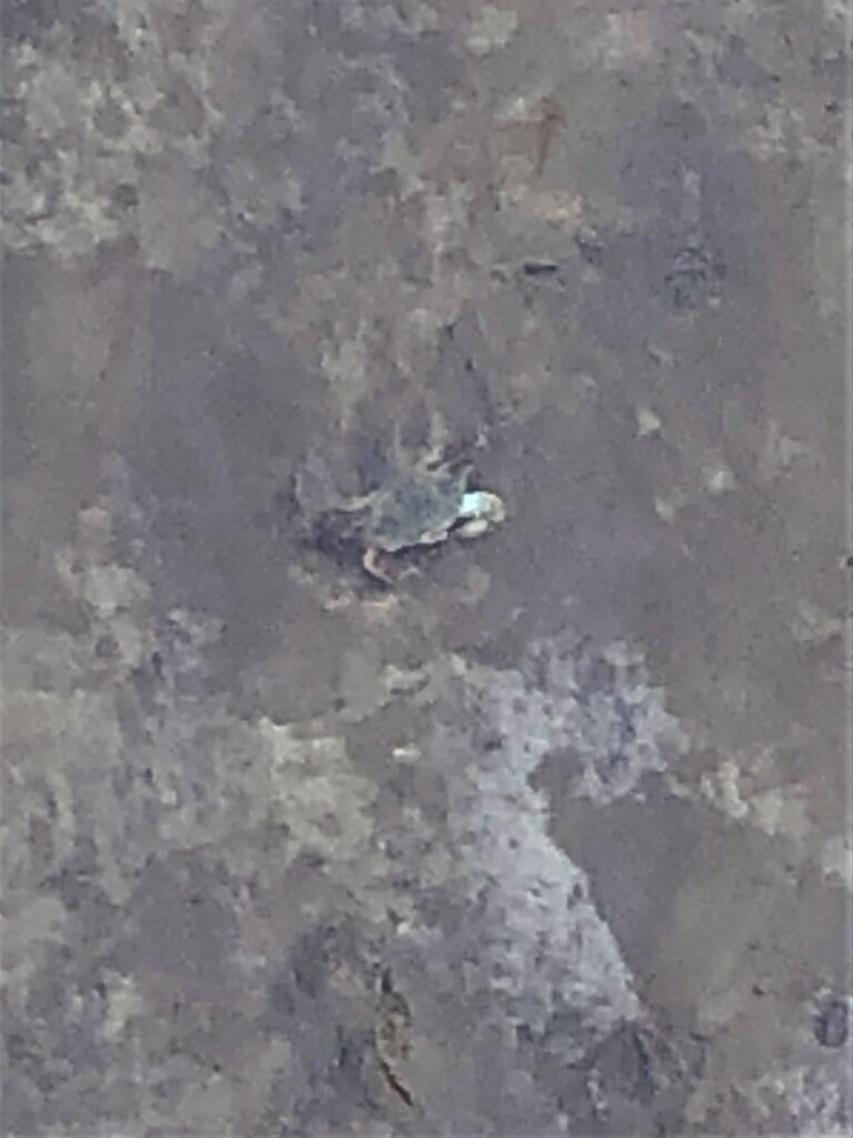
We could see blue crabs wandering around in the water.
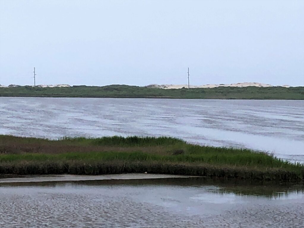
Ted suggested we see the Oregon Inlet, so we drove over the big bridge but there wasn’t a place to stop on either side to get a good look at the inlet.
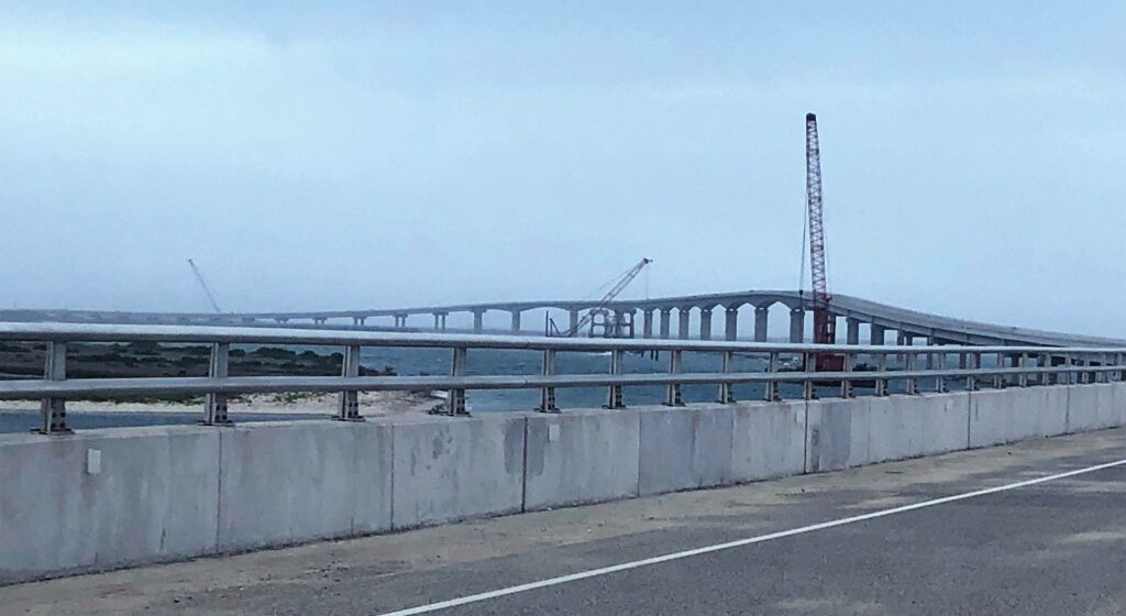
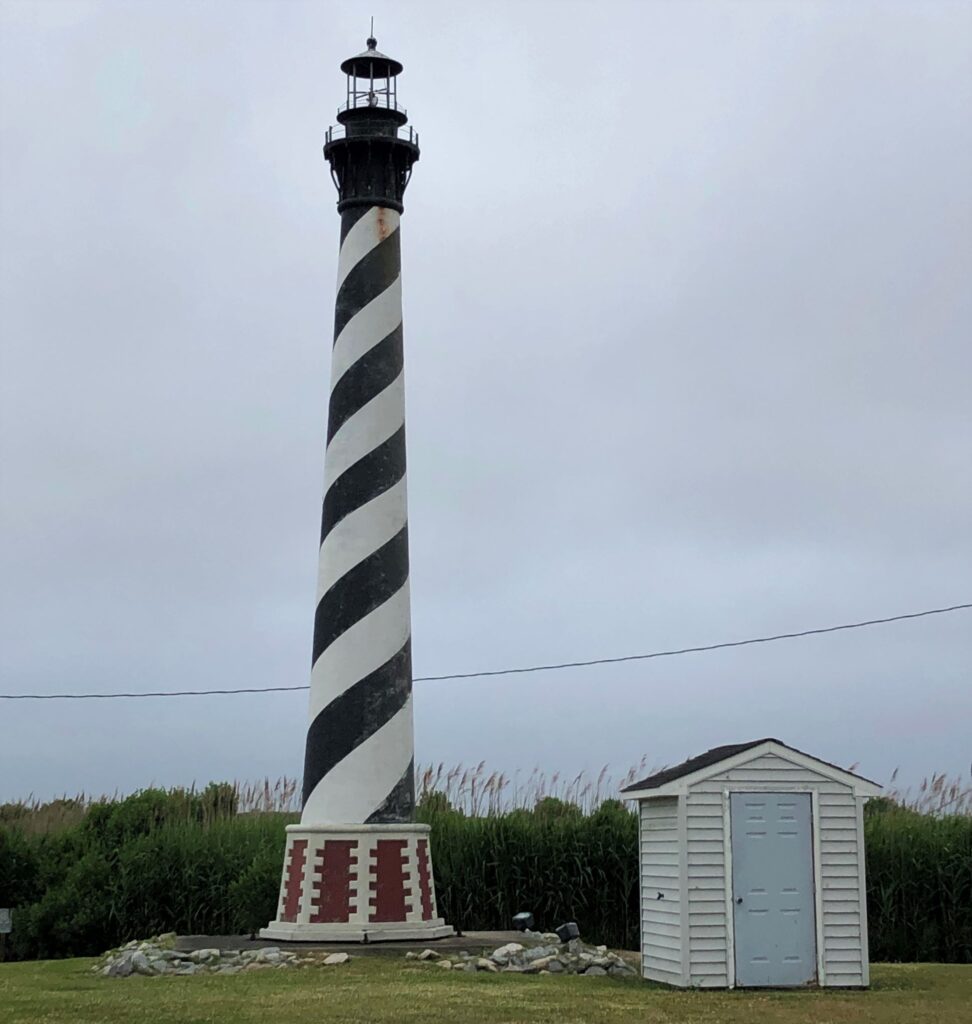
So, we found a place to turn around. We did NOT drive all the way down to Hatteras to see the famous Cape Hatteras Lighthouse, but on the way back home, we saw this model of it at the Alligator River Marina in Columbia, NC!
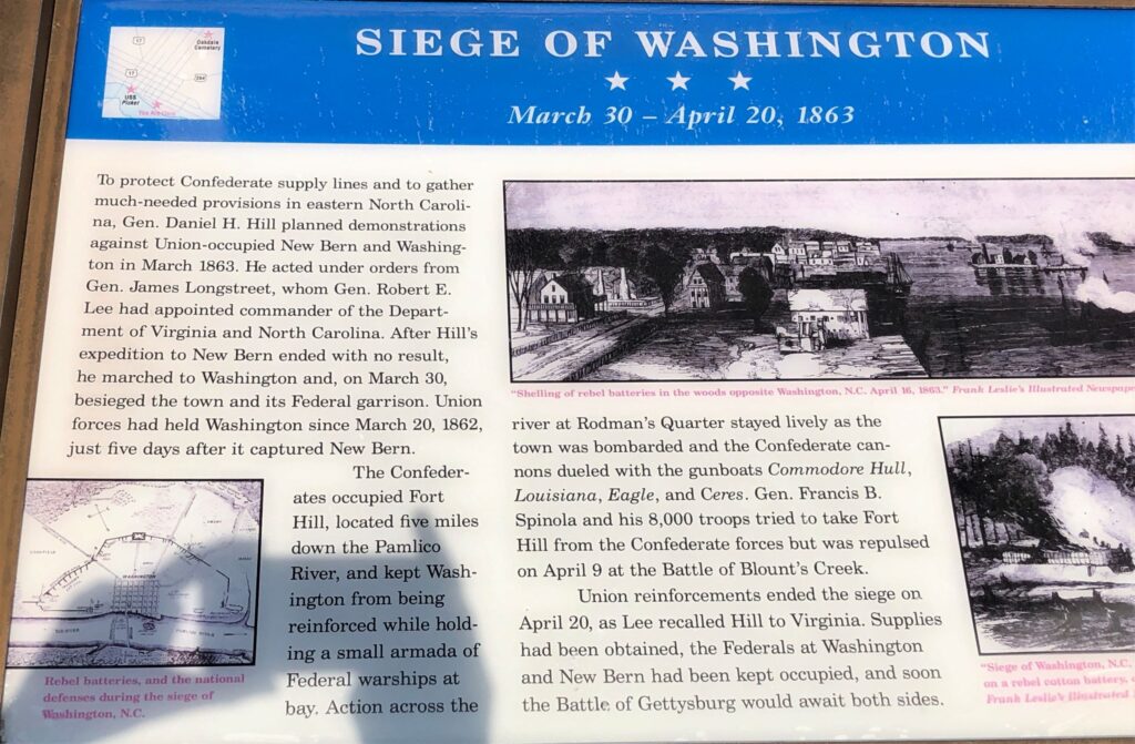
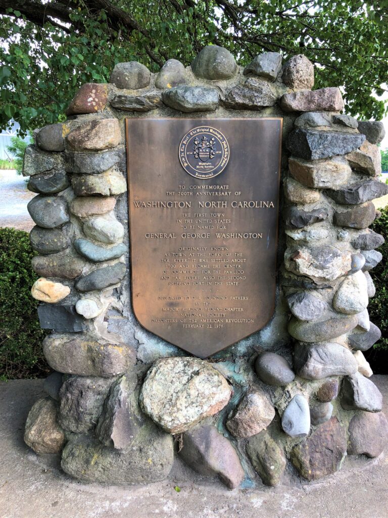
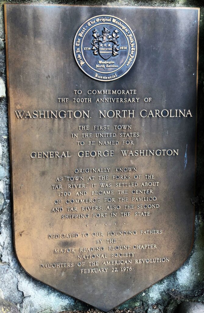
We got back to the RV park after the office closed on Monday, so on Tuesday, we received our mail that Chris sent and went through all of it! After lunch, we visited Washington; the first city named after George Washington. During the American Revolutionary War, Washington served as a supply port when major neighboring ports were under British siege. There was another siege during the Civil War, not long before the Battle at Gettysburg.
It is now a very quiet and quaint city with a population of about 10,000.
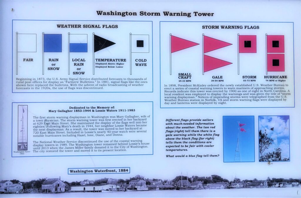
We saw a square white flag flying and this sign explains what the flag means.
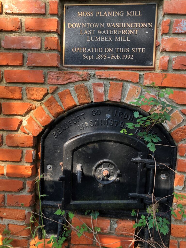
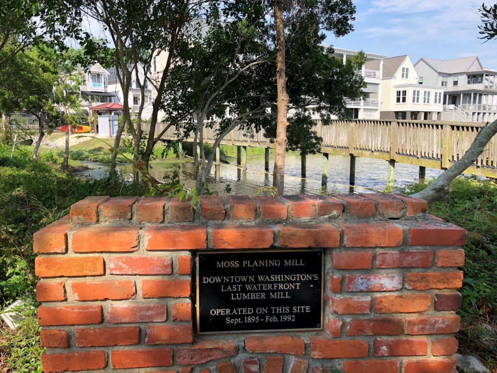
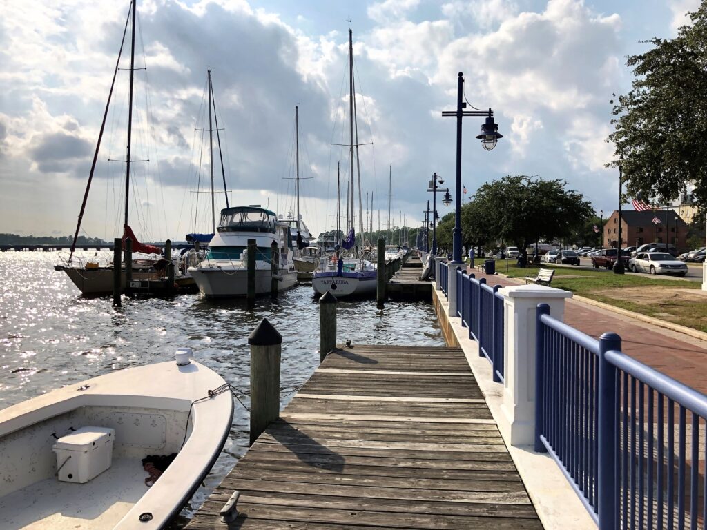
We walked along the waterfront at the Pamlico River where there was a nice boardwalk. Apparently, there were several lumber mills on the waterfront at one time – we saw this brick structure with a marker.
Lots of large homes along the waterfront.
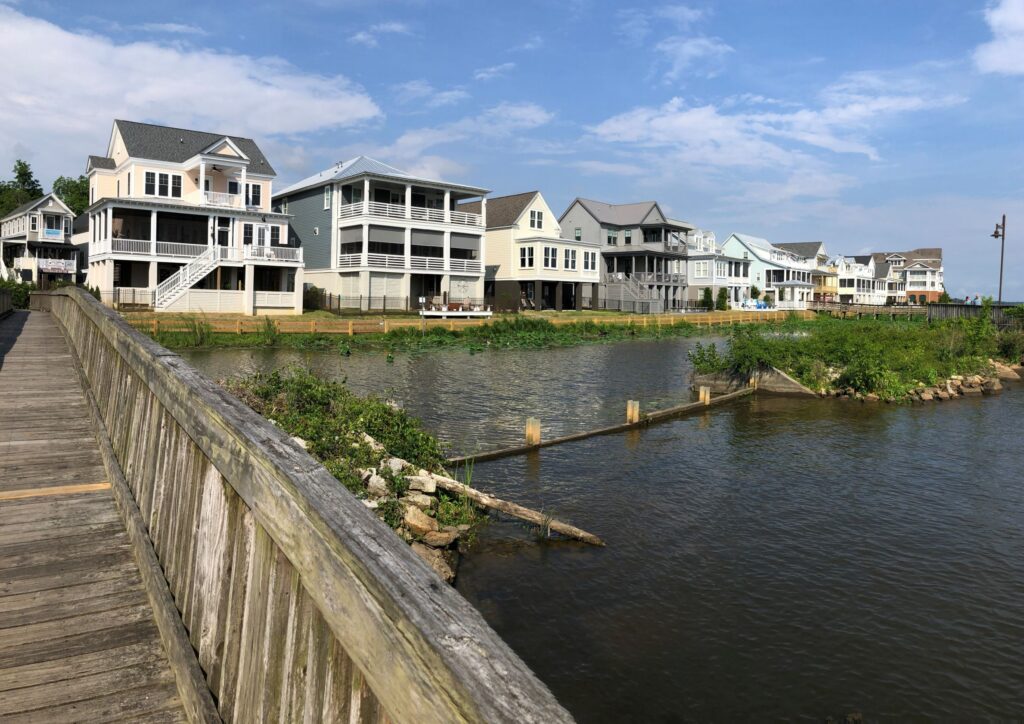
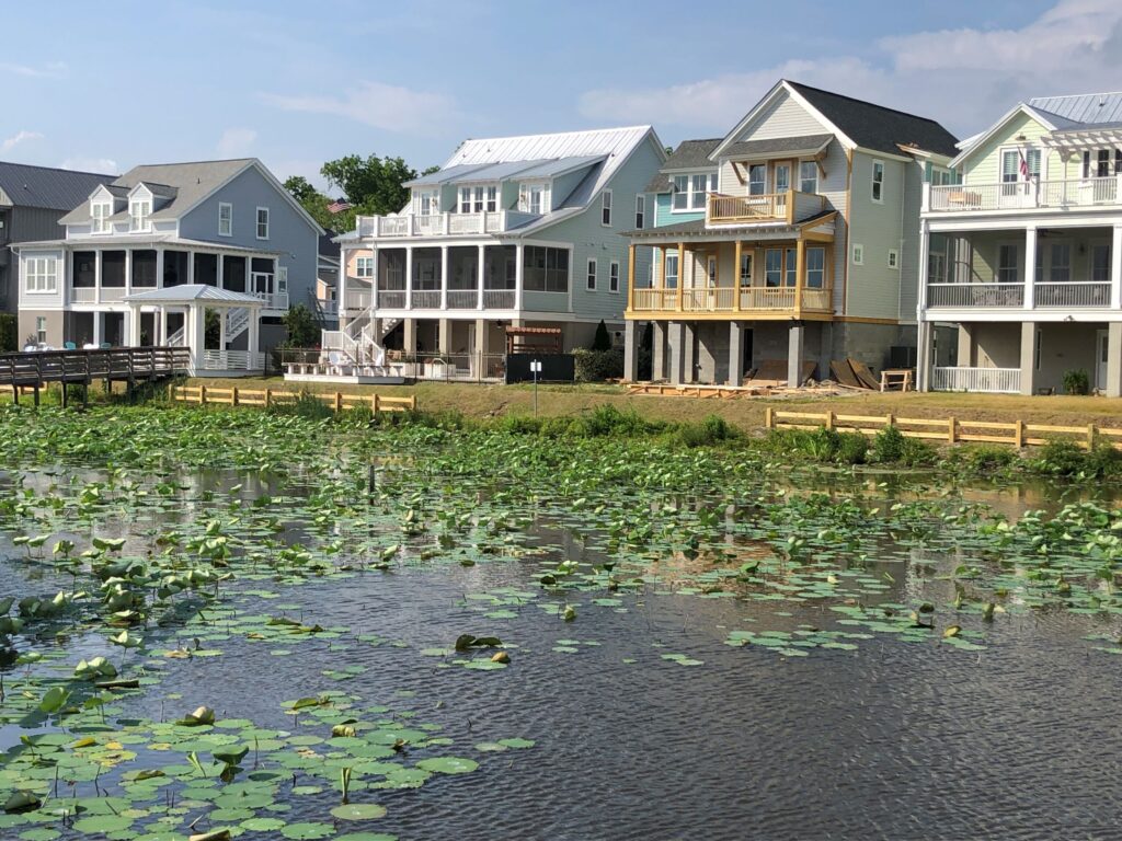
more homes! 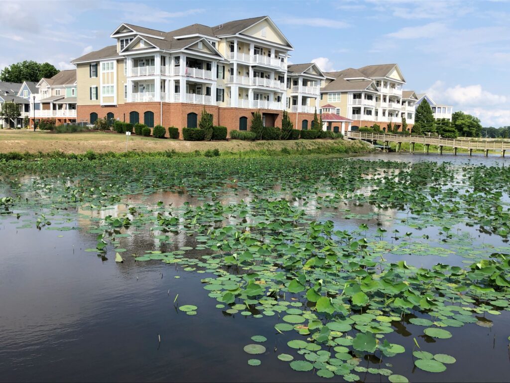
This looks like a hotel.
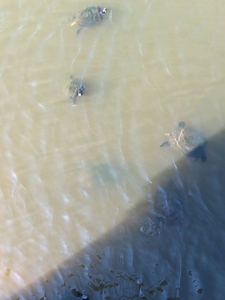
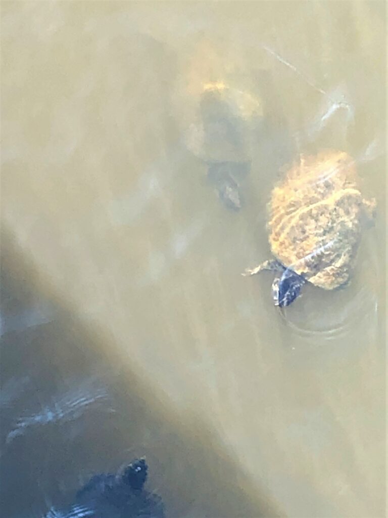
Several turtles were swimming around
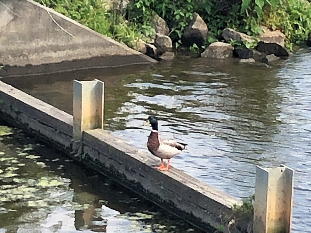
and a duck stopped for a pose…
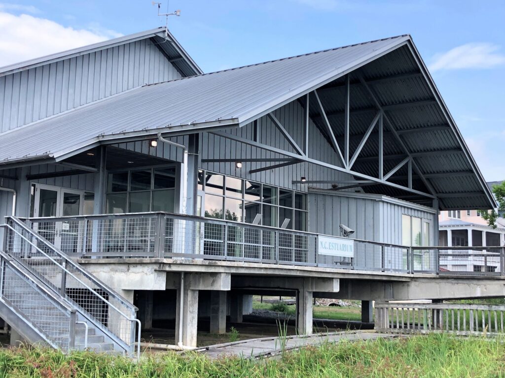
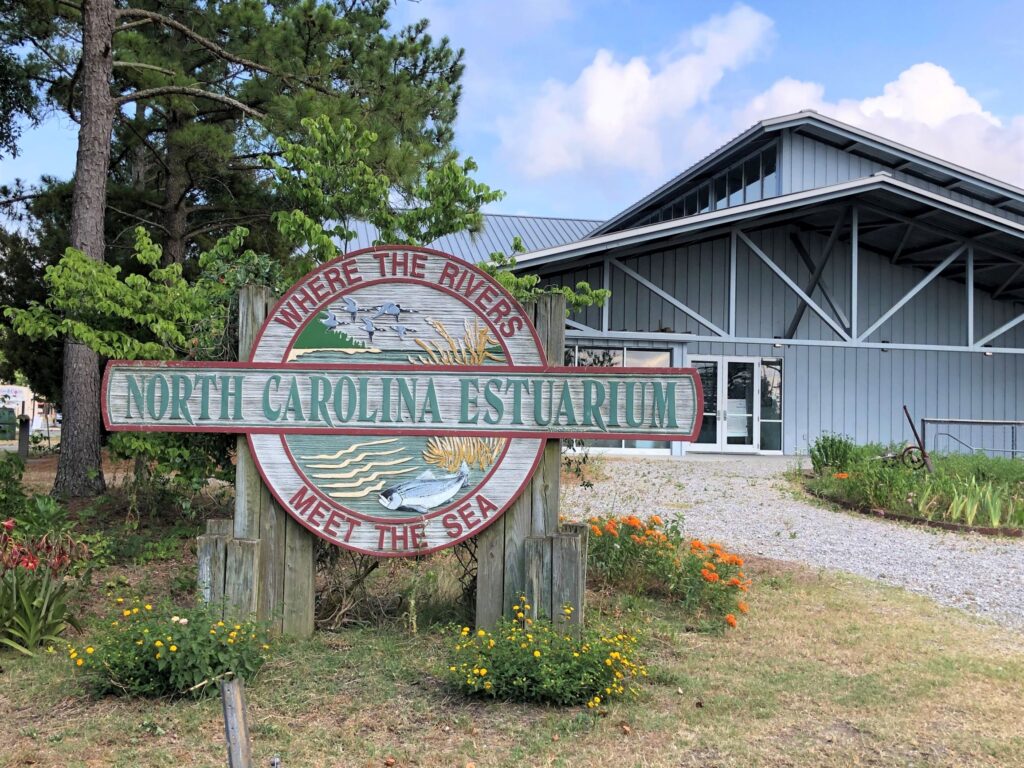
We saw the N.C. Estuarium, but it was closed already; we’ll come back tomorrow!
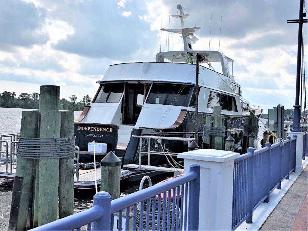
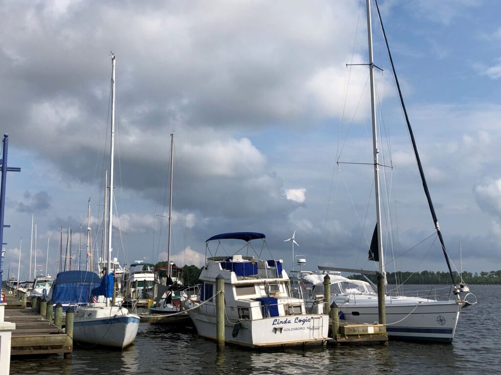
There were lots of boats moored on the waterfront. This one was particularly large!
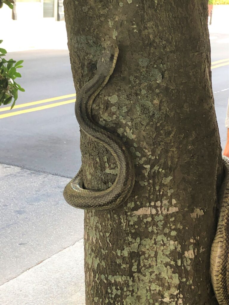
We walked around the downtown area and saw a corn snake on the sidewalk! it was probably 4-5 feet long.
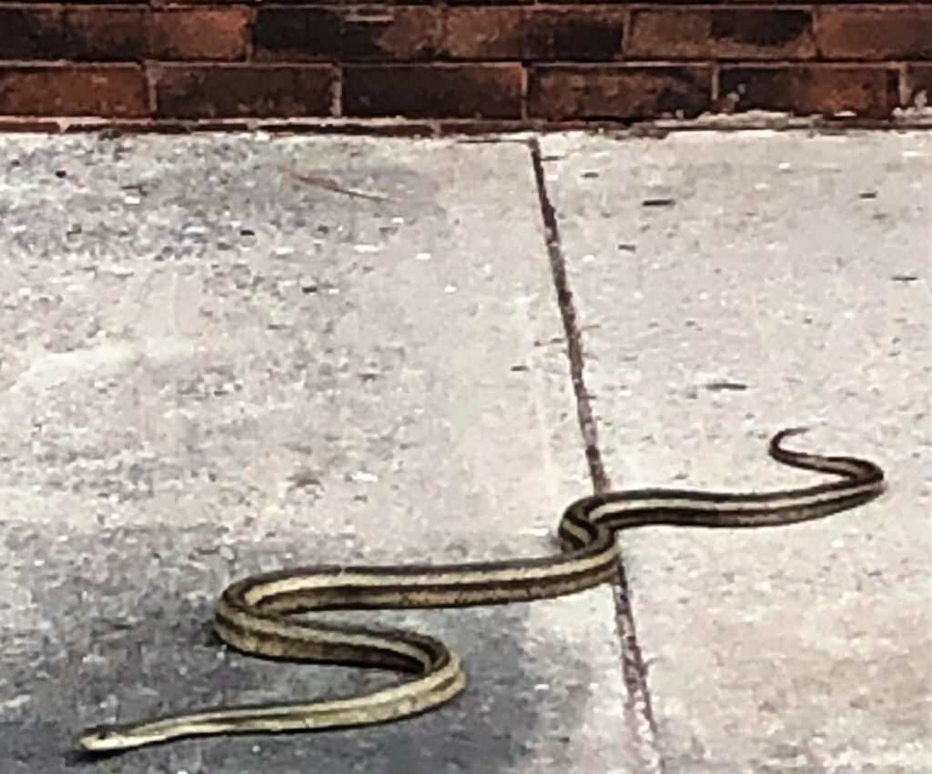
It climbed up a tree and was likely after a robin and its nest – the poor bird was chirping like crazy – as if it would scare the snake away?!
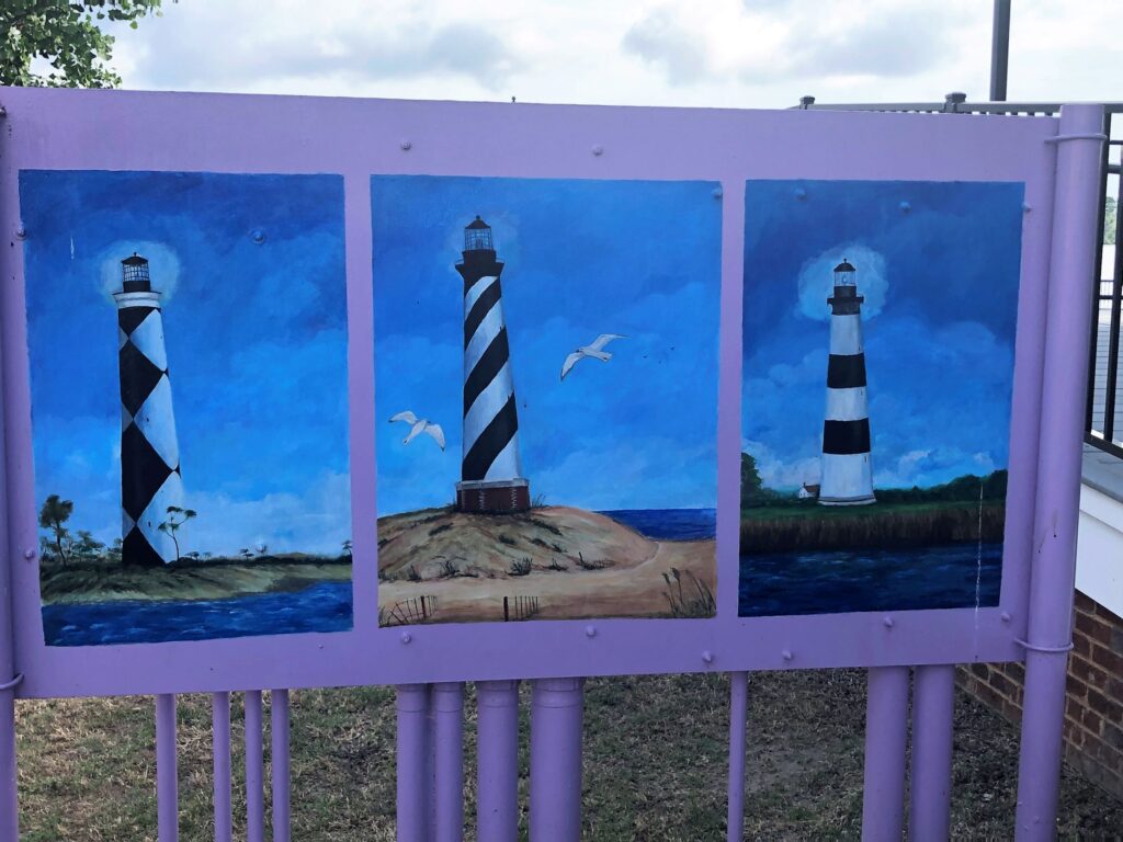
Love to see nice art work on Utility boxes that are otherwise a bit of an eyesore!
Wednesday, we did indeed visit the North Carolina Estuarium. and, go figure, it has exhibits about North Carolina’s estuaries! It was the world’s FIRST estuarium.
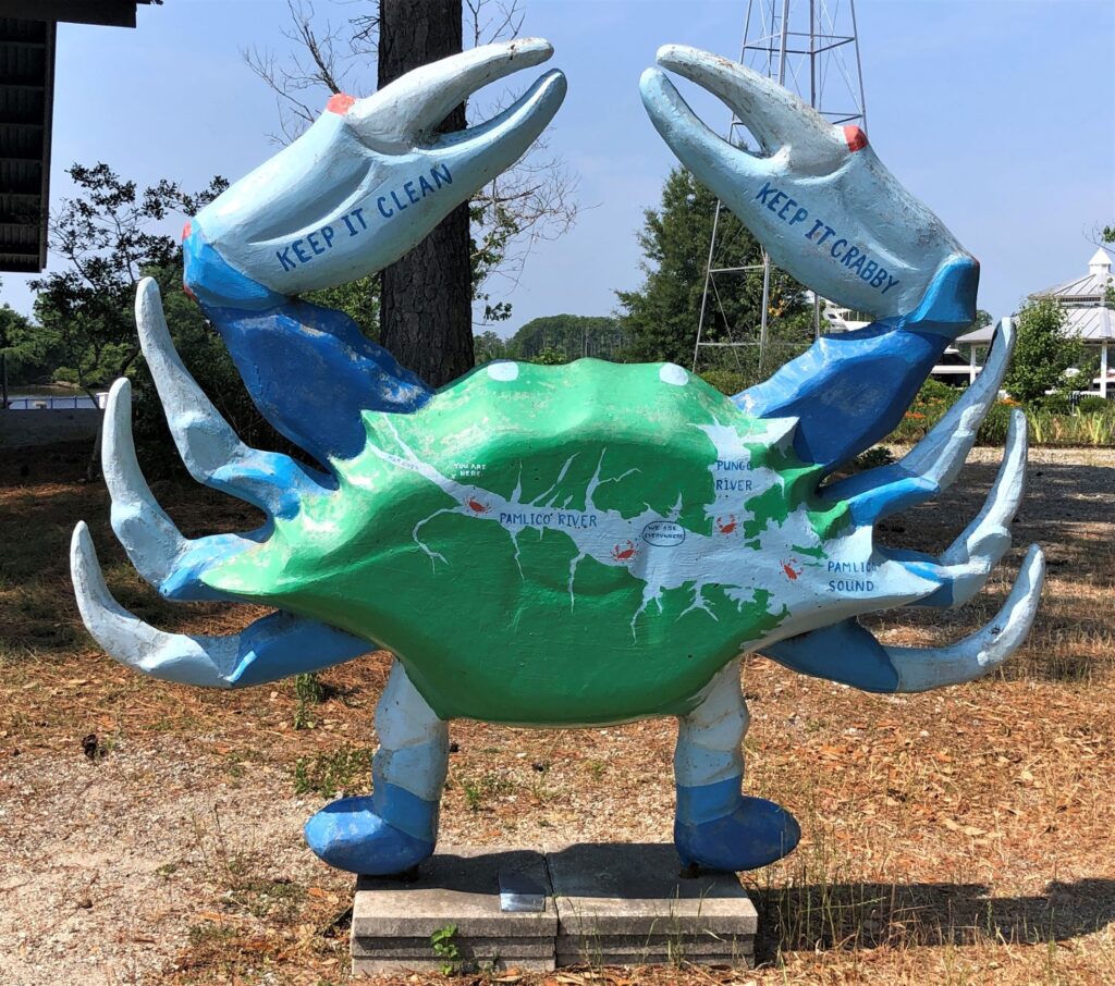
This crab was standing guard outside the estuarium. “Keep it clean – Keep it crabby!”
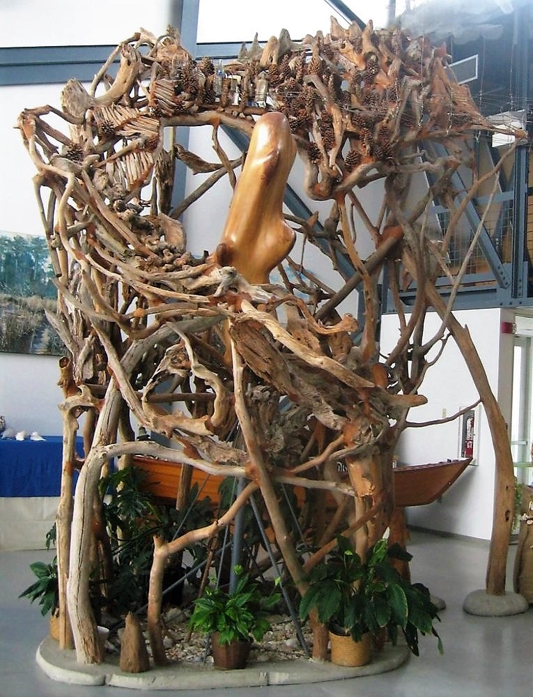
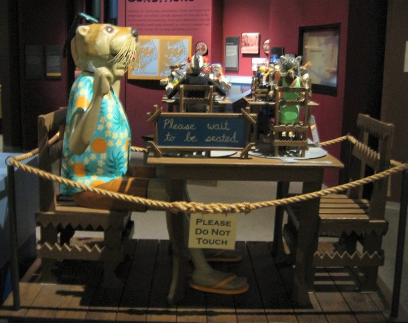
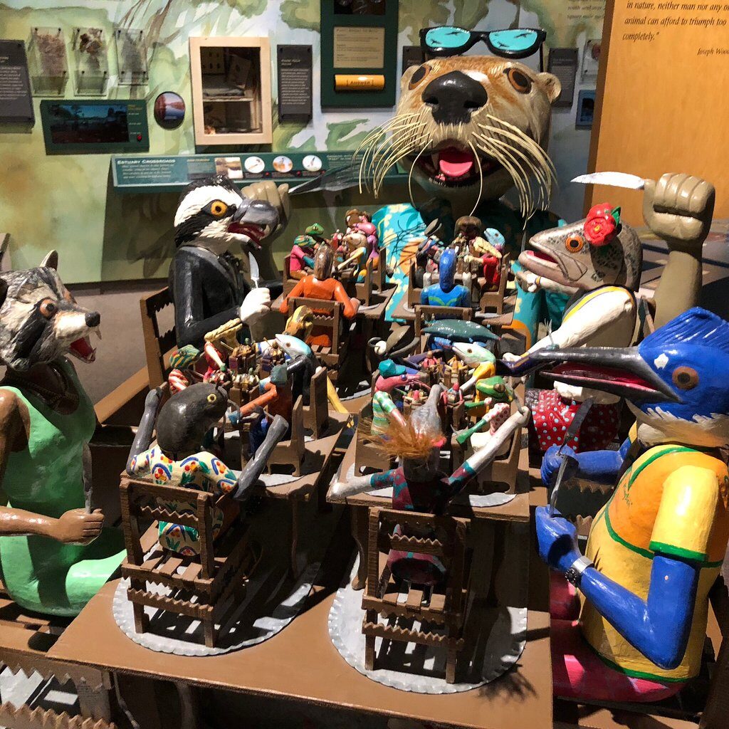
We were not allowed to take photos inside, but on Trip Advisor, Linda found that several folks had photos posted. Two of the sculptures were very interesting. The lobby had one that is, or represents, a nest, that, in turn. represents the state of North Carolina. We can’t remember all that the museum employee told us, but starting at the 10:00 position, the “ribs” represent farm land, the bottles represent cities, then the mountains, the branch coming down the right side to the floor represents the Outer Banks. The sculpture actually filled the whole room with a cloud over it, and a track that a ball, representing a raindrop would fall, and then run its course, into the river and back to the cloud.
This sculpture represents the food chain; in reverse order, the otter can eat all the critters on the big table; the critters on the big table that have a smaller table of what they can eat, etc.
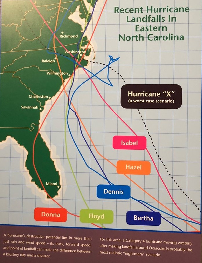
There were some aquariums and pools with critters that live in the estuary and displays of all sorts of interesting things. There was a map of the tracks of recent hurricanes that have hit North Carolina and a track that would be a worst case scenario.
An interesting place – and only a $5.00 admission. They also run a free boat tour out in the estuary, but we had not made a reservation, so we were unable to go.
On Thursday morning we left for Williamsburg, arriving with Acey’s mileage at 73,005.9.
May 27 marks ONE YEAR on the road! In that year, we have driven Acey 11,171.4 miles, Thor has gone 18,976 and ridden our bikes 1,097 miles and visited 27 states. We thank God for safe travels and good health!
![]()
Thank you for the show on the road. That bridge by Oregon Inlet was gigantic. I don’t recall it being so big when we were there, but you may’ve gone further south than we did. Interesting info about Orville and Wilbur’s parents.
A beautiful area of the country – we are learning a lot about historical events as we move along!