We left Newberry at 9am on Monday August 23 with Acey’s mileage at 76,467.1 and Thor had 91,314 miles. We stopped at Muldoons Pasties (PASS-TEES) in Munising and bought 4 pasties to have for dinner – 2 tonight and 2 to freeze. We stopped to top off Acey’s fuel and also made lunch at L’Anse. It was a beautiful day for a long drive!
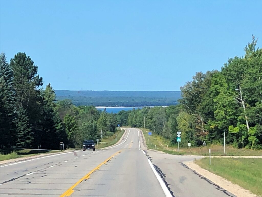
We arrived at Lake Fanny Hooe Resort & Campground in Copper Harbor at 4pm.
After we got settled, we walked over to Brickside Brewery for a pint or 2, then came back to Acey and heated up the pasties. They were very good! We like to have them with a bit of chili sauce.
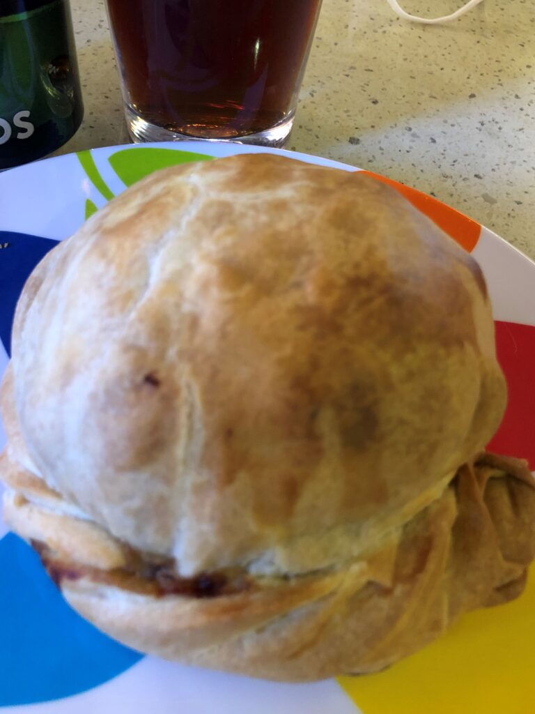
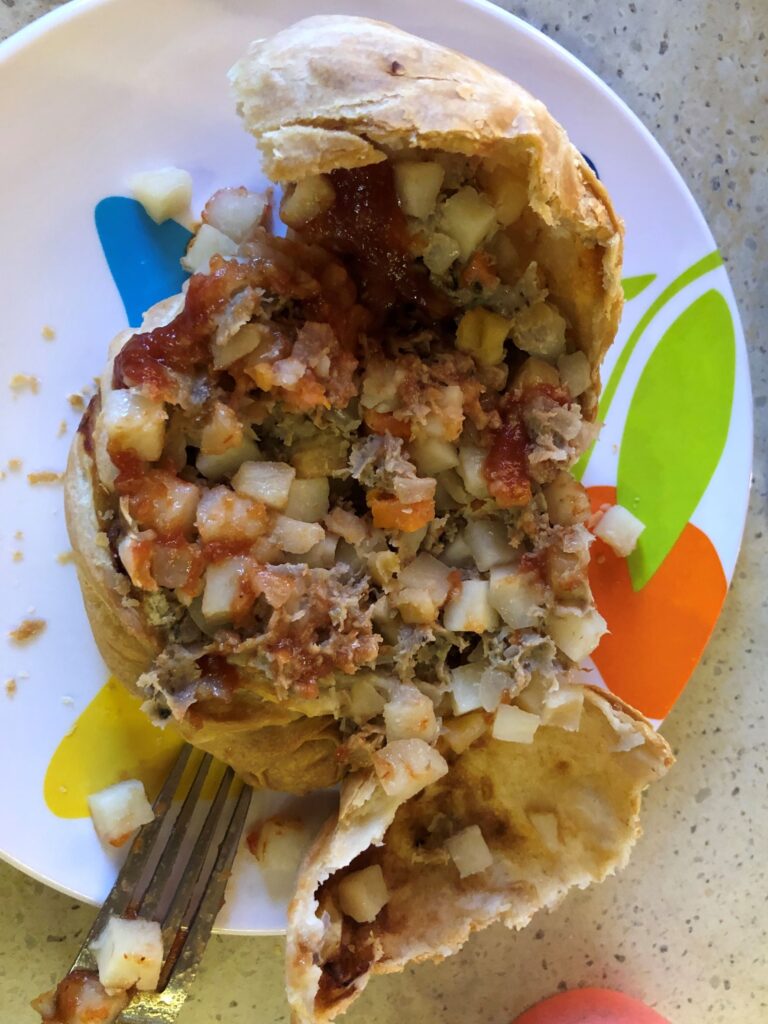
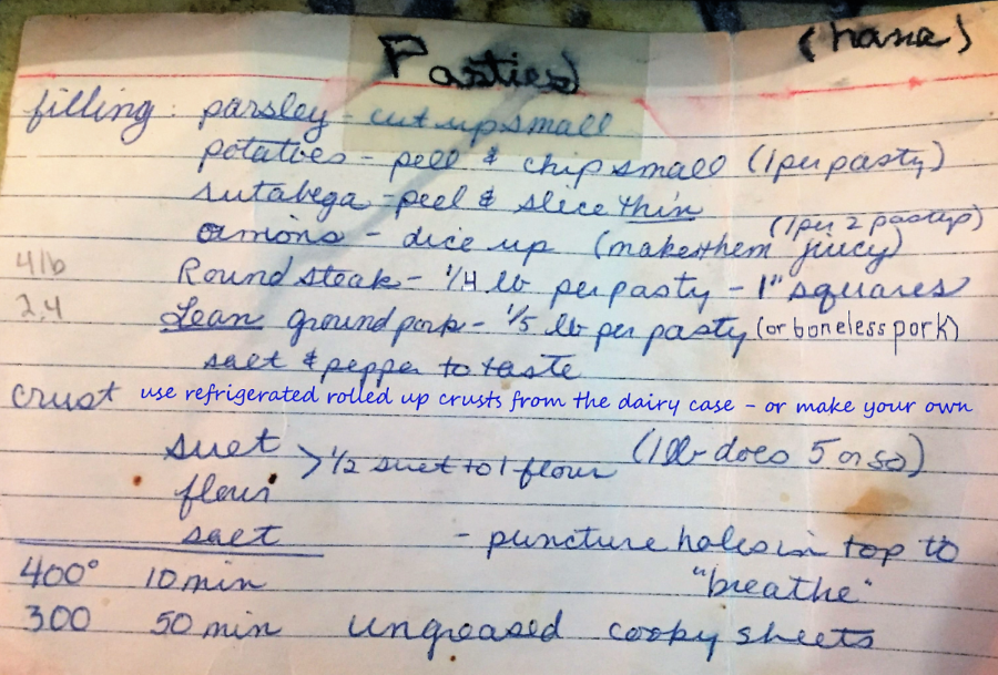
Here is a copy of our family recipe for pasties – we do not use carrots like the ones from Muldoons. They use ground beef – we use round steak and boneless pork.
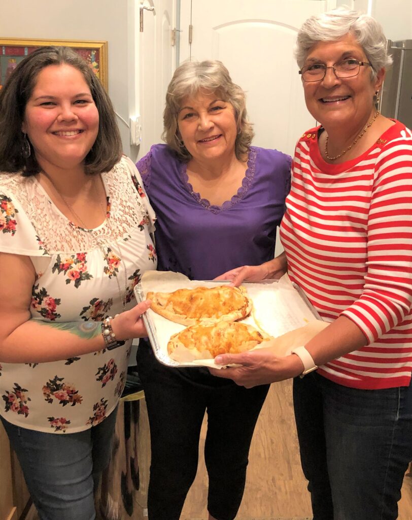
We made some pasties at Eve’s back in March – here’s two of the ones we made
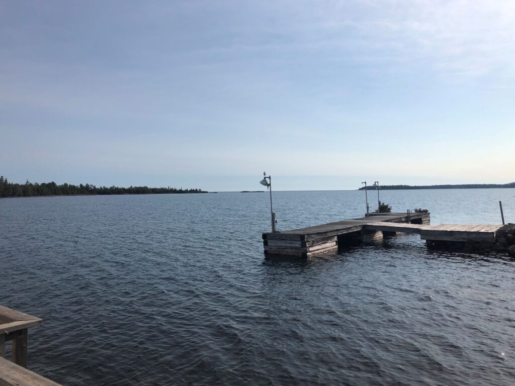
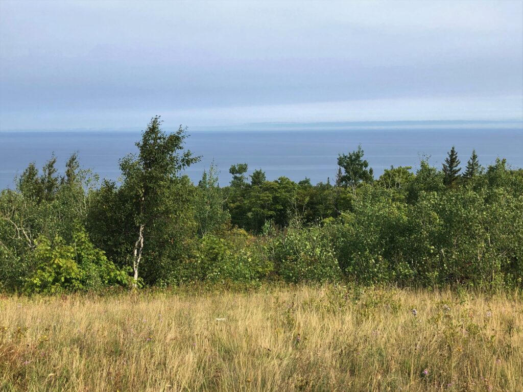
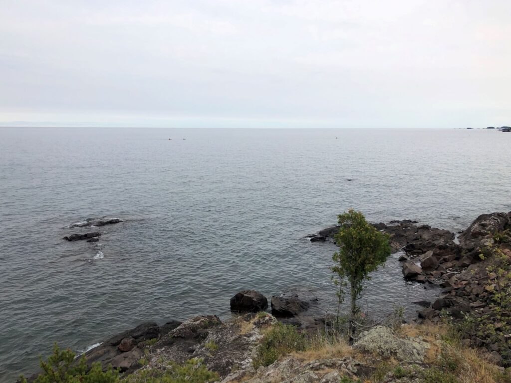
Tuesday we drove around Copper Harbor to see the area. There was a viewing dock not far from the campground where we could see the harbor – the inlet is further to the right – there were large rocks visible between these land masses.
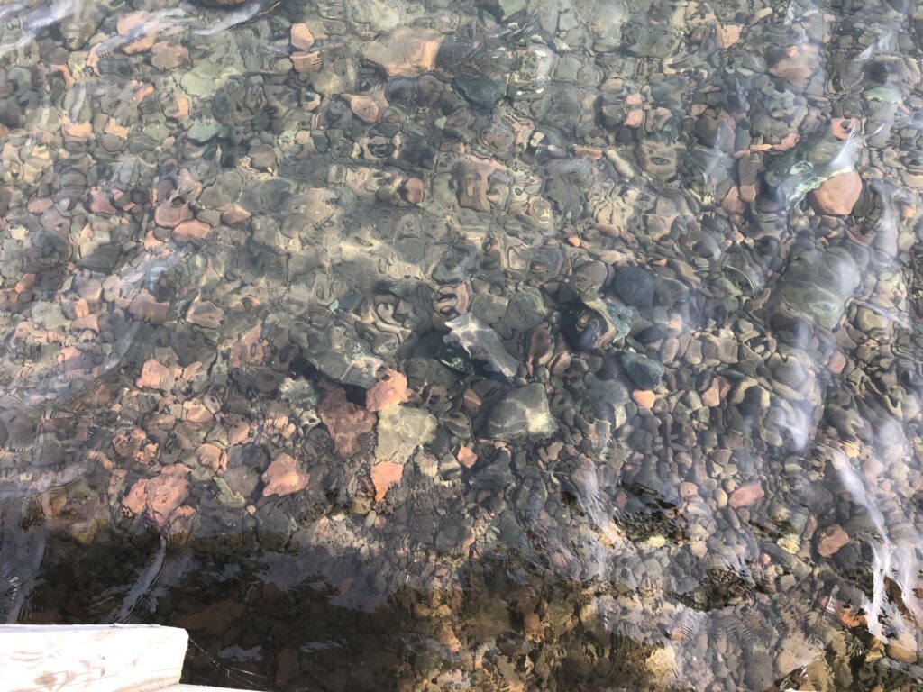
the water was crystal clear.
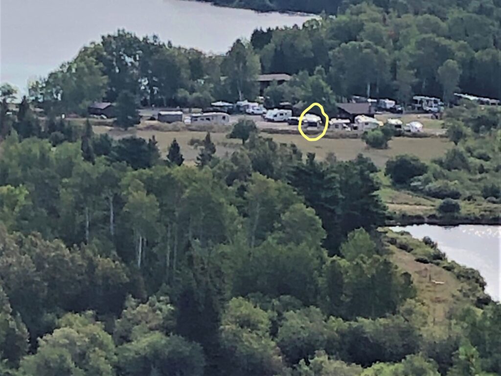
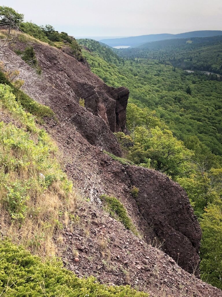
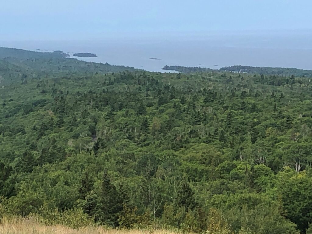
We drove up Brockaway Mountain and the view was amazing – at the first view point, we could see Copper Harbor and Lake Fanny Hooe – the long lake to the right of the harbor – the campground is visible between Mud Lake and Lake Fanny Hooe.
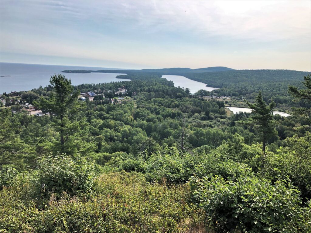
We could just barely make out Acey at the campground! We really needed a better camera than the iPhone 8…
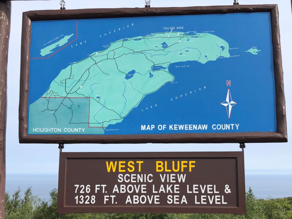
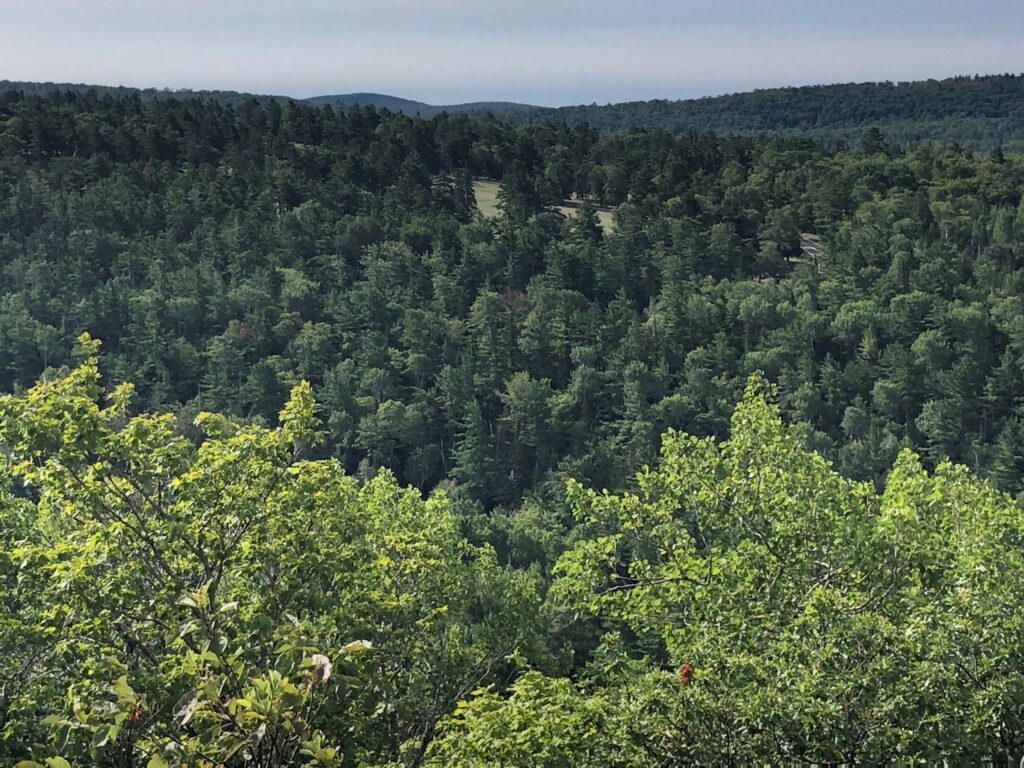
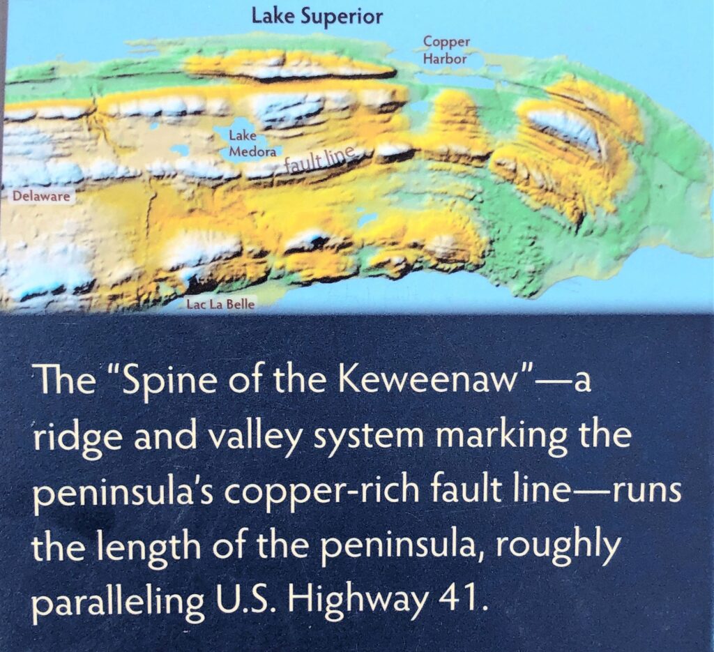
Here’s the view at the top of the mountain. There was a map of the peninsula; the “dog ear” of the U P.
We could see the part of the golf course too
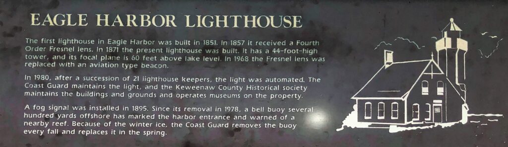
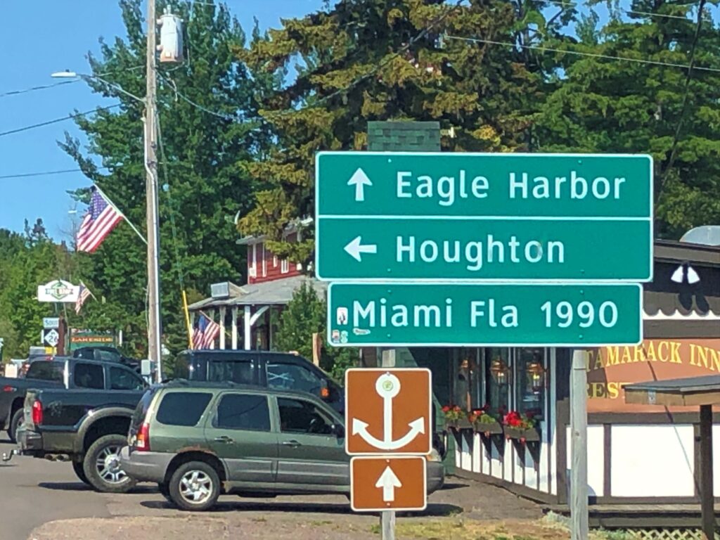
Eagle Harbor
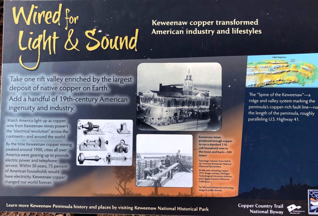
A lot of copper was mined in this area – giving the name to Copper Harbor.
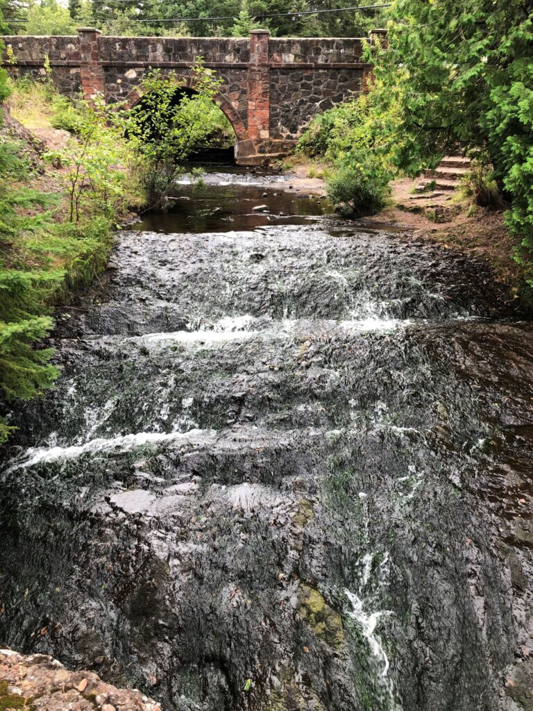
We drove down the mountain and stopped to take a look at Silver River Falls.
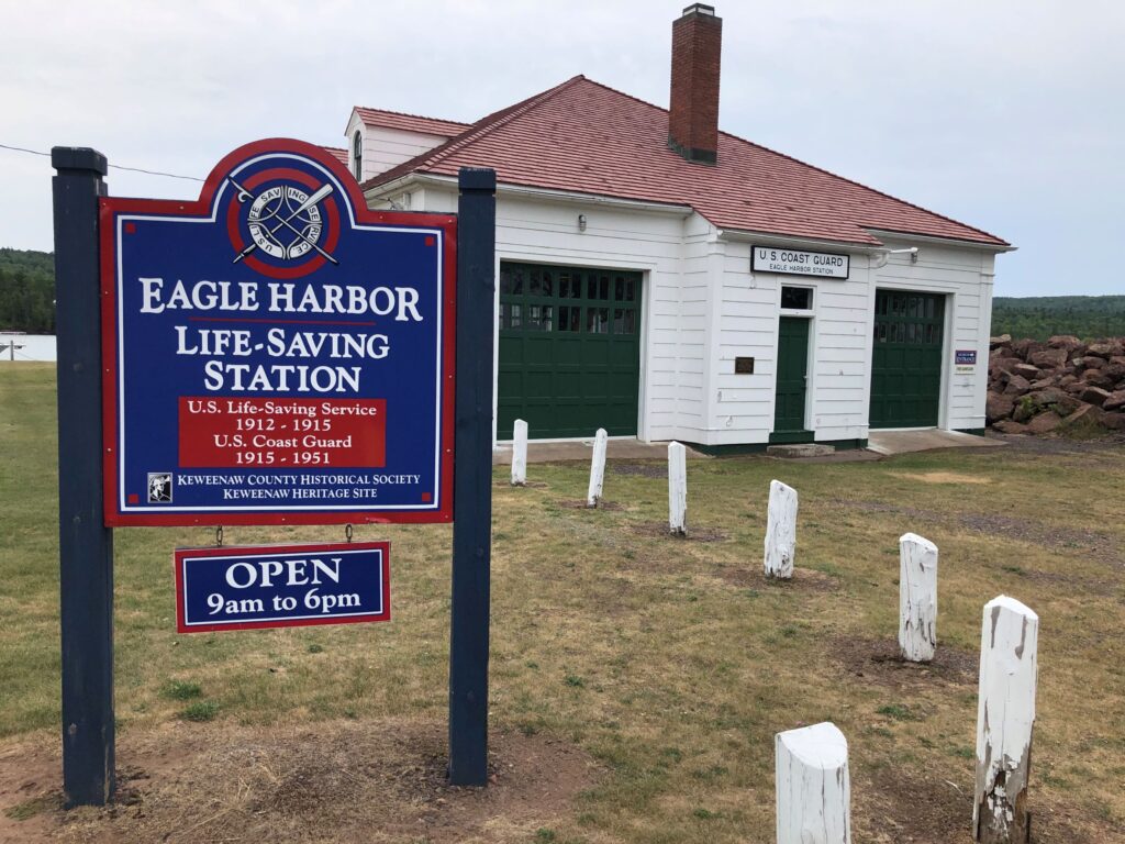
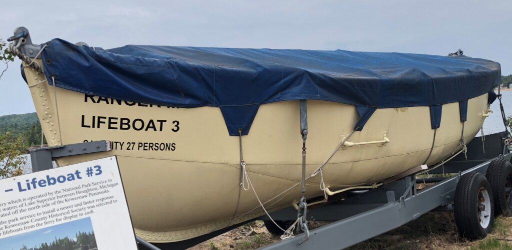
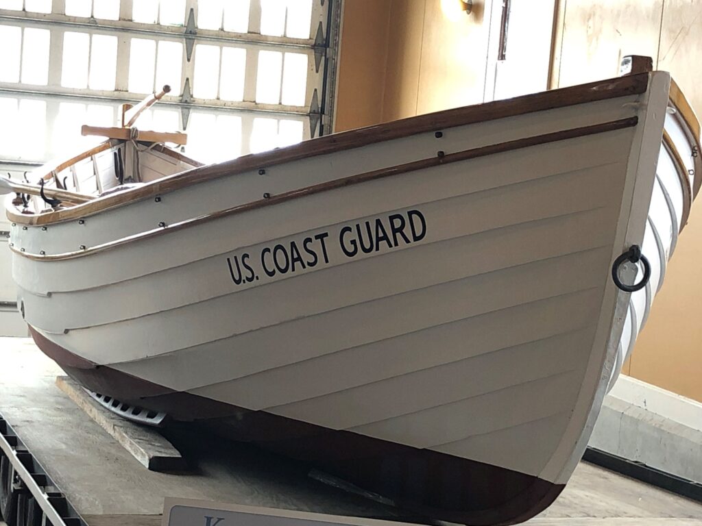
A sign indicated a Life-Saving Station so we stopped there too. This used to be a Coast Guard Station.
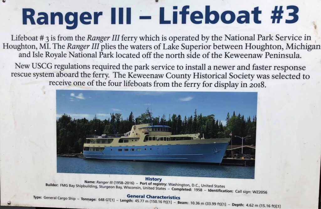
Next to the building was a lifeboat from the Ranger III ferry that runs between Houghton and Isle Royal National Park.
Inside, there were some surfboats used for rescuing those in peril. We saw one like this at Whitefish Bay. This is a 26 foot Tye H Pulling/Sailing Surfboat that is being restored.
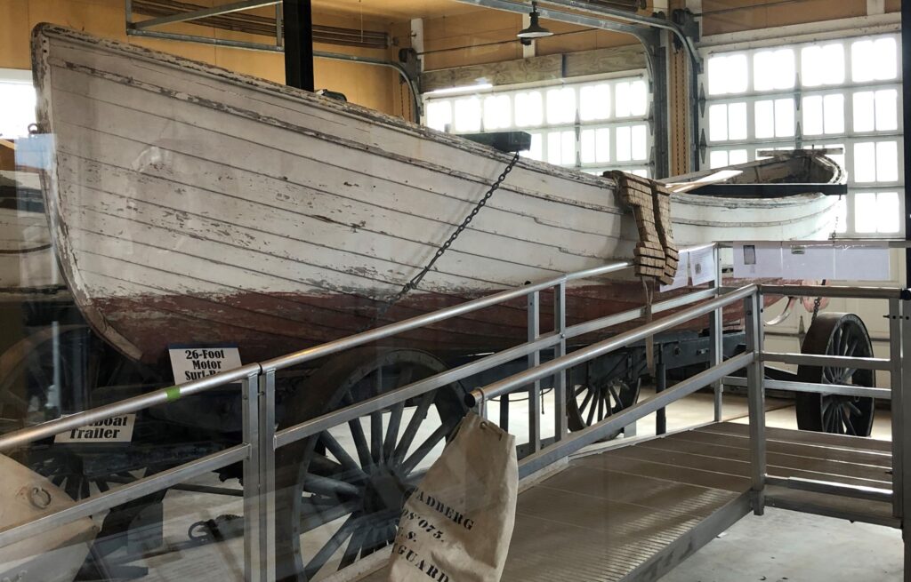
This is a 26 Foot Type S Motor Surfboat – the very first experiments of placing motors into the surfboats occurred in Marquette, MI – the surfboat trailer under this boat made it easier to haul the boat down the shore to launch it closer to where it was needed.
Across the water, we could see the Eagle Harbor Light
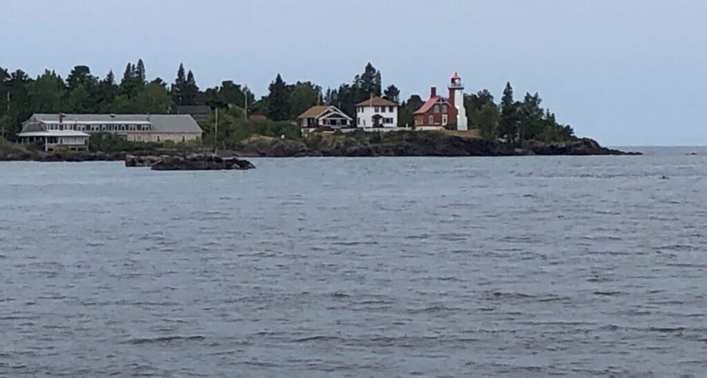
We drove over to Eagle Harbor and got a closer look!
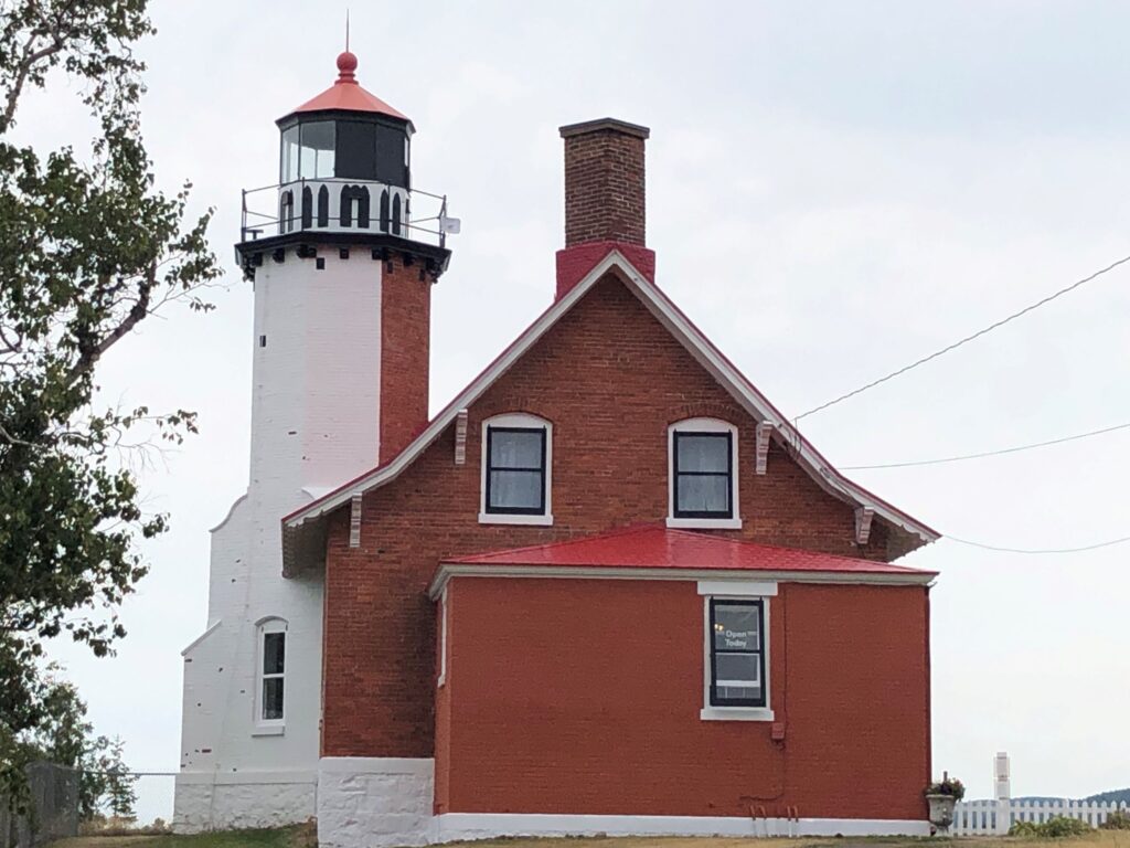
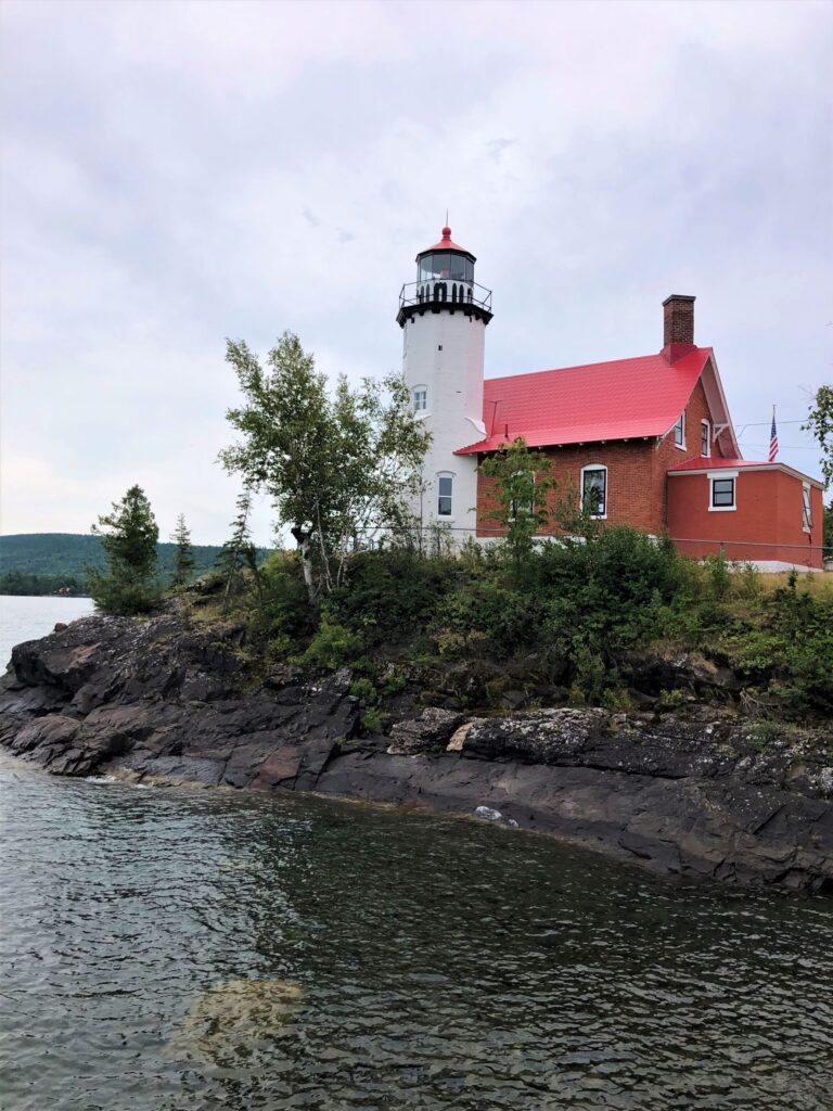
Some signage gave us good information.
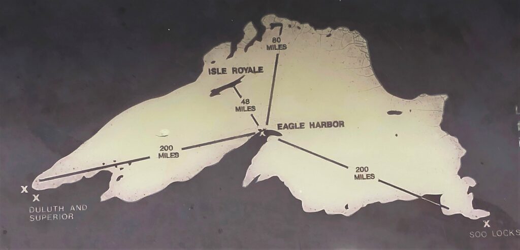
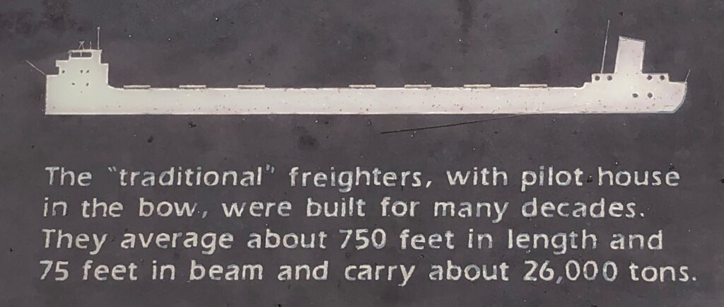
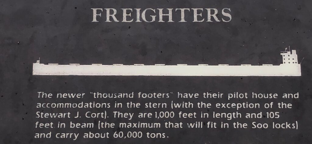
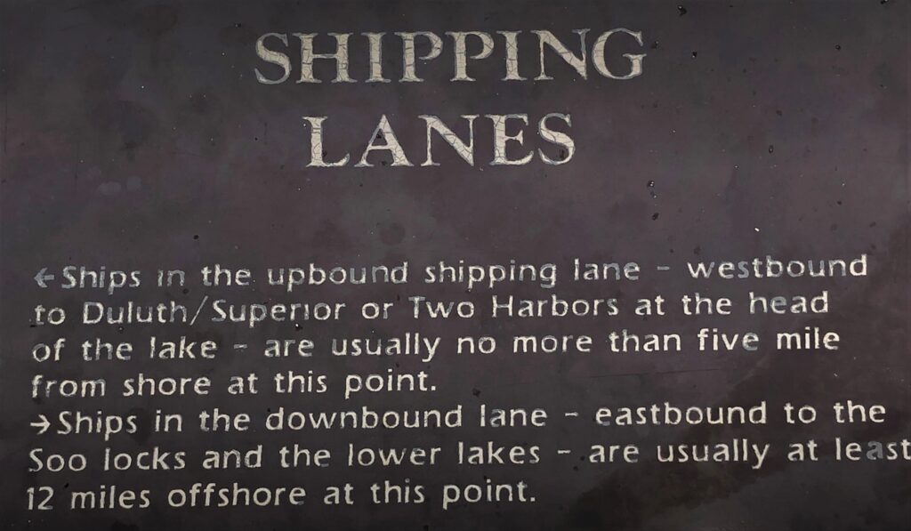
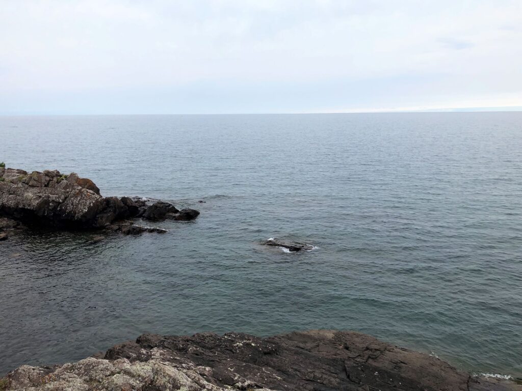
Lake Superior – at 31,700 square miles, is the largest fresh-water lake in the world. Its deepest point is 1,333 feet. Its surface is 602 feet above sea level. Here’s a little info about freighters that was posted near the lighthouse.
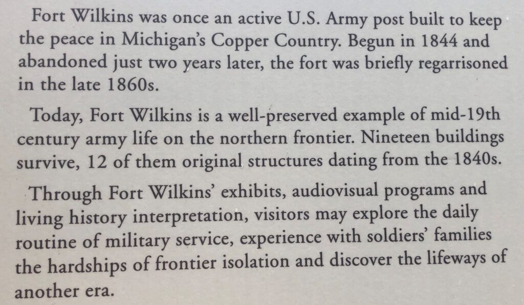
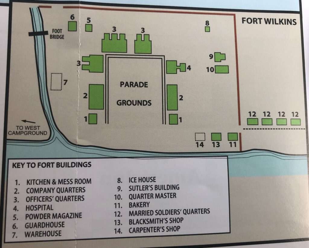
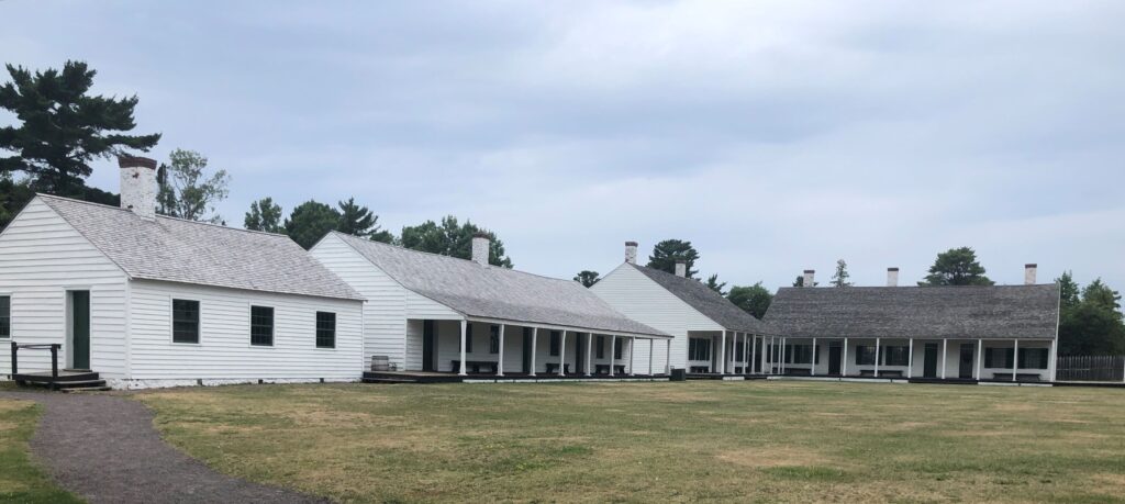
This was one of the few days we didn’t pack lunch, but we found a nice diner at Eagle Harbor. Then we went to see Fort Wilkins.
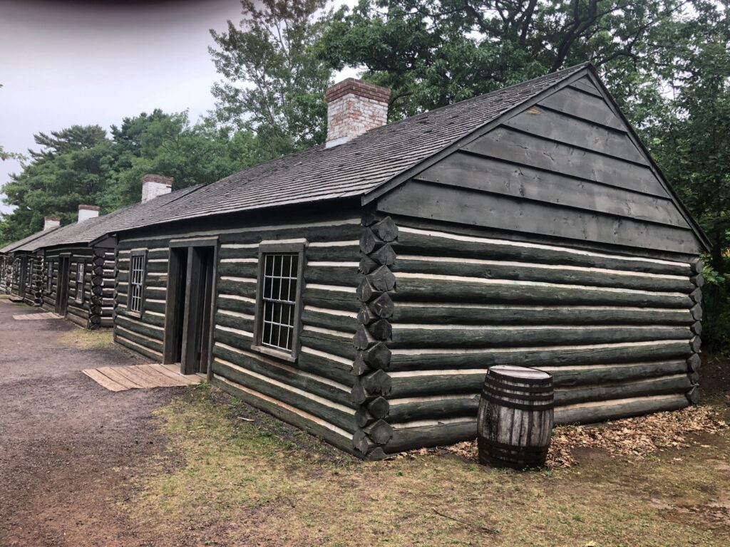
These were the married soldiers cabins. The wives did laundry for the soldiers and were paid for their efforts – the soldiers had a fee deducted from their pay.
Most of the buildings were open and had information about soldiers liives – some were furnished as they would have been during the time the fort was active.
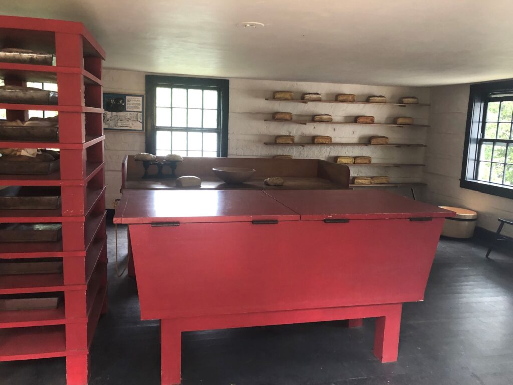
The bakery was full of “fresh loaves of bread”!
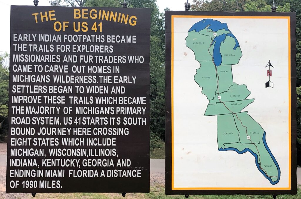
Just past Fort Wilkins was the northern end of US 41 – it runs from Copper Habor all the way south to Miami, crossing eight states – Tennessee is not mentioned – nor is Florida (by name anyway). Passing thru Nashville, US 41 is Murfreesboro Road.
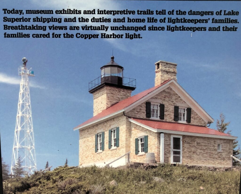
We could see the Copper Harbor lighthouse from a viewpoint near the Fort. To get a closer look, you have to go by boat.
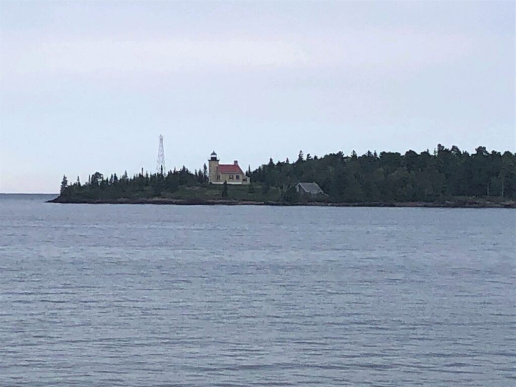
A sign at the viewpoint had a nice photo of the lighthouse and some more information. The steel tower next to the lighthouse now holds an automated beacon. Certainly not as picturesque as a lighthouse!
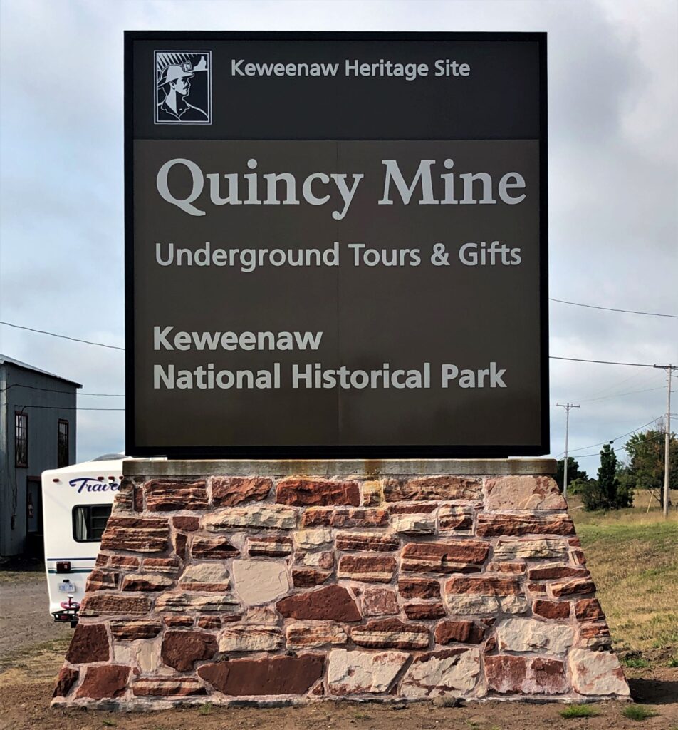
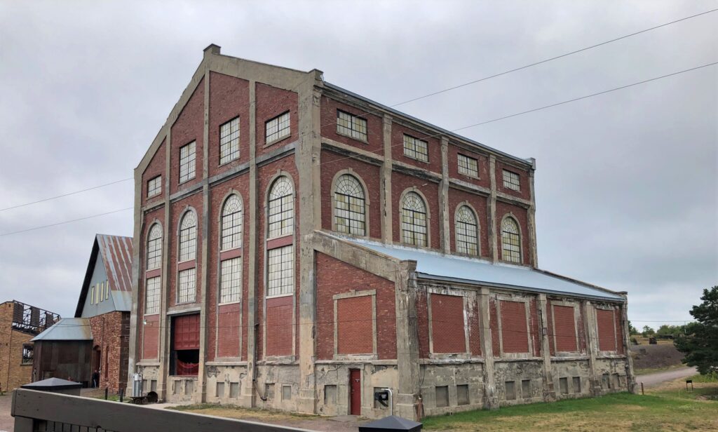
We toured the Quincy Mine in Houghton on Wednesday. This mine was Michigan’s second largest copper producer, and operated between 1846 and 1945, with some activities continuing in the 1970s.
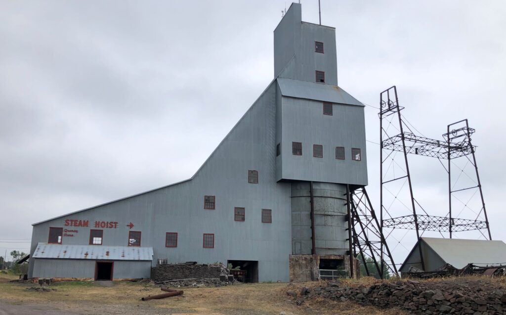
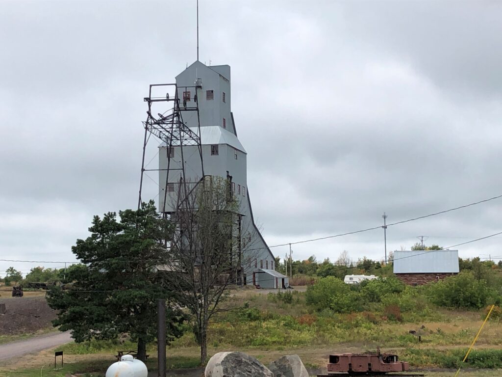
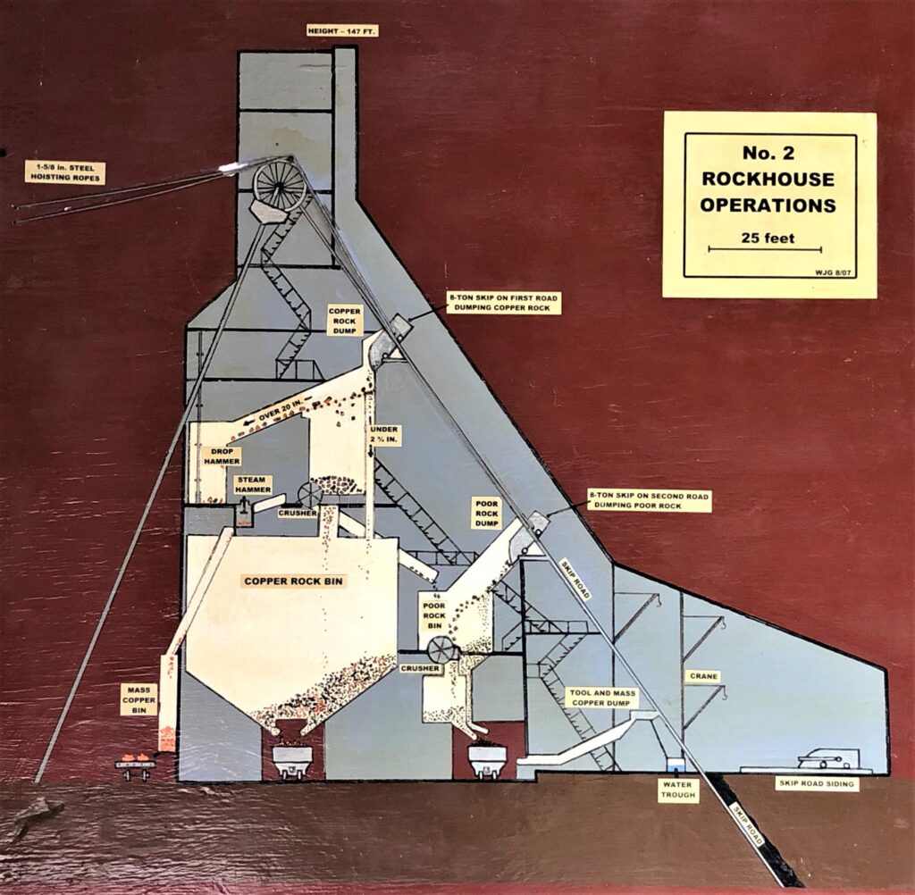
The Rockhouse was this tall structure by the highway – we noticed it on our way to Copper Harbor on Monday.
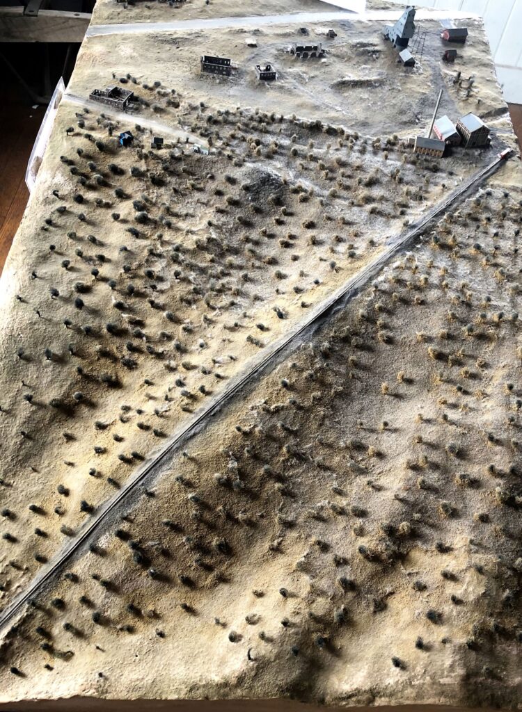
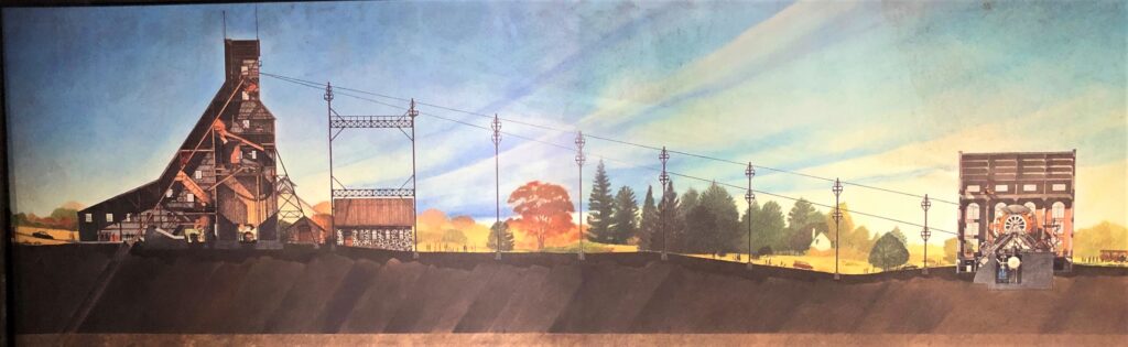
This is a model of the copper mining site – Hwy 41 crosses at the top of the model – and a cog railway runs down to the bottom of the model where we entered to see the mining area. The rockhouse is by the highway – the Steam Hoist is in the building on the right by the rail line.
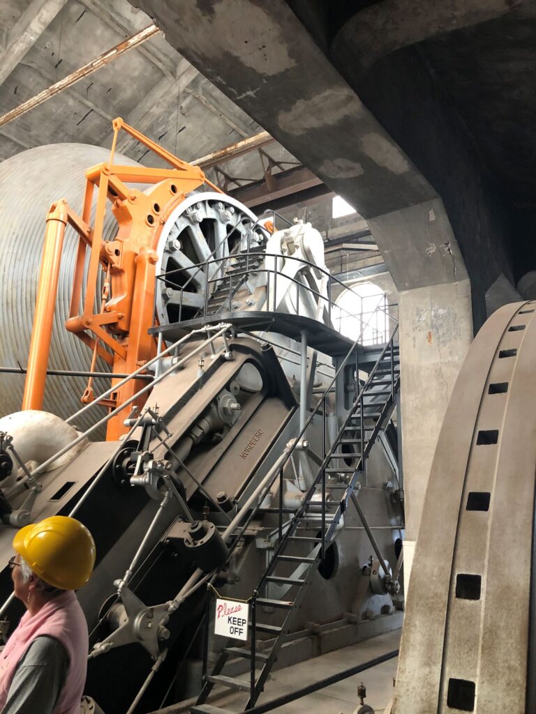
The Steam Hoist was in this building. The tour guide said they made the building fancy looking to entice investors, thinking they would be impressed by fancy windows — and tile work inside was also nicely done.
The hoist cylinder is 30 feet in diameter in the center – 16 feet on the outside; the cables wind around it acting like an elevator to raise and lower rock skips and man cars in and out of the mine.
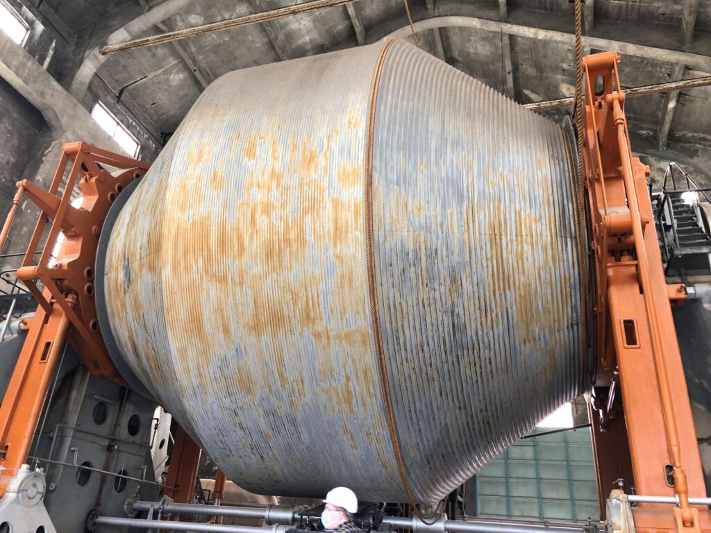
There are 4 huge pistons – 2 on each side – like a train locomotove – to drive the hoist – with 36 rpm, it could run 1,810 feet per minute – to 3,400 feet per minute!
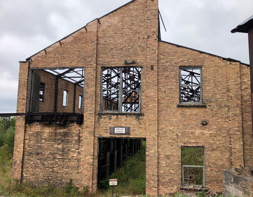
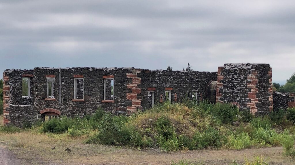
Close by was the remains of the Boiler House
Up the hill we could see the Rock House and some of the remaining scaffold-like structure that held the pulleys for the cables that ran between the buildings.
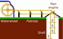
This diagram helped to explain how the hoist connected to the rockhouse
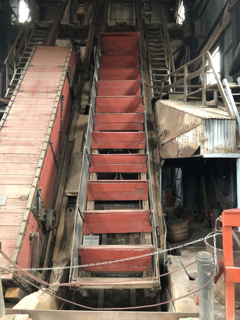
These are some of the cars that would go in and out of the mine – the one on the left could bring water out of the mine, and on the right is the man car – 30 men could be taken in or out of the mine on it.
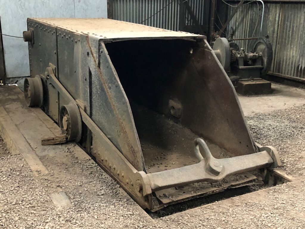
This is a rock skip – it would be used to bring the copper rock up from the mine using the hoist.
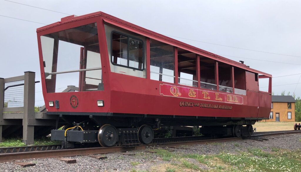
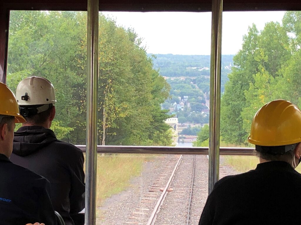
We rode the cog train down the hill to see the mine
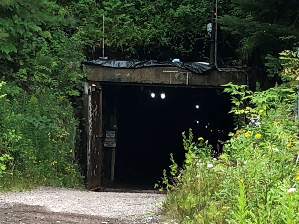
We entered at level 7 – not really all that far down; the mine went down 90 levels! This was NOT how the miners entered the mine – this entrance was actually made/enlarged by students at the Houghton College.
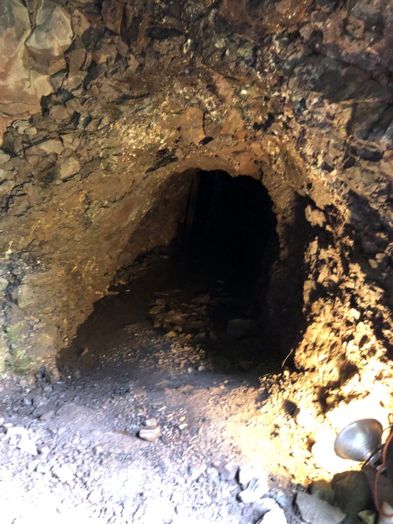
Just inside where we entered, there was a small tunnel that WAS part of the mine – dug out to let water flow out of the mine and was barely large enough for a person to crawl in and out of to maintain the tunnel.
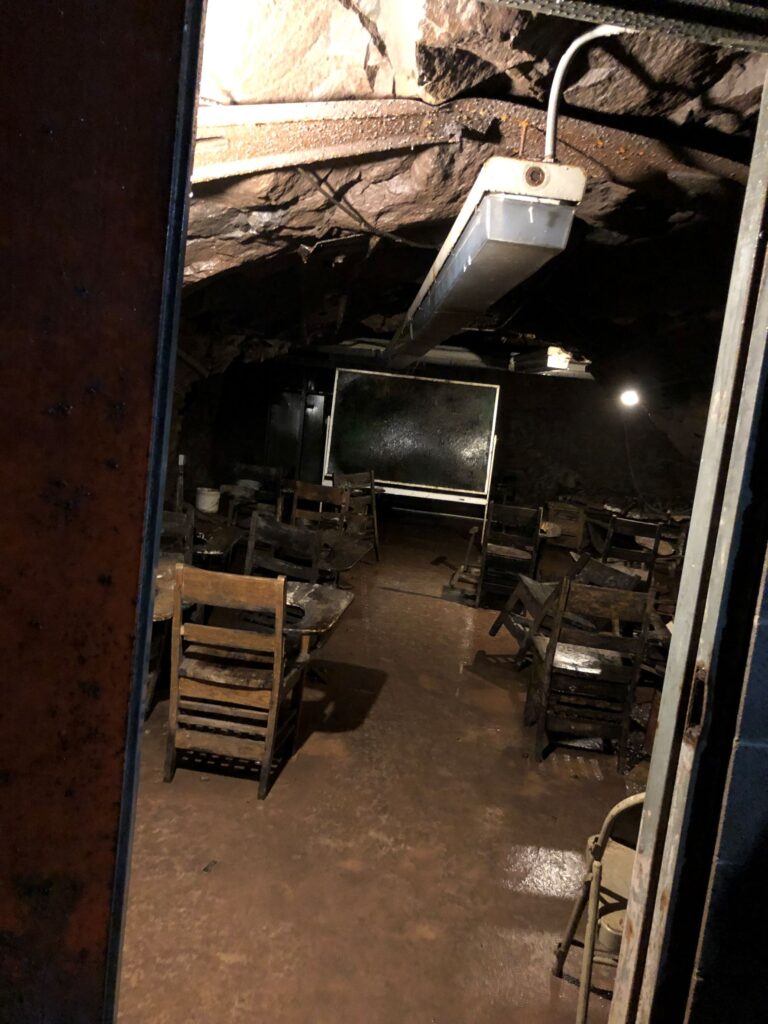
We passed by a room that was used as a classroom; it obviously had not been used in quite some time!
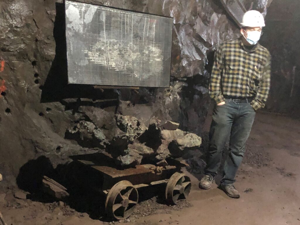
Sitting on this truck is a whole piece of copper rock! Most of the copper mined would be very small pieces imbedded in the rock. A truck like this – (with sides) would be used to transfer the mined rock to a skip to be pulled out of the mine. You can see some of the holes drilled into the rock – the miners used hand drills and sledgehammers to make the holes. They filled the holes with black powder – light the fuse and RUN!
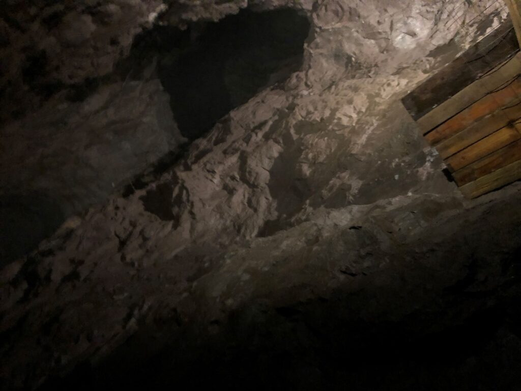
Its really hard to see the shaft here – we could look up to see part of level 6. Early miners used ladders to get between levels.
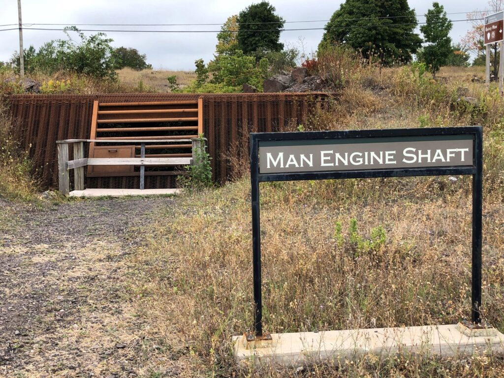
Later, they used a “Man Engine” that sounded really dangerous – the men would walk between platforms with a 5-second change as they moved up or down. Here is an automated video from Wikipedia showing men going up and out, but our guide said that often the men would change places as one man went up and one man went down! The video shows it much faster than it would actually run. This is where it was located.
More diagrams to help “see” the mine…

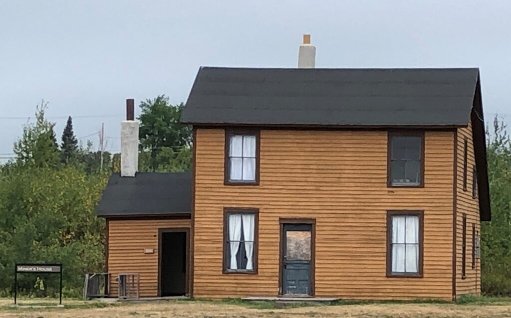
We walked around the area and saw remains of buildings
This looked to be a restored home where a miner and his family would have lived.
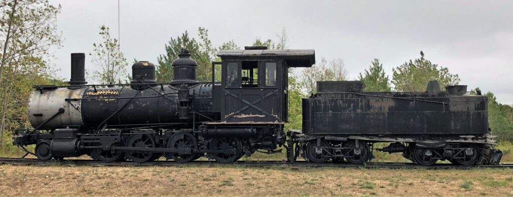
There were a couple of steam engines that were used to move the copper
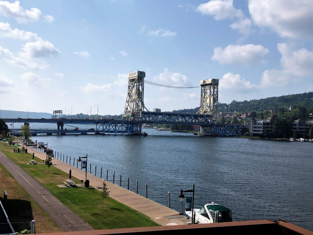
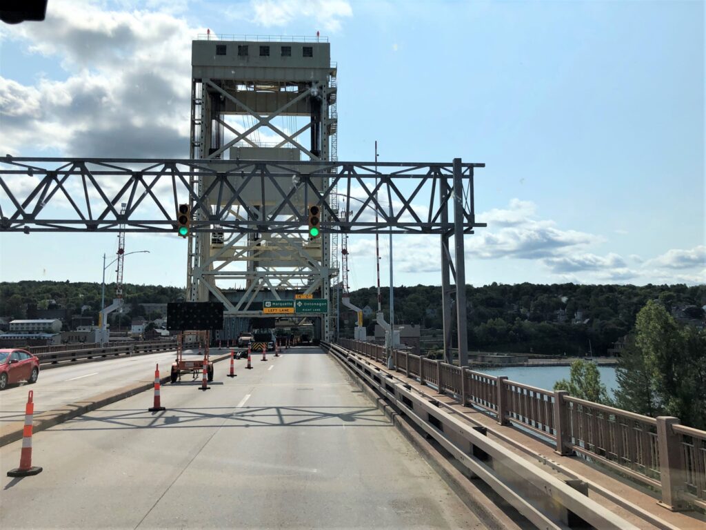
We drove on to Houghton – the Keweenaw Waterway cuts across the peninsula; this big drawbridge on Highway 41 is impressive!
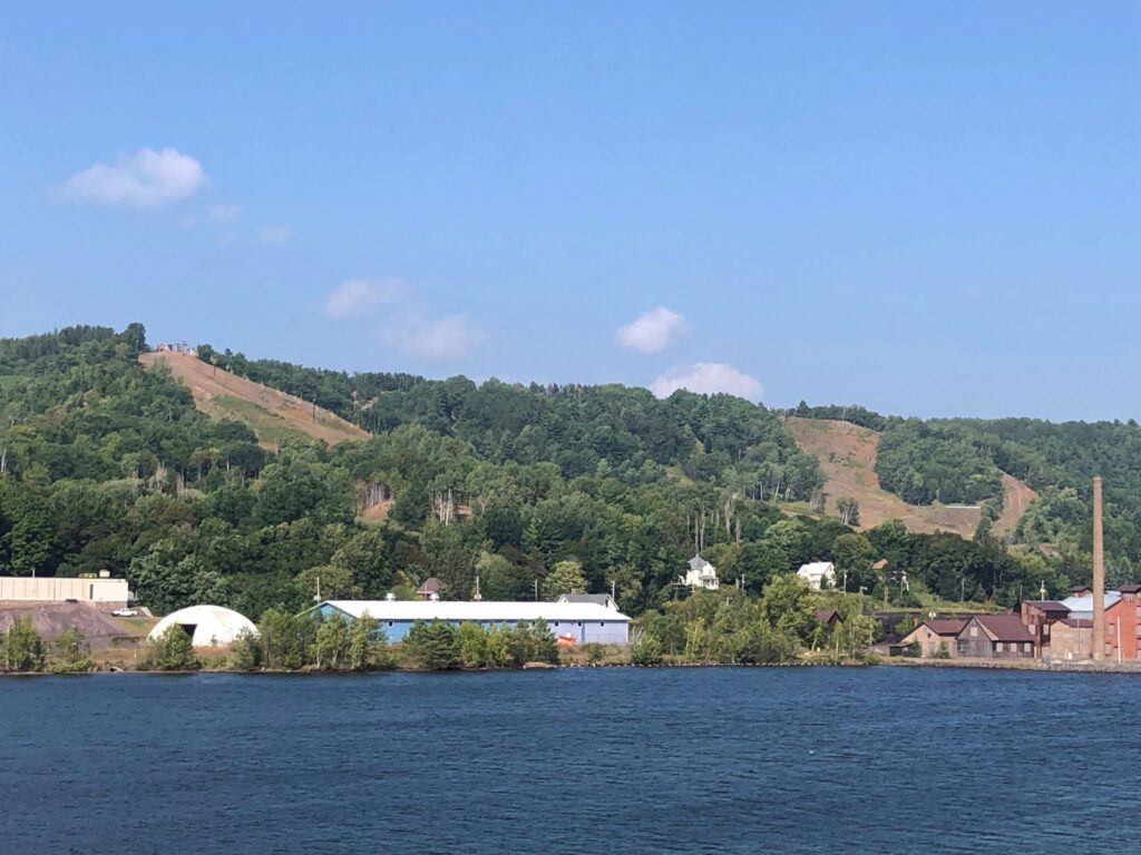
Across the water, we could see some ski slopes on the hillside
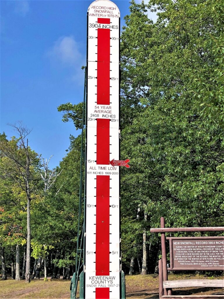
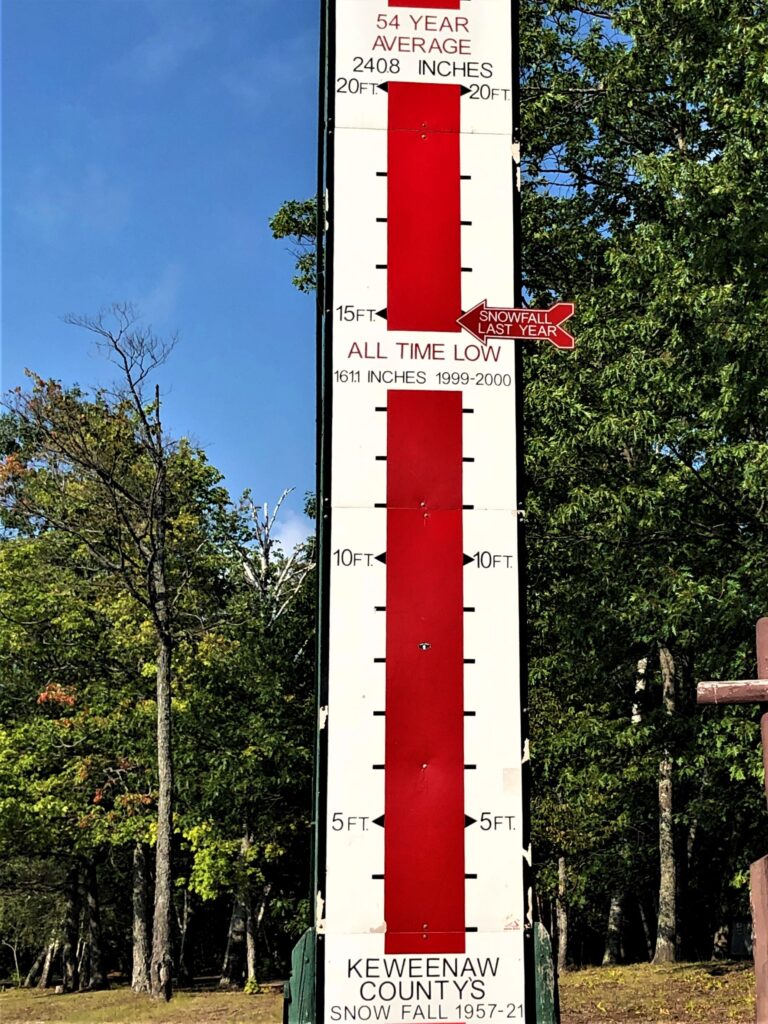
As we headed bback to Copper Harbor, we saw this snow meter and stopped to take a look. They get a lot of snow up here in Keweenaw County! The record of 390.4 inches is 32.53 feet!
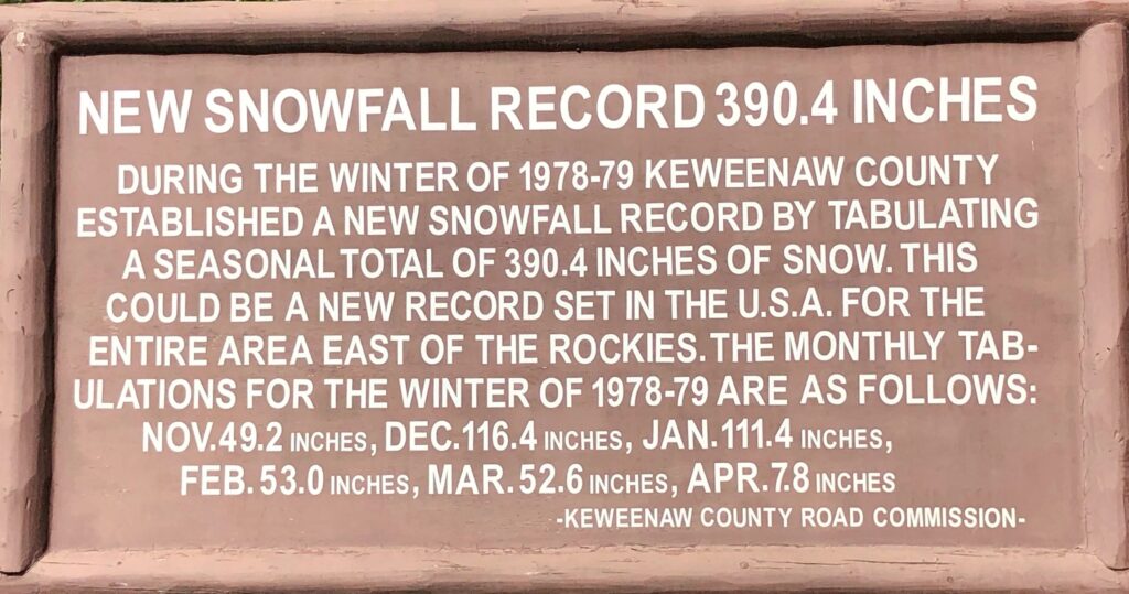
The meter shows that the AVERAGE snowfall from 1957 – 2021 is about 20 feet – and about 15 feet fell last year. The ALL TIME LOW is 161.1 inches (13.4 feet) in the winter of 1999-2000.
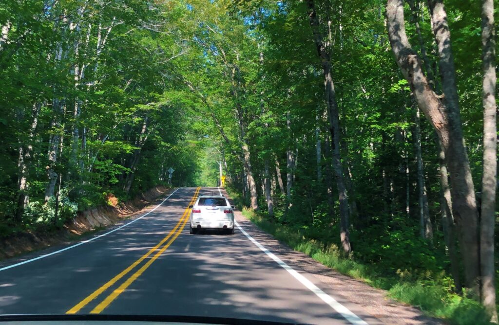
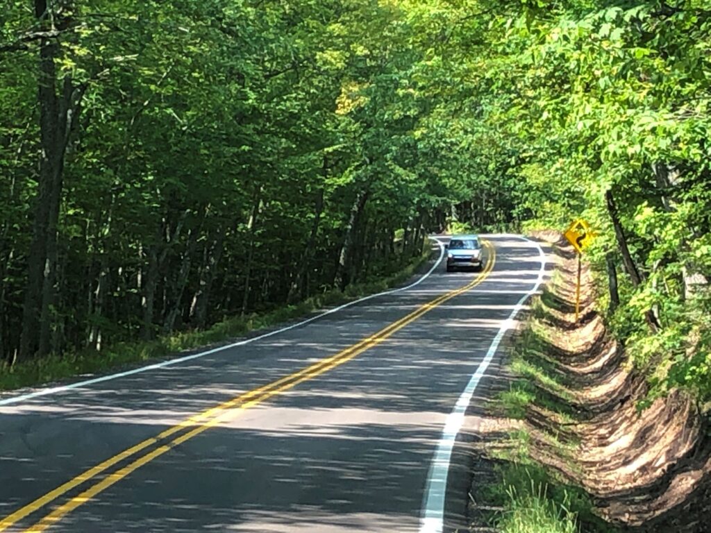
As we drove toward Copper Harbor, the Hwy 41 became a tunnel of trees for a stretch. Imagine how much prettier this would be with fall colors decorating the trees!
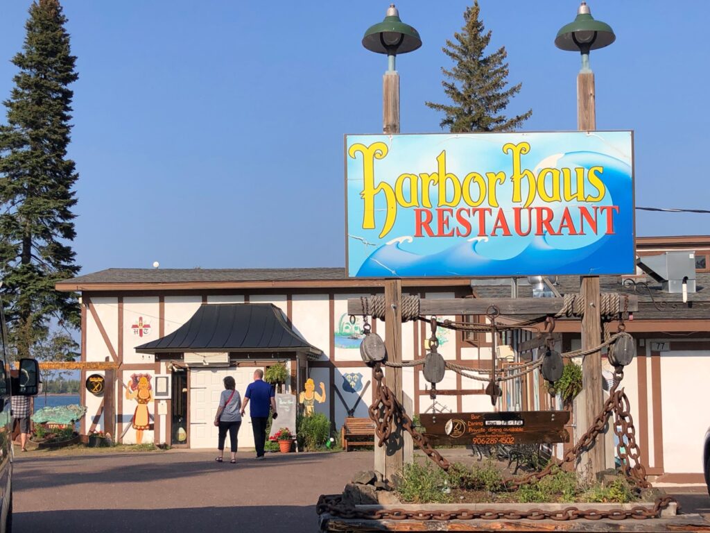
Chuck reminded us by text that there is a really nice German restaurant in Copper Harbor, so we decided to go there for dinner on our last night. Harbor Haus is located on the water, and we walked there from our campground!
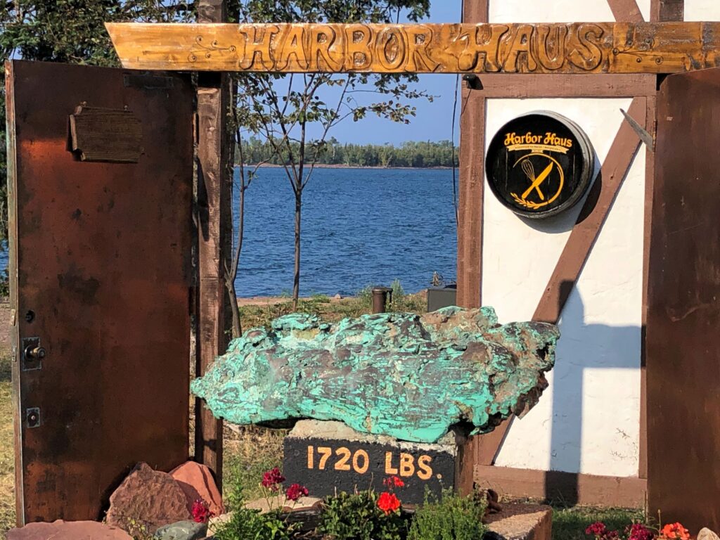
By their entry, they had a copper rock – weighing nearly a ton! A copper door was next to it, not sure why… There was a sign on it basically saying not to touch it as it is (or could be) hot!
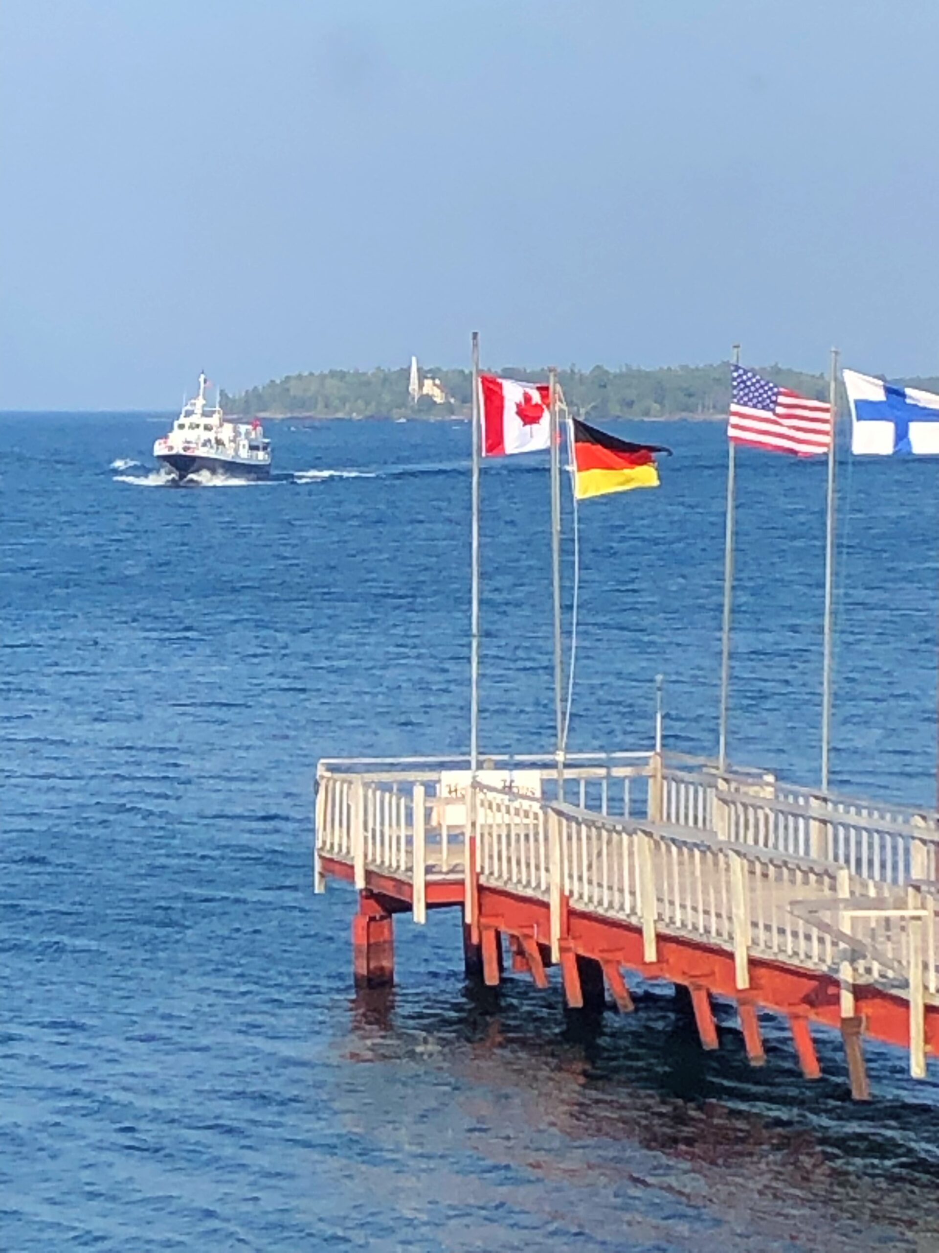
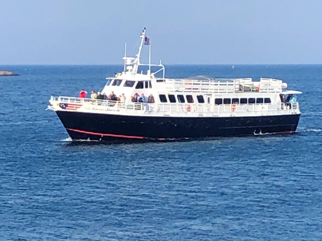
As we were enjoying our meal up on the second floor, we saw the ferry returning from Isle Royale, and saw the lighthouse behind it. The ISLE ROYALE QUEEN IV leaves at 8am and returns at 6:30pm – it’s a 3 1/2 hour ride out to the island which is the least visited US National Park – very remote! Chuck went out for a day trip and suggests that you stay overnight if you want to go – it makes for a really long day!
Thursday we could not check into the campground in Marquette until 3, so we did a load of laundry after breakfast and headed out about noon. We drove south on Highway 41 – which ends in Miami, FL
back thru the “tunnel of trees”
And over the drawbridge in Houghton
… and on to Marquette!
![]()
You are closing in on Ishpeming, just down Hwy 41. I wonder if the supermarket where Herman Magnuson worked is still standing. So facinating to know that much of the copper that wired the world for electricity came from the Keweenaw Peninsula. Have you read ‘The Last Days of Night by Graham Moore? It’s all about that era.
Thanks for posting. Good reading and photos, too.
We stopped by Ishpeming – check the next blog!
Great pictures of beautiful country. They can have the snow!
Our sentiments exactly! Nice place to visit – in good weather!