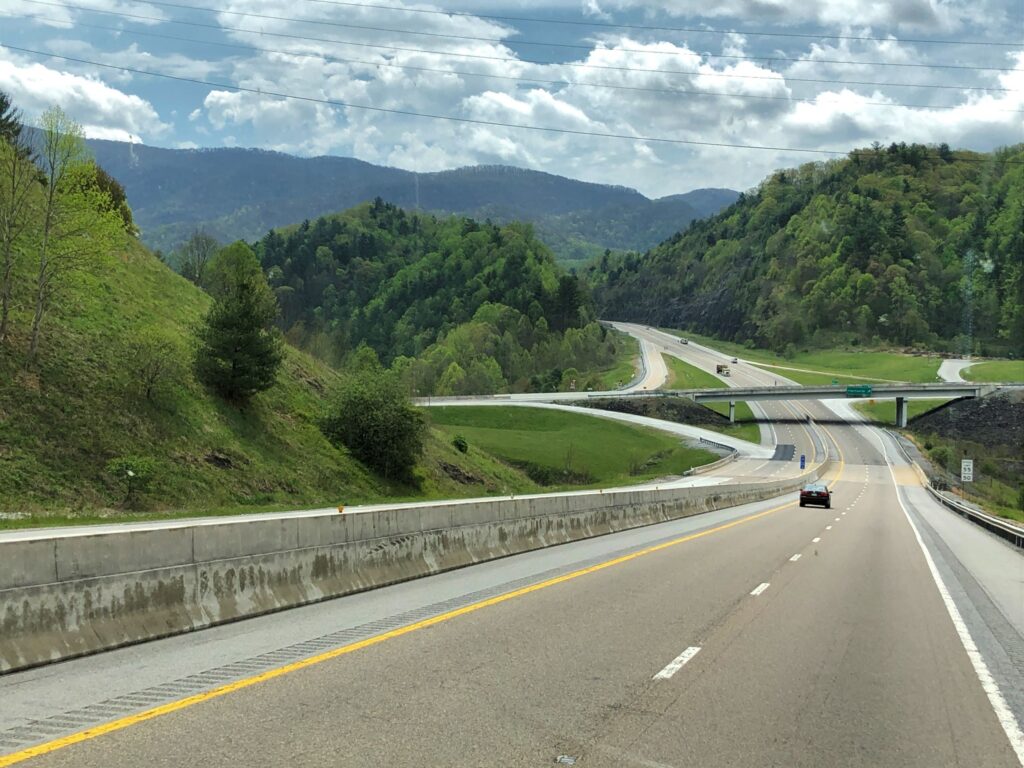
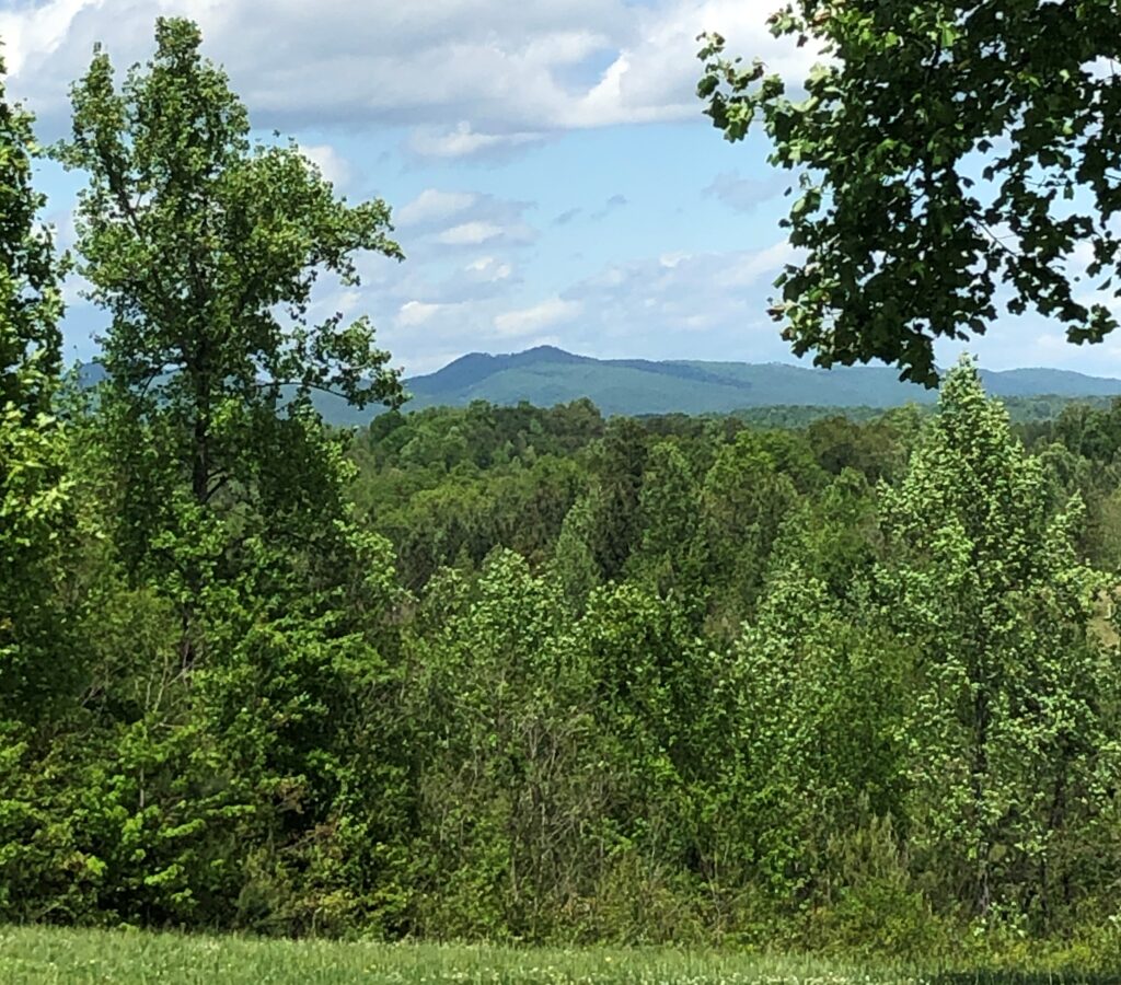
We left Bluff City, TN at 11am on Thursday, April 29 with Acey’s mileage 72,091 and Thor’s 83,515. It was a pretty drive into the mountains!
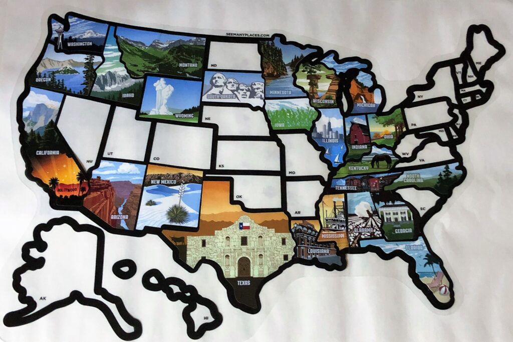
We had a short driving day, arriving at Bear Creek just after 1pm. We had not added a new state to our map since we hit Mississippi on November 29, so today we were able to add our 25th state – North Carolina!
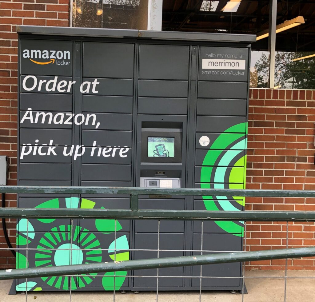
We drove into Asheville and picked up an Amazon order from a locker at Whole Foods. These lockers are a very convenient way for us to receive packages while on the road!
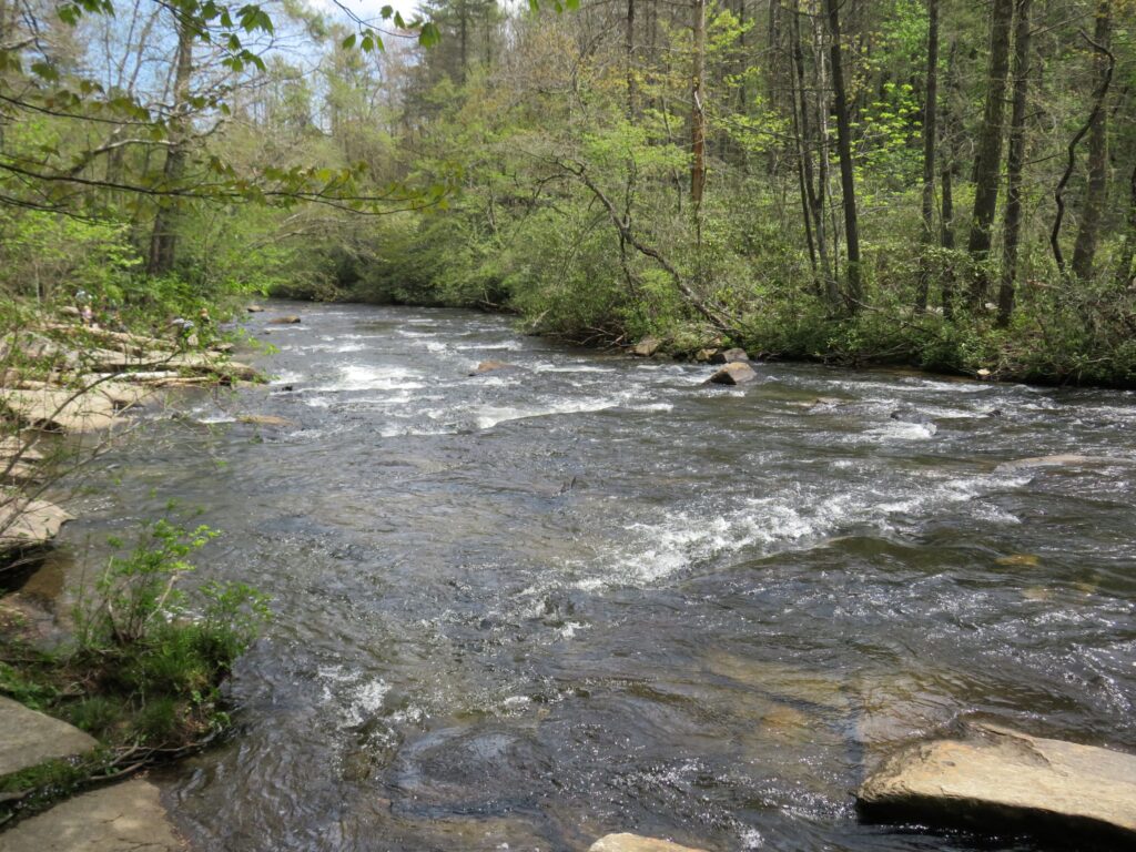
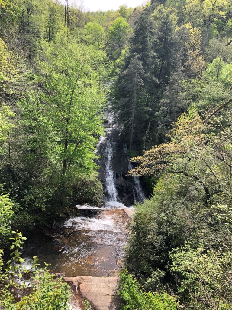
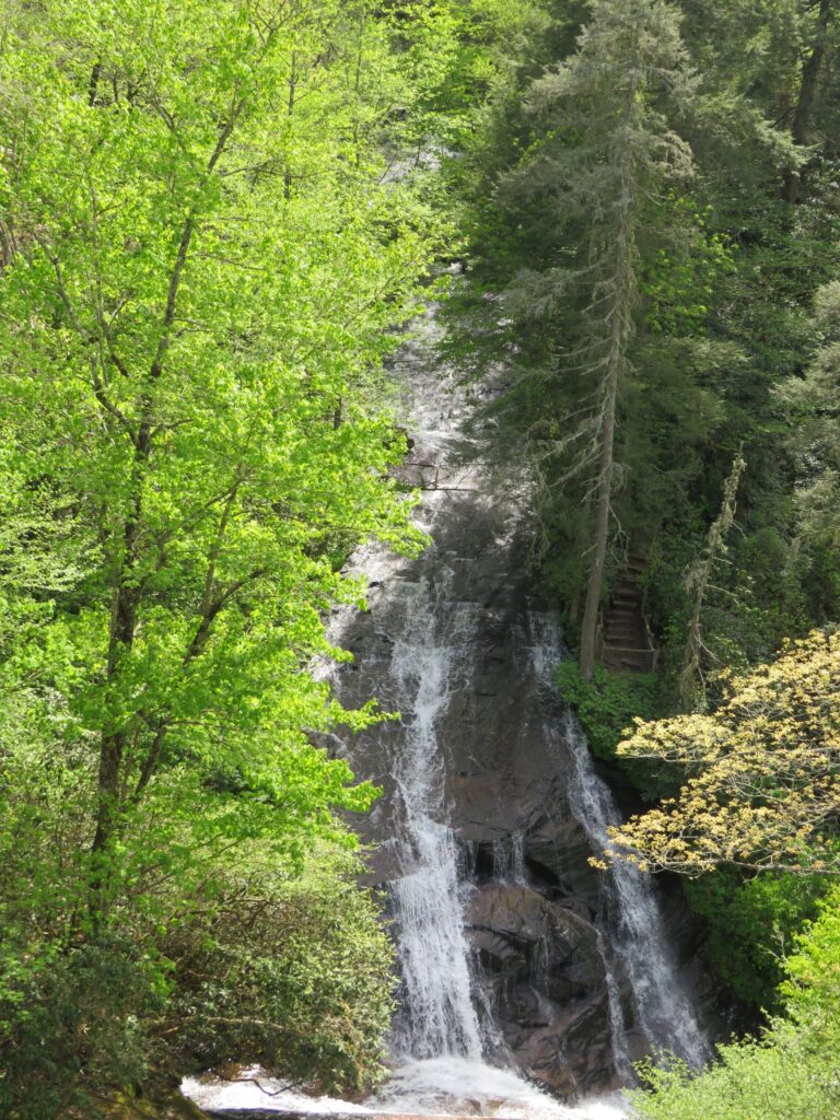
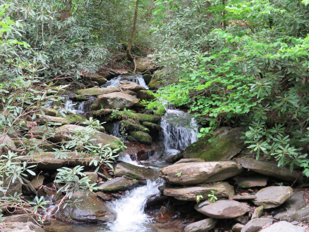
Friday was a 4 waterfall day! We drove to the Dupont State Forest. We hiked out to see High Falls and Triple Falls. Our first view of High Falls was spectacular!

A closer look at the right side of the falls
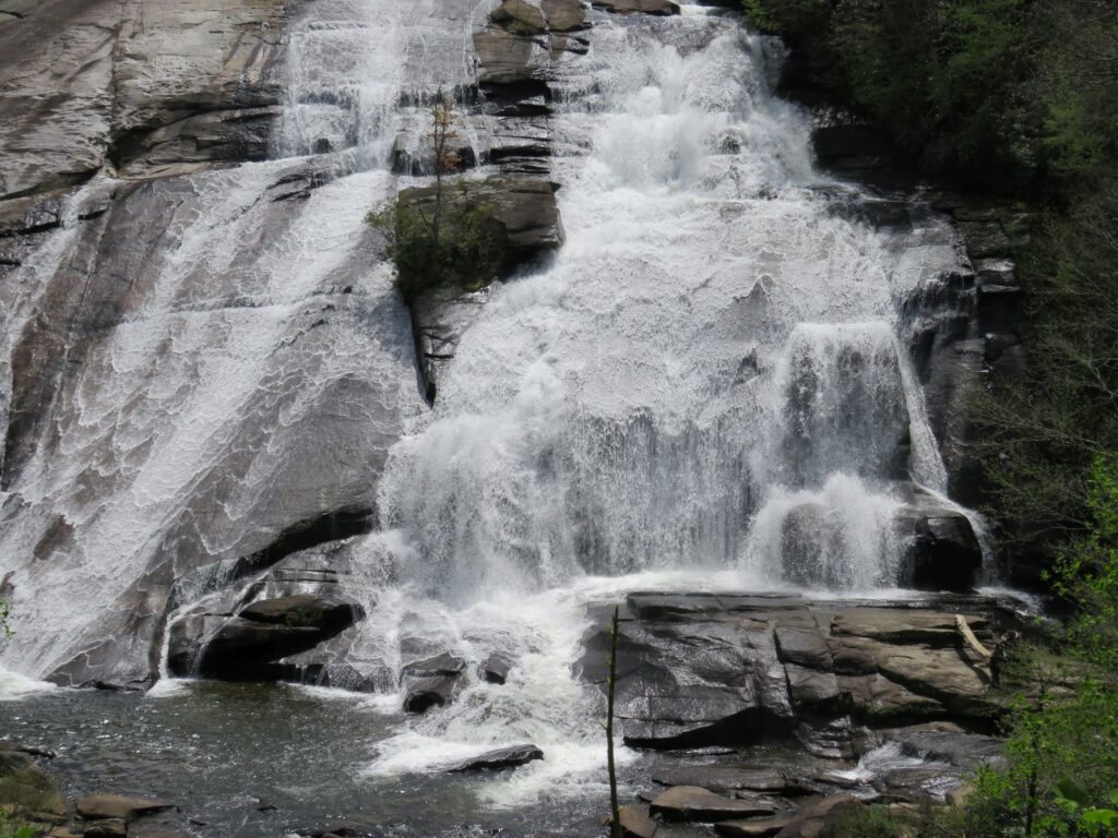
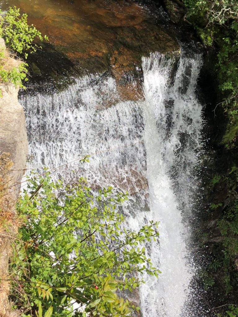
We walked around to the base of the falls
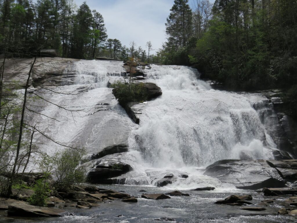
Watch High Falls in action!
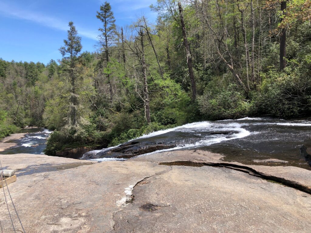
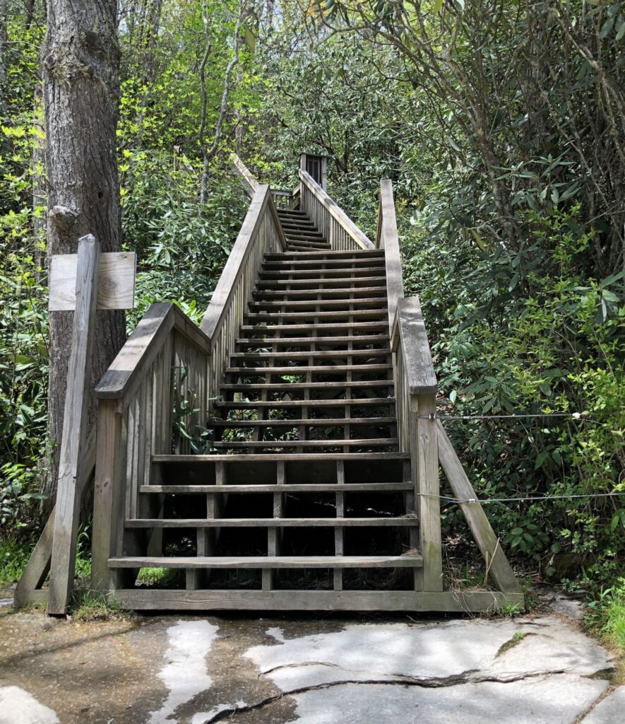
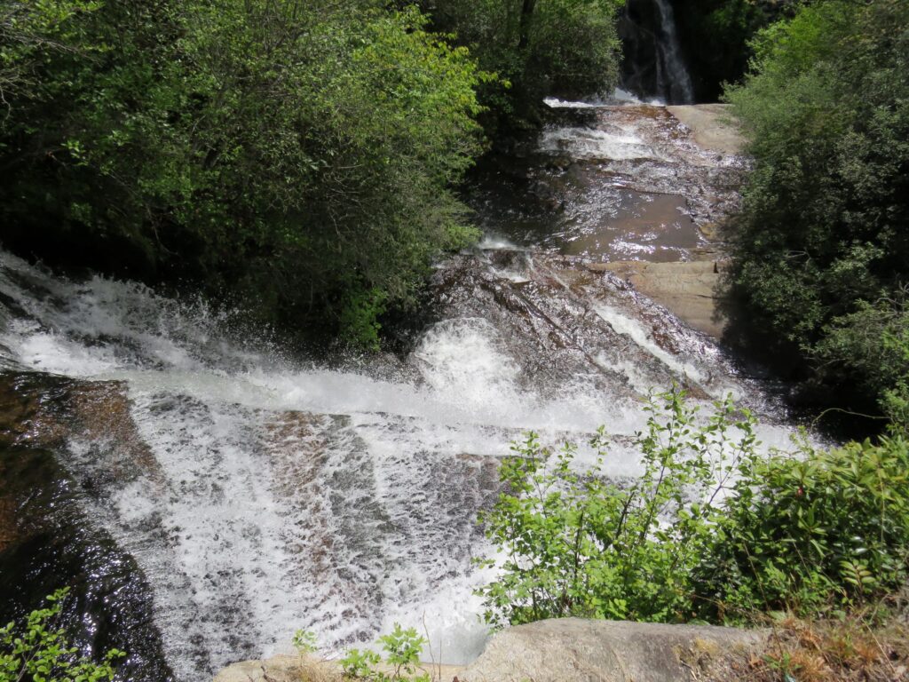
We took a short walk and down 112 steps to the viewpoint for Triple Falls. Two of the falls were to the right, and a 3rd all to the left.

The falls to the left
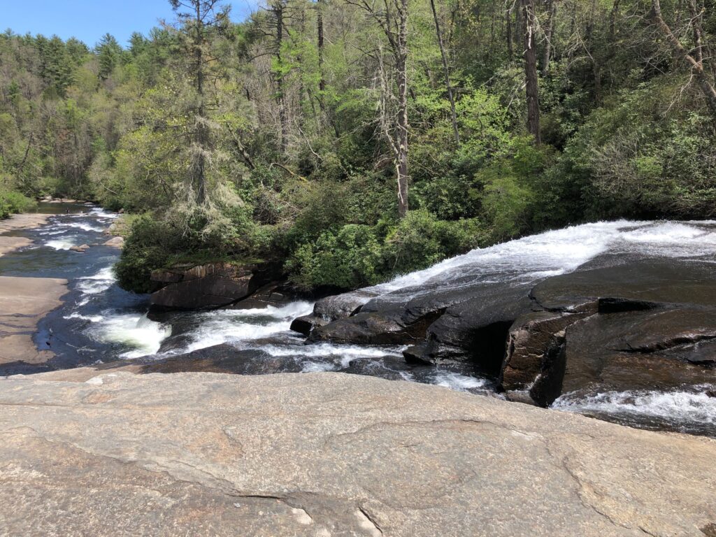

Then back up the 112 stairs!
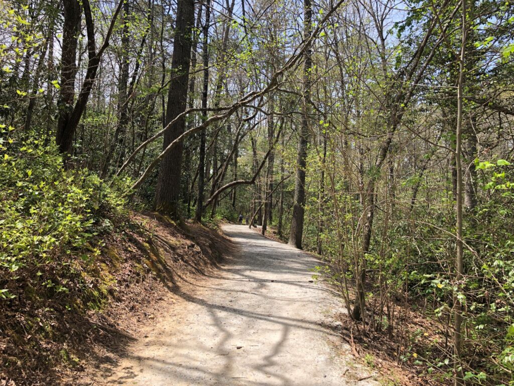
The trails in Dupont State Forest were well maintained.
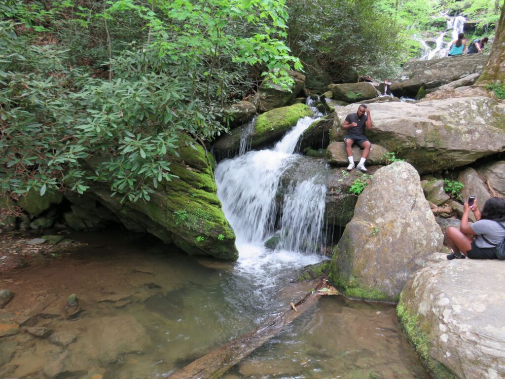
A short drive took us to a trailhead for Hooker Falls. The picnic tables were all stacked up and blocked off, so we ate our packed lunch in the car and went to see the falls.

Linda’s parents had lived in nearby Brevard – in a community called Connestee Falls. They lived there about 20 years and built 4 homes.

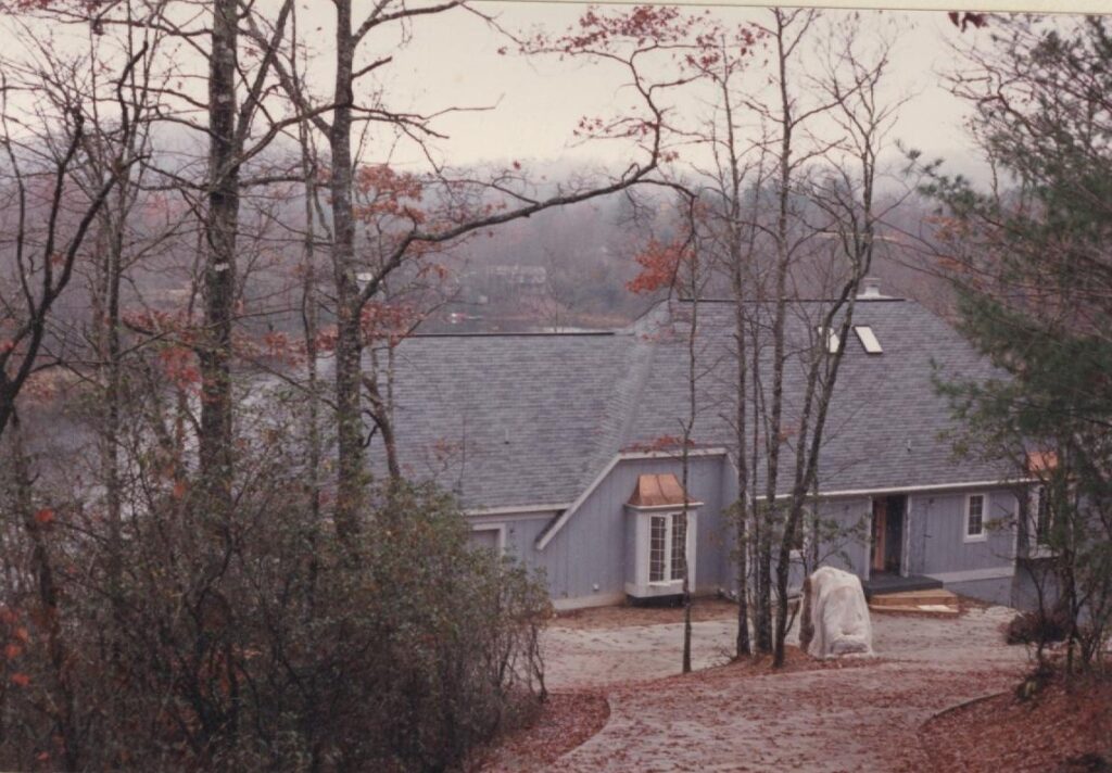
We visited often, especially when the boys were young; great memories!!
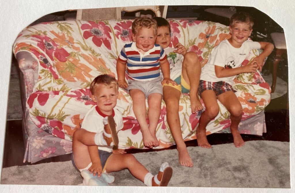
The Mags celebrated their 50th anniversary in 1997.

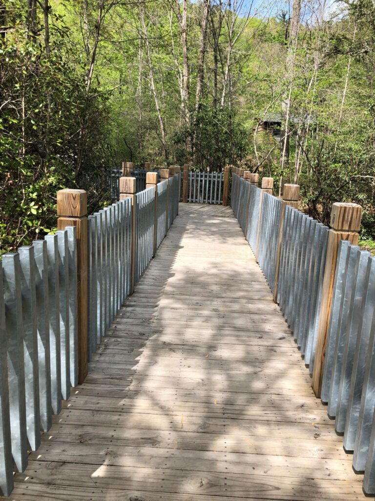
The falls are just off US276, not far from the Dupont State Forest. The last time we went to Connestee Falls, well over 15 years ago, there was a wooden staircase that went to the base of the falls, and it was in “iffy” condition then… so we weren’t sure what to expect! We were glad to see a fairly new, very sturdy looking structure had been built, but only gives a view at the top of the falls.
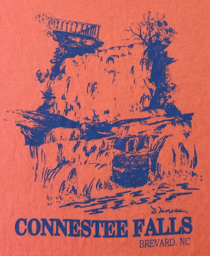
Linda had on her (very old) Connestee Falls t-shirt.
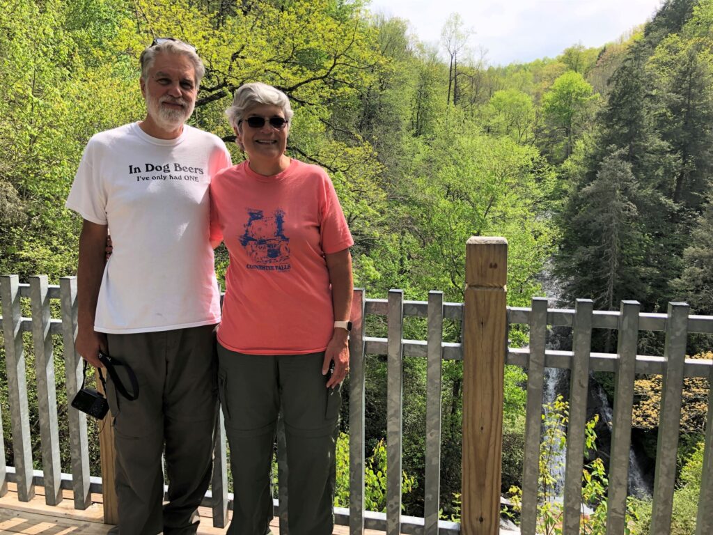
On the shirt, you can see part of the old wooden structure that was to the left and about 6 feet below where we are standing. The “double falls” are pictured.
There are actually two falls here, the far falls and the more impressive near double falls
The far falls are hidden behind the trees
The top of the double falls could be seen from the platform.
This is the area between the double falls; you can see the edge of the lower falls. Its too bad we can’t go down to the base any longer.
This video helps to see this beautiful waterfall – what we can see of it anyway!
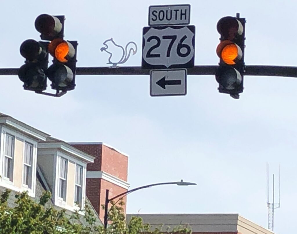
Driving thru Brevard, it was fun to see the squirrel by the traffic lights; Brevard is known for its white squirrels – they are NOT albino as they have dark eyes. We never have seen one, but they say they exist!

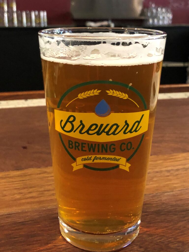
We stopped at Brevard Brewing for a some refreshment.
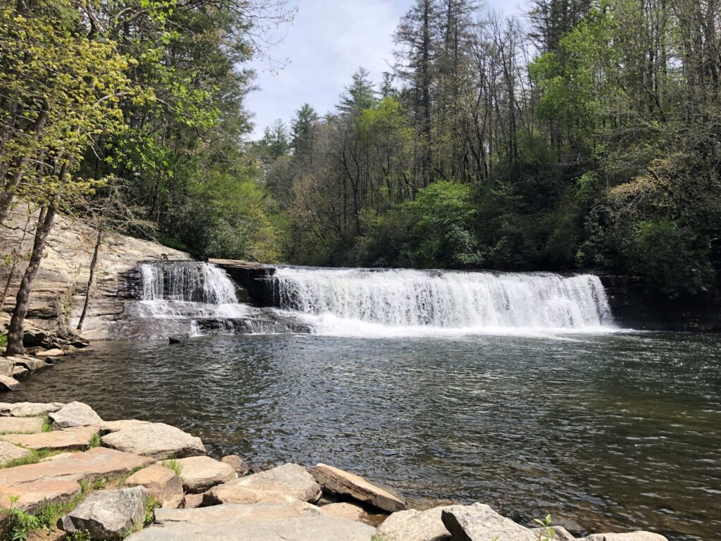
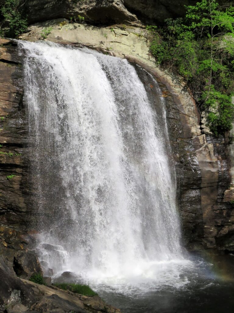
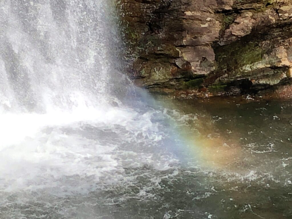
Our last stop was at Looking Glass Falls which is right along US 276 just outside of Brevard. We had been here many times before, since we had been to Brevard so many times, but its worth the stop to see the falls.
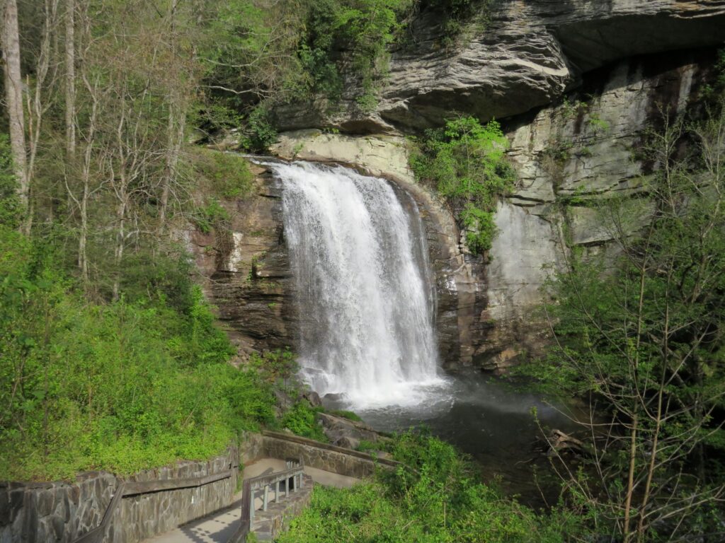
A very short walk and down some stairs you have a better view below the highway level viewpoint.
There was a bit of a rainbow at the bottom of Looking Glass Falls on this sunny day!
On Saturday, we drove into Asheville and found the French Broad Greenway – a bike route along both sides of the French Broad River. We had packed our lunch and found a picnic table next to the trail and watched the activity on the trail and river.

The trail was mostly paved but some of it was confusing – we rode just over 10 miles.
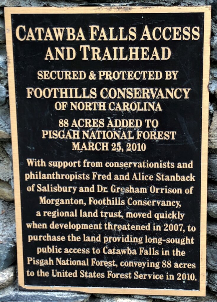
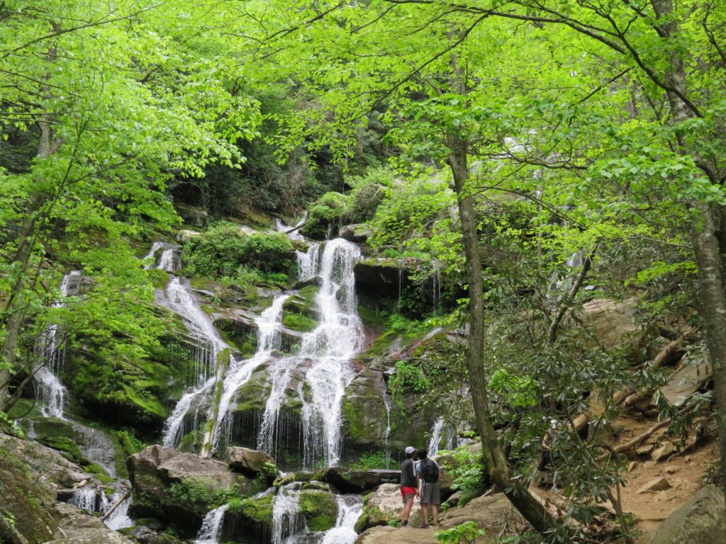
On Sunday, we zoomed with our Sunday School class – still studying Genesis and the faithful life of Abraham. We worshiped with Stephens Valley Church by YouTube; the book of Esther is the focus for the sermons. If you want to tune in, here is a link: to watch LIVE on YouTube @ 10:40 a.m. Central (or watch later!) and you can click here to view the bulletin. After lunch, we drove out to Old Fort to see Catawba Falls.
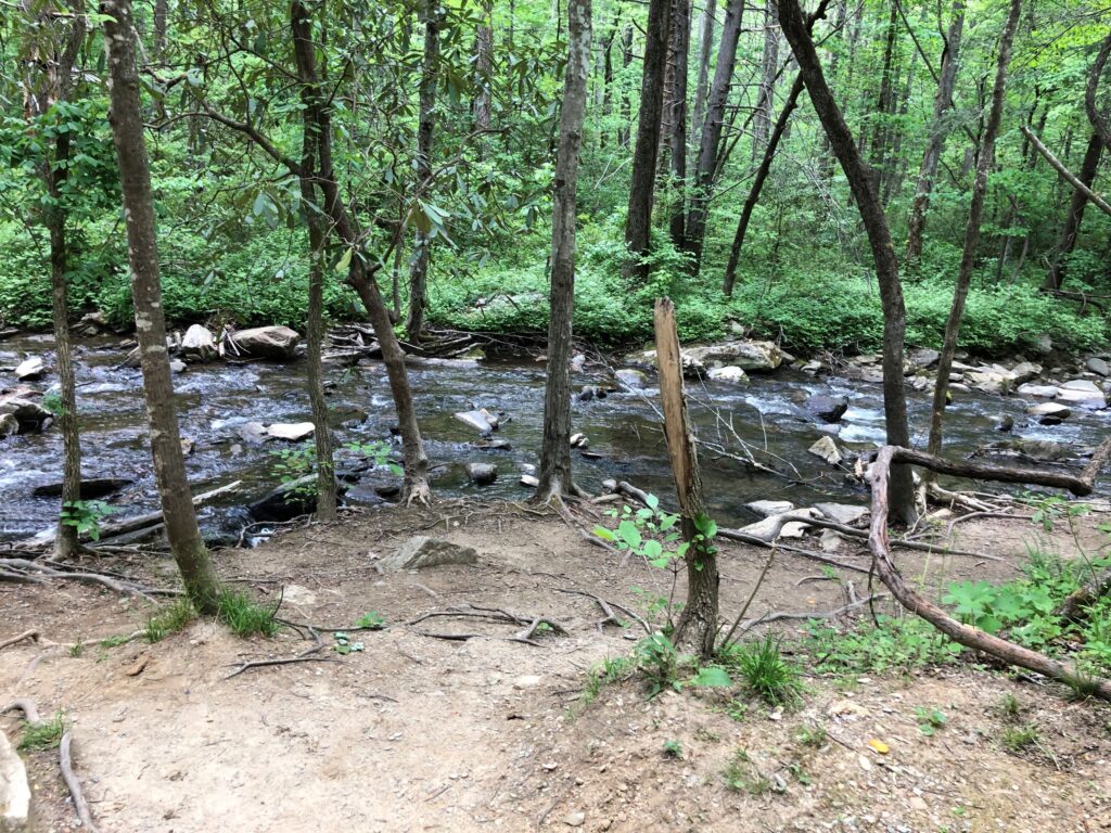
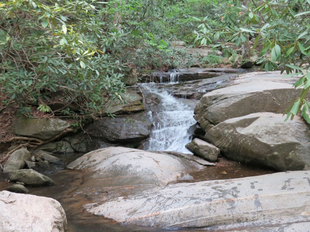
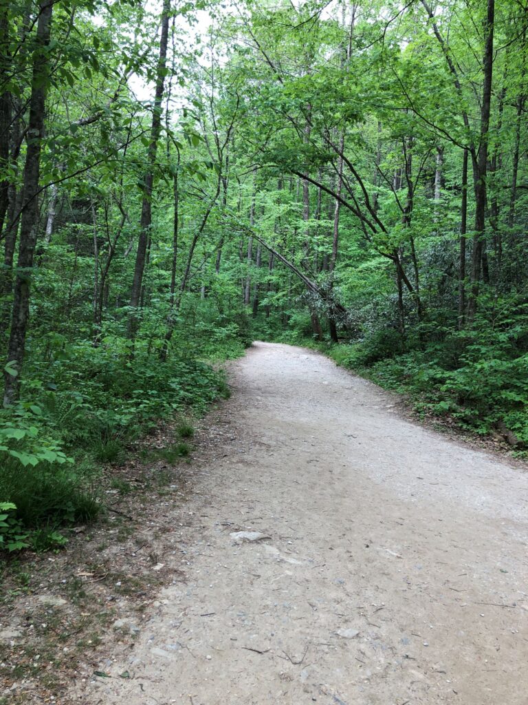
Most of the 1.2 mile trail to the falls followed along the Catawba River. There were many other folks out on this lovely day to see the waterfall, and some were swimming in the cold water!
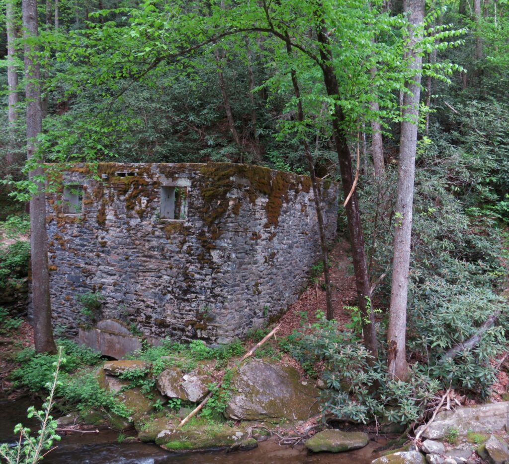
There had been a hydroelectric dam on the river at one time, providing power for the town of Old Fort. This structure was part of it. It closed in the mid 1900’s.

So many pretty views along the way!
The remains of the dam were further upstream

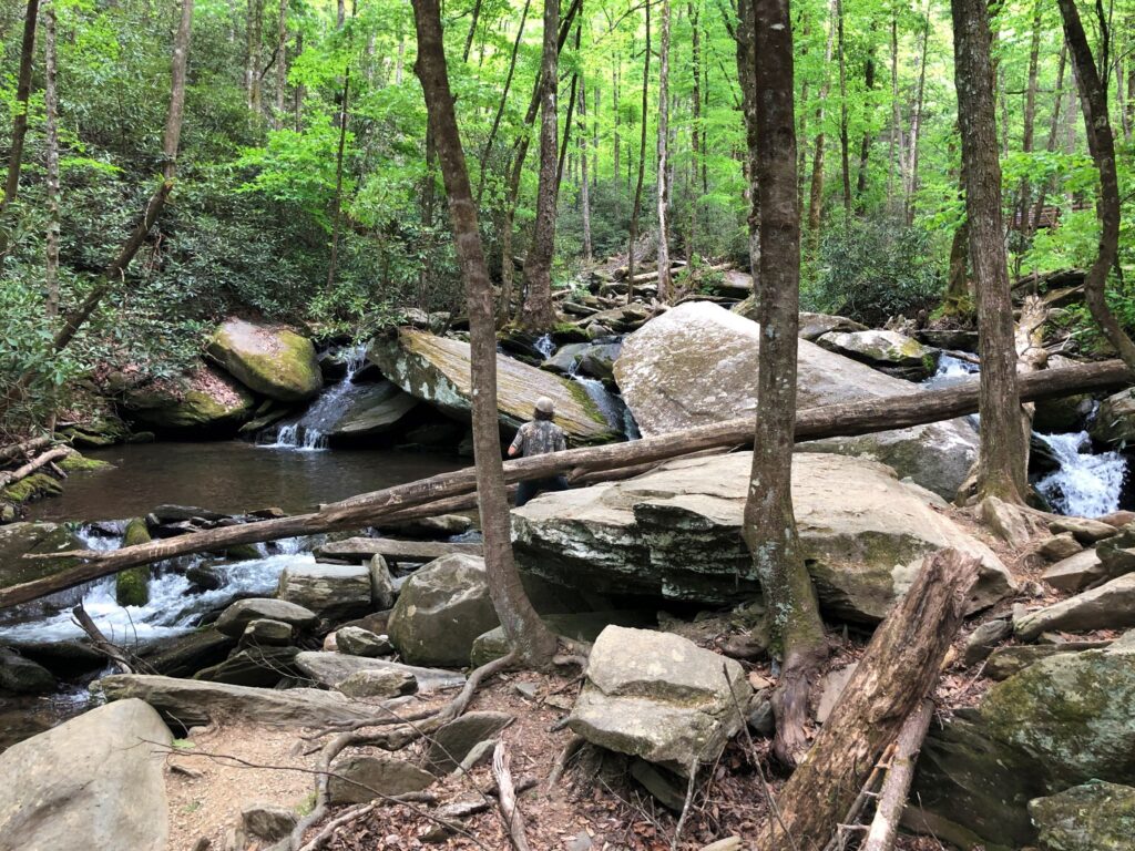
We got to the viewing area at the end of the trail. This tree was growing out of the rocks in the middle of the river!

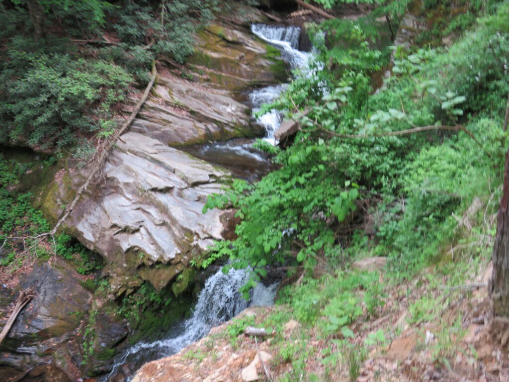
This little falls was just below the tree – you can see the base of the tree on the upper right – and a glimpse of the upper falls!
Jim climbed up further to get photos of the falls.
Linda stayed down below…
Beautiful Catawba Falls!

The very top of the falls was out of sight above the trees
It was another nice day to be out exploring God’s creation!
Monday it rained a good part of the day, Linda worked on the blog, sorting through all the photos we took of the waterfalls! Jim made some campground reservations and has been thinking about finding or building a shelf unit to go in the back bathroom. Searching online, he found a unit at Home Depot and ordered it for pickup next week at the Home Depot near where we are staying.
Tuesday we aimed for an early start to go for a bike ride and beat the forecasted afternoon thunderstorms, but the storms came early and it rained most of the day. A string had broken on one of the window shades yesterday, so we went shopping for replacement string and got that fixed! Just like a “stick n bricks” home – there is always something to fix…
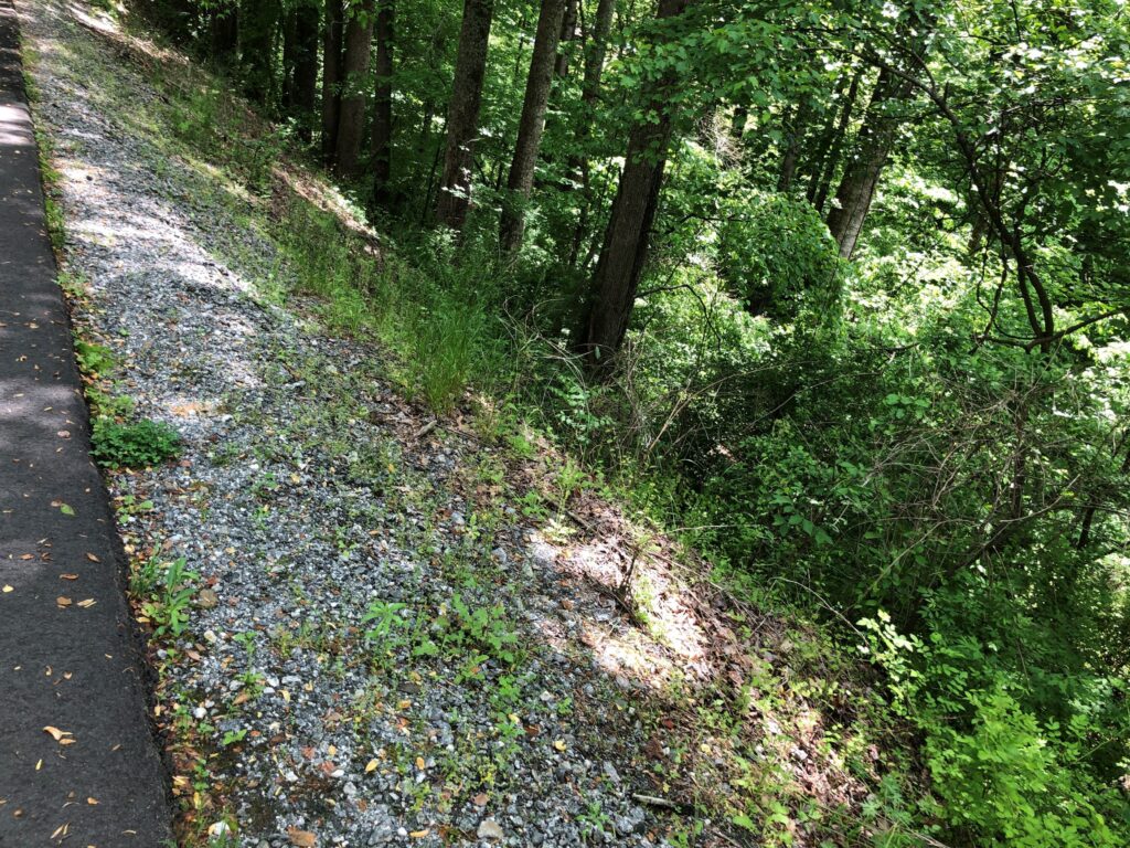
On Wednesday the sun returned, so we drove to Gilkey to ride our bikes on the Thermal Belt Rail Trail.
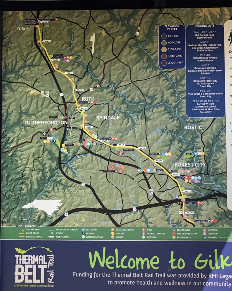
We are always thankful that these rail beds, that had so much work put into them in order for trains to run, have been made into bike paths. The railroad corridor was chartered in 1887 and the paved bike trail opened in 2019.
Several sections of the trail were raised as much as 50 feet (maybe more) above the surrounding ground level – probably to keep the grade from being too steep when the trains ran here.
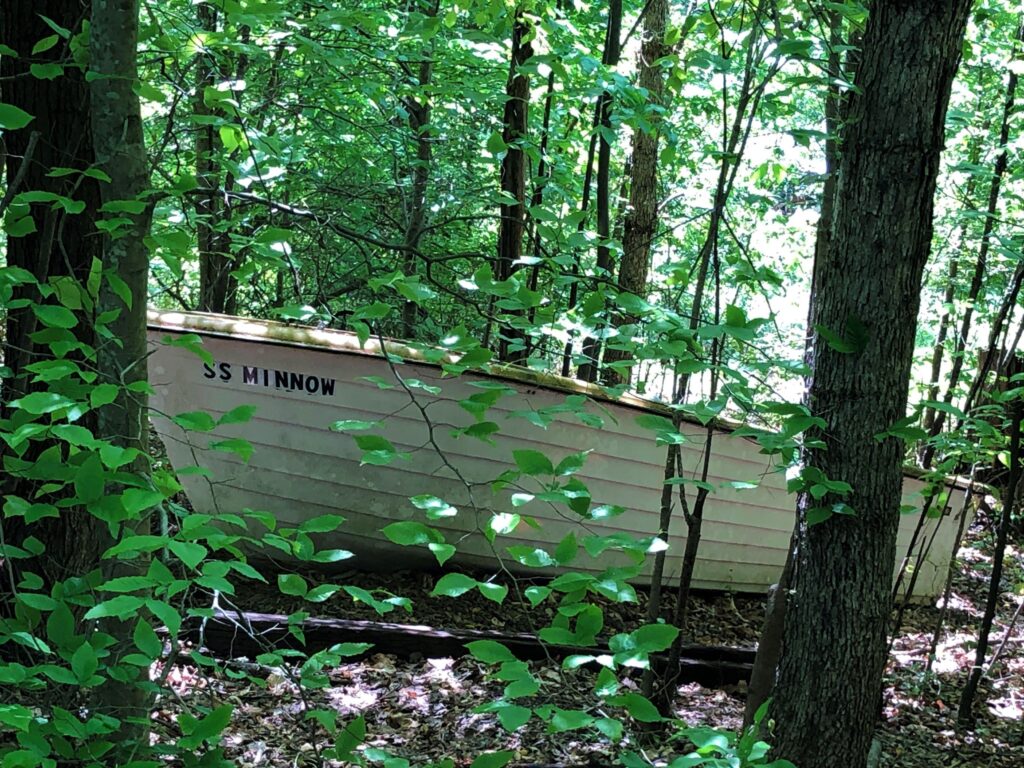
A very well kept trail – smooth pavement for the portion we rode on. A boat was off to the side – Hmmmm the S S Minnow… 3 hour tour?!
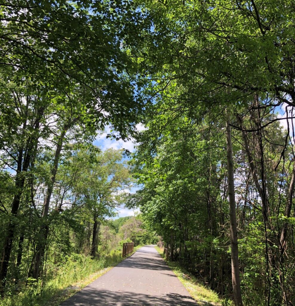
There were a few street crossings, but for the most part, it was a great trail to ride.
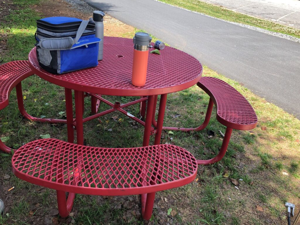
We took our lunch and found a picnic table!
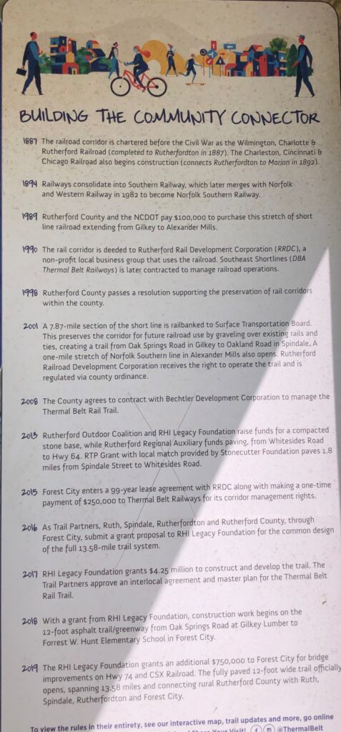
An interesting stop along the way was the Bechtler Mint Historic Park.

“Using only hand-operated equipment, the Bechtlers minted $2.2Million in coins between 1831 and 1840.”
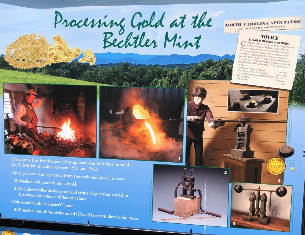
Linda found more information at www.VisitNCGold.com; “Did you know that before the California Gold Rush there was the NC Gold Rush? A couple of America’s first Gold Rush facts:
- The first ever documented gold nugget was discovered at Reed Gold Mine in Cabarrus County near Charlotte, NC in 1799.
- The first $1 gold coin was minted by Christopher Bechtler in 1832 in Rutherfordton, NC.
- North Carolina led the country in gold production until the California Gold Rush in 1848.”
This was a beautiful place to live and work!
We rode 20 miles today. Then we headed back to Acey and got ready to leave in the morning for South Carolina!
![]()
Love the waterfalls. So glad you got by the house mom and dad built. Love the videos– I will listen to them at night. Although the last few nights have sounded like a waterfall with all the rain!!
We did not actually go into the Connestee Falls community – I don’t think they would let us in the gate! The photo of the Mags house was from my photo file…